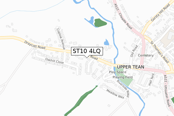
ST10 4LQ is located in the Checkley electoral ward, within the local authority district of Staffordshire Moorlands and the English Parliamentary constituency of Stone. The Sub Integrated Care Board (ICB) Location is NHS Staffordshire and Stoke-on-Trent ICB - 05G and the police force is Staffordshire. This postcode has been in use since May 2018.


GetTheData
Source: OS Open Zoomstack (Ordnance Survey)
Licence: Open Government Licence (requires attribution)
Attribution: Contains OS data © Crown copyright and database right 2025
Source: Open Postcode Geo
Licence: Open Government Licence (requires attribution)
Attribution: Contains OS data © Crown copyright and database right 2025; Contains Royal Mail data © Royal Mail copyright and database right 2025; Source: Office for National Statistics licensed under the Open Government Licence v.3.0
| Easting | 400644 |
| Northing | 339637 |
| Latitude | 52.954127 |
| Longitude | -1.991860 |
GetTheData
Source: Open Postcode Geo
Licence: Open Government Licence
| Country | England |
| Postcode District | ST10 |
➜ See where ST10 is on a map ➜ Where is Upper Tean? | |
GetTheData
Source: Land Registry Price Paid Data
Licence: Open Government Licence
| Ward | Checkley |
| Constituency | Stone |
GetTheData
Source: ONS Postcode Database
Licence: Open Government Licence
| Garden Village (High St) | Upper Tean | 27m |
| Garden Village (High St) | Upper Tean | 34m |
| Coplow Avenue (Draycott Road) | Upper Tean | 155m |
| Coplow Avenue (Draycott Rd) | Upper Tean | 198m |
| Cross Keys Ph (Cheadle Rd) | Upper Tean | 299m |
GetTheData
Source: NaPTAN
Licence: Open Government Licence
| Percentage of properties with Next Generation Access | 100.0% |
| Percentage of properties with Superfast Broadband | 100.0% |
| Percentage of properties with Ultrafast Broadband | 0.0% |
| Percentage of properties with Full Fibre Broadband | 0.0% |
Superfast Broadband is between 30Mbps and 300Mbps
Ultrafast Broadband is > 300Mbps
| Percentage of properties unable to receive 2Mbps | 0.0% |
| Percentage of properties unable to receive 5Mbps | 0.0% |
| Percentage of properties unable to receive 10Mbps | 0.0% |
| Percentage of properties unable to receive 30Mbps | 0.0% |
GetTheData
Source: Ofcom
Licence: Ofcom Terms of Use (requires attribution)
GetTheData
Source: ONS Postcode Database
Licence: Open Government Licence


➜ Get more ratings from the Food Standards Agency
GetTheData
Source: Food Standards Agency
Licence: FSA terms & conditions
| Last Collection | |||
|---|---|---|---|
| Location | Mon-Fri | Sat | Distance |
| Wedgwood Road | 16:30 | 11:00 | 2,690m |
| Cheadle Post Office | 17:50 | 11:45 | 2,983m |
| Deadmans Green | 12:00 | 07:00 | 3,956m |
GetTheData
Source: Dracos
Licence: Creative Commons Attribution-ShareAlike
The below table lists the International Territorial Level (ITL) codes (formerly Nomenclature of Territorial Units for Statistics (NUTS) codes) and Local Administrative Units (LAU) codes for ST10 4LQ:
| ITL 1 Code | Name |
|---|---|
| TLG | West Midlands (England) |
| ITL 2 Code | Name |
| TLG2 | Shropshire and Staffordshire |
| ITL 3 Code | Name |
| TLG24 | Staffordshire CC |
| LAU 1 Code | Name |
| E07000198 | Staffordshire Moorlands |
GetTheData
Source: ONS Postcode Directory
Licence: Open Government Licence
The below table lists the Census Output Area (OA), Lower Layer Super Output Area (LSOA), and Middle Layer Super Output Area (MSOA) for ST10 4LQ:
| Code | Name | |
|---|---|---|
| OA | E00151795 | |
| LSOA | E01029791 | Staffordshire Moorlands 013E |
| MSOA | E02006216 | Staffordshire Moorlands 013 |
GetTheData
Source: ONS Postcode Directory
Licence: Open Government Licence
| ST10 4JG | Garden Village | 61m |
| ST10 4JR | Wallfield Close | 97m |
| ST10 4JE | The Island | 132m |
| ST10 4JF | Draycott Road | 137m |
| ST10 4EE | Riverside Road | 208m |
| ST10 4JQ | Coplow Avenue | 211m |
| ST10 4JP | Oakhill Close | 213m |
| ST10 4EF | Meadow Way | 244m |
| ST10 4EG | Old Road | 259m |
| ST10 4DZ | High Street | 296m |
GetTheData
Source: Open Postcode Geo; Land Registry Price Paid Data
Licence: Open Government Licence