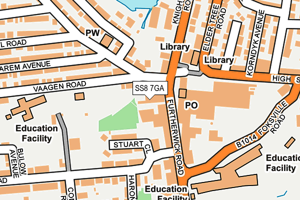
SS8 7GA is located in the Canvey Island South electoral ward, within the local authority district of Castle Point and the English Parliamentary constituency of Castle Point. The Sub Integrated Care Board (ICB) Location is NHS Mid and South Essex ICB - 99F and the police force is Essex. This postcode has been in use since June 2000.


GetTheData
Source: OS OpenMap – Local (Ordnance Survey)
Source: OS VectorMap District (Ordnance Survey)
Licence: Open Government Licence (requires attribution)
| Easting | 579902 |
| Northing | 183590 |
| Latitude | 51.522571 |
| Longitude | 0.591783 |
GetTheData
Source: Open Postcode Geo
Licence: Open Government Licence
| Country | England |
| Postcode District | SS8 |
➜ See where SS8 is on a map ➜ Where is Canvey Island? | |
GetTheData
Source: Land Registry Price Paid Data
Licence: Open Government Licence
Elevation or altitude of SS8 7GA as distance above sea level:
| Metres | Feet | |
|---|---|---|
| Elevation | 0m | 0ft |
Elevation is measured from the approximate centre of the postcode, to the nearest point on an OS contour line from OS Terrain 50, which has contour spacing of ten vertical metres.
➜ How high above sea level am I? Find the elevation of your current position using your device's GPS.
GetTheData
Source: Open Postcode Elevation
Licence: Open Government Licence
| Ward | Canvey Island South |
| Constituency | Castle Point |
GetTheData
Source: ONS Postcode Database
Licence: Open Government Licence
| Oyster Fleet (Knightswick Road) | Canvey | 169m |
| Market (High Street) | Canvey | 177m |
| Furtherwick Park School (Foksville Road) | Canvey | 183m |
| Haystack Corner (Long Road) | Canvey | 237m |
| Haystack Corner (Long Road) | Canvey | 245m |
| Benfleet Station | 3.2km |
| Leigh-on-Sea Station | 4km |
GetTheData
Source: NaPTAN
Licence: Open Government Licence
GetTheData
Source: ONS Postcode Database
Licence: Open Government Licence


➜ Get more ratings from the Food Standards Agency
GetTheData
Source: Food Standards Agency
Licence: FSA terms & conditions
| Last Collection | |||
|---|---|---|---|
| Location | Mon-Fri | Sat | Distance |
| Thorney Bay Camp | 17:15 | 11:30 | 1,129m |
| Martins Post Office | 17:30 | 12:30 | 1,333m |
| Canvey Village Post Office | 17:15 | 12:00 | 1,735m |
GetTheData
Source: Dracos
Licence: Creative Commons Attribution-ShareAlike
| Risk of SS8 7GA flooding from rivers and sea | Very Low |
| ➜ SS8 7GA flood map | |
GetTheData
Source: Open Flood Risk by Postcode
Licence: Open Government Licence
The below table lists the International Territorial Level (ITL) codes (formerly Nomenclature of Territorial Units for Statistics (NUTS) codes) and Local Administrative Units (LAU) codes for SS8 7GA:
| ITL 1 Code | Name |
|---|---|
| TLH | East |
| ITL 2 Code | Name |
| TLH3 | Essex |
| ITL 3 Code | Name |
| TLH37 | Essex Thames Gateway |
| LAU 1 Code | Name |
| E07000069 | Castle Point |
GetTheData
Source: ONS Postcode Directory
Licence: Open Government Licence
The below table lists the Census Output Area (OA), Lower Layer Super Output Area (LSOA), and Middle Layer Super Output Area (MSOA) for SS8 7GA:
| Code | Name | |
|---|---|---|
| OA | E00109218 | |
| LSOA | E01021498 | Castle Point 011B |
| MSOA | E02004483 | Castle Point 011 |
GetTheData
Source: ONS Postcode Directory
Licence: Open Government Licence
| SS8 7AE | Furtherwick Road | 52m |
| SS8 9AA | Furtherwick Road | 64m |
| SS8 7AB | Furtherwick Road | 77m |
| SS8 9BX | Linde Road | 107m |
| SS8 7AG | Furtherwick Road | 116m |
| SS8 9DF | Stuart Close | 122m |
| SS8 9DE | Lionel Road | 140m |
| SS8 7AJ | Furtherwick Road | 153m |
| SS8 9PA | Knightswick Road | 165m |
| SS8 8AA | Elder Tree Road | 189m |
GetTheData
Source: Open Postcode Geo; Land Registry Price Paid Data
Licence: Open Government Licence