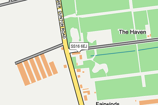
SS16 6EJ is located in the Langdon Hills electoral ward, within the local authority district of Basildon and the English Parliamentary constituency of South Basildon and East Thurrock. The Sub Integrated Care Board (ICB) Location is NHS Mid and South Essex ICB - 99E and the police force is Essex. This postcode has been in use since August 1992.


GetTheData
Source: OS OpenMap – Local (Ordnance Survey)
Source: OS VectorMap District (Ordnance Survey)
Licence: Open Government Licence (requires attribution)
| Easting | 566251 |
| Northing | 187436 |
| Latitude | 51.561304 |
| Longitude | 0.397050 |
GetTheData
Source: Open Postcode Geo
Licence: Open Government Licence
| Country | England |
| Postcode District | SS16 |
➜ See where SS16 is on a map | |
GetTheData
Source: Land Registry Price Paid Data
Licence: Open Government Licence
Elevation or altitude of SS16 6EJ as distance above sea level:
| Metres | Feet | |
|---|---|---|
| Elevation | 30m | 98ft |
Elevation is measured from the approximate centre of the postcode, to the nearest point on an OS contour line from OS Terrain 50, which has contour spacing of ten vertical metres.
➜ How high above sea level am I? Find the elevation of your current position using your device's GPS.
GetTheData
Source: Open Postcode Elevation
Licence: Open Government Licence
| Ward | Langdon Hills |
| Constituency | South Basildon And East Thurrock |
GetTheData
Source: ONS Postcode Database
Licence: Open Government Licence
| Derby Close (Highview Avenue) | Great Berry | 470m |
| Hollybank (Forest Glade) | Great Berry | 561m |
| Aylesbury Drive (Highview Avenue) | Great Berry | 721m |
| Great Berry Primary School (Forest Glade) | Great Berry | 770m |
| Great Berry Primary School (Forest Glade) | Great Berry | 776m |
| Laindon Station | 2km |
| West Horndon Station | 4km |
| Basildon Station | 4.2km |
GetTheData
Source: NaPTAN
Licence: Open Government Licence
GetTheData
Source: ONS Postcode Database
Licence: Open Government Licence


➜ Get more ratings from the Food Standards Agency
GetTheData
Source: Food Standards Agency
Licence: FSA terms & conditions
| Last Collection | |||
|---|---|---|---|
| Location | Mon-Fri | Sat | Distance |
| Hornbeam Way | 17:45 | 12:00 | 1,621m |
| Triangle Post Office | 17:30 | 11:45 | 1,674m |
| High Road/Samuel Road | 17:30 | 11:45 | 1,817m |
GetTheData
Source: Dracos
Licence: Creative Commons Attribution-ShareAlike
The below table lists the International Territorial Level (ITL) codes (formerly Nomenclature of Territorial Units for Statistics (NUTS) codes) and Local Administrative Units (LAU) codes for SS16 6EJ:
| ITL 1 Code | Name |
|---|---|
| TLH | East |
| ITL 2 Code | Name |
| TLH3 | Essex |
| ITL 3 Code | Name |
| TLH37 | Essex Thames Gateway |
| LAU 1 Code | Name |
| E07000066 | Basildon |
GetTheData
Source: ONS Postcode Directory
Licence: Open Government Licence
The below table lists the Census Output Area (OA), Lower Layer Super Output Area (LSOA), and Middle Layer Super Output Area (MSOA) for SS16 6EJ:
| Code | Name | |
|---|---|---|
| OA | E00108091 | |
| LSOA | E01021284 | Basildon 021E |
| MSOA | E02004444 | Basildon 021 |
GetTheData
Source: ONS Postcode Directory
Licence: Open Government Licence
| SS16 6UP | Hill Top Rise | 348m |
| SS16 6TQ | West Avenue | 371m |
| SS16 6UR | Armath Place | 381m |
| SS16 6TS | Meadow View | 406m |
| SS16 6SX | Forest Glade | 407m |
| SS16 6PD | Reeves Close | 409m |
| SS16 6TH | Coburg Lane | 423m |
| SS16 6TT | Milton Avenue | 462m |
| SS16 6TU | Glenwood Gardens | 471m |
| SS16 6UT | Kilowan Close | 502m |
GetTheData
Source: Open Postcode Geo; Land Registry Price Paid Data
Licence: Open Government Licence