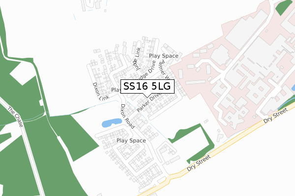
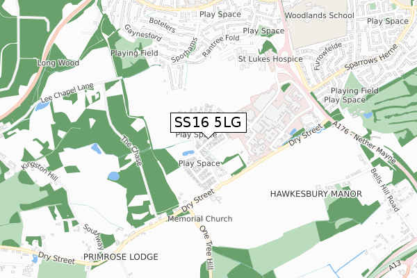
SS16 5LG is located in the Nethermayne electoral ward, within the local authority district of Basildon and the English Parliamentary constituency of South Basildon and East Thurrock. The Sub Integrated Care Board (ICB) Location is NHS Mid and South Essex ICB - 99E and the police force is Essex. This postcode has been in use since November 2018.


GetTheData
Source: OS Open Zoomstack (Ordnance Survey)
Licence: Open Government Licence (requires attribution)
Attribution: Contains OS data © Crown copyright and database right 2025
Source: Open Postcode Geo
Licence: Open Government Licence (requires attribution)
Attribution: Contains OS data © Crown copyright and database right 2025; Contains Royal Mail data © Royal Mail copyright and database right 2025; Source: Office for National Statistics licensed under the Open Government Licence v.3.0
| Easting | 569674 |
| Northing | 187084 |
| Latitude | 51.557123 |
| Longitude | 0.446215 |
GetTheData
Source: Open Postcode Geo
Licence: Open Government Licence
| Country | England |
| Postcode District | SS16 |
➜ See where SS16 is on a map ➜ Where is Basildon? | |
GetTheData
Source: Land Registry Price Paid Data
Licence: Open Government Licence
| Ward | Nethermayne |
| Constituency | South Basildon And East Thurrock |
GetTheData
Source: ONS Postcode Database
Licence: Open Government Licence
2023 30 MAY £500,000 |
2022 30 JUN £492,500 |
3, PARKER DRIVE, LANGDON HILLS, BASILDON, SS16 5LG 2019 25 OCT £664,995 |
1, PARKER DRIVE, LANGDON HILLS, BASILDON, SS16 5LG 2019 12 JUL £629,995 |
2019 22 FEB £420,995 |
2019 1 FEB £418,995 |
17, PARKER DRIVE, LANGDON HILLS, BASILDON, SS16 5LG 2018 14 DEC £418,995 |
9, PARKER DRIVE, LANGDON HILLS, BASILDON, SS16 5LG 2018 23 NOV £415,995 |
7, PARKER DRIVE, LANGDON HILLS, BASILDON, SS16 5LG 2018 23 NOV £537,995 |
5, PARKER DRIVE, LANGDON HILLS, BASILDON, SS16 5LG 2018 9 NOV £537,995 |
GetTheData
Source: HM Land Registry Price Paid Data
Licence: Contains HM Land Registry data © Crown copyright and database right 2025. This data is licensed under the Open Government Licence v3.0.
| Hospital (Hospital Forecourt) | Basildon | 451m |
| Hospital (Hospital Forecourt) | Basildon | 465m |
| Hospital Subway (Nether Mayne) | Basildon | 622m |
| Hospital Subway (Nether Mayne) | Basildon | 656m |
| Castlemayne (The Knares) | Basildon | 794m |
| Basildon Station | 1.4km |
| Laindon Station | 1.9km |
| Pitsea Station | 4.2km |
GetTheData
Source: NaPTAN
Licence: Open Government Licence
| Percentage of properties with Next Generation Access | 100.0% |
| Percentage of properties with Superfast Broadband | 100.0% |
| Percentage of properties with Ultrafast Broadband | 100.0% |
| Percentage of properties with Full Fibre Broadband | 93.8% |
Superfast Broadband is between 30Mbps and 300Mbps
Ultrafast Broadband is > 300Mbps
| Percentage of properties unable to receive 2Mbps | 0.0% |
| Percentage of properties unable to receive 5Mbps | 0.0% |
| Percentage of properties unable to receive 10Mbps | 0.0% |
| Percentage of properties unable to receive 30Mbps | 0.0% |
GetTheData
Source: Ofcom
Licence: Ofcom Terms of Use (requires attribution)
GetTheData
Source: ONS Postcode Database
Licence: Open Government Licence


➜ Get more ratings from the Food Standards Agency
GetTheData
Source: Food Standards Agency
Licence: FSA terms & conditions
| Last Collection | |||
|---|---|---|---|
| Location | Mon-Fri | Sat | Distance |
| Dry Street | 17:45 | 12:30 | 894m |
| Cherrydown | 17:30 | 11:30 | 1,093m |
| Waldergrave | 17:30 | 11:30 | 1,354m |
GetTheData
Source: Dracos
Licence: Creative Commons Attribution-ShareAlike
The below table lists the International Territorial Level (ITL) codes (formerly Nomenclature of Territorial Units for Statistics (NUTS) codes) and Local Administrative Units (LAU) codes for SS16 5LG:
| ITL 1 Code | Name |
|---|---|
| TLH | East |
| ITL 2 Code | Name |
| TLH3 | Essex |
| ITL 3 Code | Name |
| TLH37 | Essex Thames Gateway |
| LAU 1 Code | Name |
| E07000066 | Basildon |
GetTheData
Source: ONS Postcode Directory
Licence: Open Government Licence
The below table lists the Census Output Area (OA), Lower Layer Super Output Area (LSOA), and Middle Layer Super Output Area (MSOA) for SS16 5LG:
| Code | Name | |
|---|---|---|
| OA | E00108165 | |
| LSOA | E01021297 | Basildon 020D |
| MSOA | E02004443 | Basildon 020 |
GetTheData
Source: ONS Postcode Directory
Licence: Open Government Licence
| SS16 5TU | Fletchers | 434m |
| SS16 5NF | Dry Street | 467m |
| SS16 5TS | Sporhams | 492m |
| SS16 5TR | Rantree Fold | 504m |
| SS16 5TX | Morrells | 574m |
| SS16 5SH | Gaynesford | 587m |
| SS16 5TP | Rantree Fold | 593m |
| SS16 5NJ | Nether Mayne | 599m |
| SS16 5TT | Sporhams | 601m |
| SS16 5SE | Botelers | 636m |
GetTheData
Source: Open Postcode Geo; Land Registry Price Paid Data
Licence: Open Government Licence