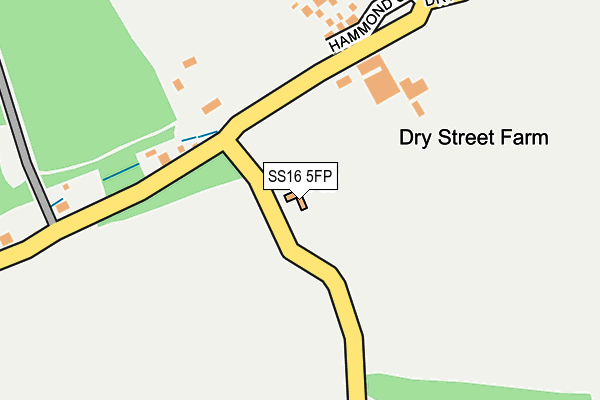
SS16 5FP is located in the Langdon Hills electoral ward, within the local authority district of Basildon and the English Parliamentary constituency of South Basildon and East Thurrock. The Sub Integrated Care Board (ICB) Location is NHS Mid and South Essex ICB - 99E and the police force is Essex. This postcode has been in use since September 2011.


GetTheData
Source: OS OpenMap – Local (Ordnance Survey)
Source: OS VectorMap District (Ordnance Survey)
Licence: Open Government Licence (requires attribution)
| Easting | 569622 |
| Northing | 186614 |
| Latitude | 51.552914 |
| Longitude | 0.445208 |
GetTheData
Source: Open Postcode Geo
Licence: Open Government Licence
| Country | England |
| Postcode District | SS16 |
➜ See where SS16 is on a map | |
GetTheData
Source: Land Registry Price Paid Data
Licence: Open Government Licence
Elevation or altitude of SS16 5FP as distance above sea level:
| Metres | Feet | |
|---|---|---|
| Elevation | 60m | 197ft |
Elevation is measured from the approximate centre of the postcode, to the nearest point on an OS contour line from OS Terrain 50, which has contour spacing of ten vertical metres.
➜ How high above sea level am I? Find the elevation of your current position using your device's GPS.
GetTheData
Source: Open Postcode Elevation
Licence: Open Government Licence
| Ward | Langdon Hills |
| Constituency | South Basildon And East Thurrock |
GetTheData
Source: ONS Postcode Database
Licence: Open Government Licence
| Hospital (Hospital Forecourt) | Basildon | 827m |
| Hospital (Hospital Forecourt) | Basildon | 843m |
| Hospital Subway (Nether Mayne) | Basildon | 999m |
| Hospital Subway (Nether Mayne) | Basildon | 1,029m |
| Bells Hill Road (Nether Mayne) | Basildon | 1,034m |
| Basildon Station | 1.9km |
| Laindon Station | 2.2km |
| Pitsea Station | 4.3km |
GetTheData
Source: NaPTAN
Licence: Open Government Licence
GetTheData
Source: ONS Postcode Database
Licence: Open Government Licence


➜ Get more ratings from the Food Standards Agency
GetTheData
Source: Food Standards Agency
Licence: FSA terms & conditions
| Last Collection | |||
|---|---|---|---|
| Location | Mon-Fri | Sat | Distance |
| Dry Street | 17:45 | 12:30 | 561m |
| Cherrydown | 17:30 | 11:30 | 1,549m |
| Kingswood Post Office | 17:30 | 11:30 | 1,724m |
GetTheData
Source: Dracos
Licence: Creative Commons Attribution-ShareAlike
The below table lists the International Territorial Level (ITL) codes (formerly Nomenclature of Territorial Units for Statistics (NUTS) codes) and Local Administrative Units (LAU) codes for SS16 5FP:
| ITL 1 Code | Name |
|---|---|
| TLH | East |
| ITL 2 Code | Name |
| TLH3 | Essex |
| ITL 3 Code | Name |
| TLH37 | Essex Thames Gateway |
| LAU 1 Code | Name |
| E07000066 | Basildon |
GetTheData
Source: ONS Postcode Directory
Licence: Open Government Licence
The below table lists the Census Output Area (OA), Lower Layer Super Output Area (LSOA), and Middle Layer Super Output Area (MSOA) for SS16 5FP:
| Code | Name | |
|---|---|---|
| OA | E00108109 | |
| LSOA | E01021282 | Basildon 021C |
| MSOA | E02004444 | Basildon 021 |
GetTheData
Source: ONS Postcode Directory
Licence: Open Government Licence
| SS16 5NF | Dry Street | 141m |
| SS16 5ND | Dry Street | 532m |
| SS16 5LZ | Southway | 693m |
| SS16 5LX | Dry Street | 736m |
| SS16 5NB | Stormonts Way | 844m |
| SS16 5TU | Fletchers | 855m |
| SS16 5JS | Hawkesbury Bush Lane | 887m |
| SS17 9NH | One Tree Hill | 929m |
| SS16 5TS | Sporhams | 936m |
| SS16 5TR | Rantree Fold | 972m |
GetTheData
Source: Open Postcode Geo; Land Registry Price Paid Data
Licence: Open Government Licence