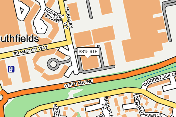
SS15 6TF is located in the Laindon Park electoral ward, within the local authority district of Basildon and the English Parliamentary constituency of Basildon and Billericay. The Sub Integrated Care Board (ICB) Location is NHS Mid and South Essex ICB - 99E and the police force is Essex. This postcode has been in use since May 2003.


GetTheData
Source: OS OpenMap – Local (Ordnance Survey)
Source: OS VectorMap District (Ordnance Survey)
Licence: Open Government Licence (requires attribution)
| Easting | 566671 |
| Northing | 188967 |
| Latitude | 51.574931 |
| Longitude | 0.403799 |
GetTheData
Source: Open Postcode Geo
Licence: Open Government Licence
| Country | England |
| Postcode District | SS15 |
➜ See where SS15 is on a map ➜ Where is Basildon? | |
GetTheData
Source: Land Registry Price Paid Data
Licence: Open Government Licence
Elevation or altitude of SS15 6TF as distance above sea level:
| Metres | Feet | |
|---|---|---|
| Elevation | 40m | 131ft |
Elevation is measured from the approximate centre of the postcode, to the nearest point on an OS contour line from OS Terrain 50, which has contour spacing of ten vertical metres.
➜ How high above sea level am I? Find the elevation of your current position using your device's GPS.
GetTheData
Source: Open Postcode Elevation
Licence: Open Government Licence
| Ward | Laindon Park |
| Constituency | Basildon And Billericay |
GetTheData
Source: ONS Postcode Database
Licence: Open Government Licence
| Menzies Avenue (Durham Road) | Laindon | 130m |
| Menzies Avenue (Durham Road) | Laindon | 155m |
| Hoover Drive (Durham Road) | Laindon | 241m |
| Hoover Drive (Durham Road) | Laindon | 294m |
| Fenton Way | Laindon | 372m |
| Laindon Station | 1.6km |
| Basildon Station | 3.8km |
| West Horndon Station | 4.4km |
GetTheData
Source: NaPTAN
Licence: Open Government Licence
GetTheData
Source: ONS Postcode Database
Licence: Open Government Licence
➜ Get more ratings from the Food Standards Agency
GetTheData
Source: Food Standards Agency
Licence: FSA terms & conditions
| Last Collection | |||
|---|---|---|---|
| Location | Mon-Fri | Sat | Distance |
| Railway Approach | 17:30 | 12:00 | 775m |
| Hornbeam Way | 17:45 | 12:00 | 1,177m |
| High Road/Samuel Road | 17:30 | 11:45 | 1,821m |
GetTheData
Source: Dracos
Licence: Creative Commons Attribution-ShareAlike
The below table lists the International Territorial Level (ITL) codes (formerly Nomenclature of Territorial Units for Statistics (NUTS) codes) and Local Administrative Units (LAU) codes for SS15 6TF:
| ITL 1 Code | Name |
|---|---|
| TLH | East |
| ITL 2 Code | Name |
| TLH3 | Essex |
| ITL 3 Code | Name |
| TLH37 | Essex Thames Gateway |
| LAU 1 Code | Name |
| E07000066 | Basildon |
GetTheData
Source: ONS Postcode Directory
Licence: Open Government Licence
The below table lists the Census Output Area (OA), Lower Layer Super Output Area (LSOA), and Middle Layer Super Output Area (MSOA) for SS15 6TF:
| Code | Name | |
|---|---|---|
| OA | E00108073 | |
| LSOA | E01021277 | Basildon 014D |
| MSOA | E02004437 | Basildon 014 |
GetTheData
Source: ONS Postcode Directory
Licence: Open Government Licence
| SS15 6BG | Broadwater Green | 179m |
| SS15 6LE | Kennedy Avenue | 240m |
| SS15 6BQ | Palatine Park | 242m |
| SS15 6SX | Menzies Avenue | 248m |
| SS15 6BE | Brooklands Park | 249m |
| SS15 6SD | Hornsby Square | 266m |
| SS15 6LG | Woodstock Crescent | 287m |
| SS15 6SY | Menzies Avenue | 288m |
| SS15 6LQ | Woodstock Gardens | 328m |
| SS15 6SU | Fraser Close | 338m |
GetTheData
Source: Open Postcode Geo; Land Registry Price Paid Data
Licence: Open Government Licence