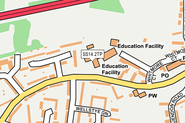
SS14 2TP is located in the Fryerns electoral ward, within the local authority district of Basildon and the English Parliamentary constituency of Basildon and Billericay. The Sub Integrated Care Board (ICB) Location is NHS Mid and South Essex ICB - 99E and the police force is Essex. This postcode has been in use since January 1980.


GetTheData
Source: OS OpenMap – Local (Ordnance Survey)
Source: OS VectorMap District (Ordnance Survey)
Licence: Open Government Licence (requires attribution)
| Easting | 572150 |
| Northing | 189998 |
| Latitude | 51.582547 |
| Longitude | 0.483292 |
GetTheData
Source: Open Postcode Geo
Licence: Open Government Licence
| Country | England |
| Postcode District | SS14 |
➜ See where SS14 is on a map ➜ Where is Basildon? | |
GetTheData
Source: Land Registry Price Paid Data
Licence: Open Government Licence
Elevation or altitude of SS14 2TP as distance above sea level:
| Metres | Feet | |
|---|---|---|
| Elevation | 30m | 98ft |
Elevation is measured from the approximate centre of the postcode, to the nearest point on an OS contour line from OS Terrain 50, which has contour spacing of ten vertical metres.
➜ How high above sea level am I? Find the elevation of your current position using your device's GPS.
GetTheData
Source: Open Postcode Elevation
Licence: Open Government Licence
| Ward | Fryerns |
| Constituency | Basildon And Billericay |
GetTheData
Source: ONS Postcode Database
Licence: Open Government Licence
| Matching Green (Whitmore Way) | Basildon | 93m |
| Matching Green (Whitmore Way) | Basildon | 152m |
| The Jolly Friar (Whitmore Way) | Basildon | 212m |
| The Jolly Friar (Whitmore Way) | Basildon | 225m |
| York Factory (Gardiners Lane South) | Basildon | 384m |
| Basildon Station | 2.4km |
| Pitsea Station | 2.9km |
| Wickford Station | 4.4km |
GetTheData
Source: NaPTAN
Licence: Open Government Licence
GetTheData
Source: ONS Postcode Database
Licence: Open Government Licence


➜ Get more ratings from the Food Standards Agency
GetTheData
Source: Food Standards Agency
Licence: FSA terms & conditions
| Last Collection | |||
|---|---|---|---|
| Location | Mon-Fri | Sat | Distance |
| Chichester Close | 17:30 | 12:15 | 843m |
| Festival Leisure Park | 18:30 | 11:30 | 1,285m |
| Festival Leisure Park | 1,285m | ||
GetTheData
Source: Dracos
Licence: Creative Commons Attribution-ShareAlike
The below table lists the International Territorial Level (ITL) codes (formerly Nomenclature of Territorial Units for Statistics (NUTS) codes) and Local Administrative Units (LAU) codes for SS14 2TP:
| ITL 1 Code | Name |
|---|---|
| TLH | East |
| ITL 2 Code | Name |
| TLH3 | Essex |
| ITL 3 Code | Name |
| TLH37 | Essex Thames Gateway |
| LAU 1 Code | Name |
| E07000066 | Basildon |
GetTheData
Source: ONS Postcode Directory
Licence: Open Government Licence
The below table lists the Census Output Area (OA), Lower Layer Super Output Area (LSOA), and Middle Layer Super Output Area (MSOA) for SS14 2TP:
| Code | Name | |
|---|---|---|
| OA | E00108027 | |
| LSOA | E01021270 | Basildon 012D |
| MSOA | E02004435 | Basildon 012 |
GetTheData
Source: ONS Postcode Directory
Licence: Open Government Licence
| SS14 2TJ | Whitmore Way | 95m |
| SS14 2TN | Whitmore Way | 112m |
| SS14 2SS | Danbury Down | 132m |
| SS14 2TL | Whitmore Way | 141m |
| SS14 2PB | Matching Green | 146m |
| SS14 2SR | Wellstye Green | 182m |
| SS14 2PA | Whitmore Way | 183m |
| SS14 2ST | Maplestead | 202m |
| SS14 2SP | Danbury Down | 213m |
| SS14 2PD | Whitmore Way | 235m |
GetTheData
Source: Open Postcode Geo; Land Registry Price Paid Data
Licence: Open Government Licence