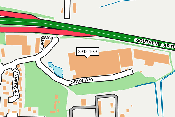
SS13 1GS is located in the Pitsea North West electoral ward, within the local authority district of Basildon and the English Parliamentary constituency of South Basildon and East Thurrock. The Sub Integrated Care Board (ICB) Location is NHS Mid and South Essex ICB - 99E and the police force is Essex. This postcode has been in use since December 1997.


GetTheData
Source: OS OpenMap – Local (Ordnance Survey)
Source: OS VectorMap District (Ordnance Survey)
Licence: Open Government Licence (requires attribution)
| Easting | 573739 |
| Northing | 191027 |
| Latitude | 51.591304 |
| Longitude | 0.506712 |
GetTheData
Source: Open Postcode Geo
Licence: Open Government Licence
| Country | England |
| Postcode District | SS13 |
➜ See where SS13 is on a map ➜ Where is Basildon? | |
GetTheData
Source: Land Registry Price Paid Data
Licence: Open Government Licence
Elevation or altitude of SS13 1GS as distance above sea level:
| Metres | Feet | |
|---|---|---|
| Elevation | 10m | 33ft |
Elevation is measured from the approximate centre of the postcode, to the nearest point on an OS contour line from OS Terrain 50, which has contour spacing of ten vertical metres.
➜ How high above sea level am I? Find the elevation of your current position using your device's GPS.
GetTheData
Source: Open Postcode Elevation
Licence: Open Government Licence
| Ward | Pitsea North West |
| Constituency | South Basildon And East Thurrock |
GetTheData
Source: ONS Postcode Database
Licence: Open Government Licence
| Archers Field (Courtauld Road) | Burnt Mills | 470m |
| Harvey Road (Courtauld Road) | Burnt Mills | 490m |
| Harvey Road (Courtauld Road) | Burnt Mills | 495m |
| Sainsbury Store (East Mayne) | Basildon | 513m |
| Sainsbury Store (East Mayne) | Basildon | 555m |
| Wickford Station | 2.8km |
| Pitsea Station | 3.4km |
| Basildon Station | 4.3km |
GetTheData
Source: NaPTAN
Licence: Open Government Licence
GetTheData
Source: ONS Postcode Database
Licence: Open Government Licence


➜ Get more ratings from the Food Standards Agency
GetTheData
Source: Food Standards Agency
Licence: FSA terms & conditions
| Last Collection | |||
|---|---|---|---|
| Location | Mon-Fri | Sat | Distance |
| Chichester Close | 17:30 | 12:15 | 1,825m |
| Burnt Mills Road | 17:30 | 12:15 | 1,917m |
| Rectory Road Post Office | 17:30 | 12:15 | 2,036m |
GetTheData
Source: Dracos
Licence: Creative Commons Attribution-ShareAlike
The below table lists the International Territorial Level (ITL) codes (formerly Nomenclature of Territorial Units for Statistics (NUTS) codes) and Local Administrative Units (LAU) codes for SS13 1GS:
| ITL 1 Code | Name |
|---|---|
| TLH | East |
| ITL 2 Code | Name |
| TLH3 | Essex |
| ITL 3 Code | Name |
| TLH37 | Essex Thames Gateway |
| LAU 1 Code | Name |
| E07000066 | Basildon |
GetTheData
Source: ONS Postcode Directory
Licence: Open Government Licence
The below table lists the Census Output Area (OA), Lower Layer Super Output Area (LSOA), and Middle Layer Super Output Area (MSOA) for SS13 1GS:
| Code | Name | |
|---|---|---|
| OA | E00108234 | |
| LSOA | E01021307 | Basildon 011C |
| MSOA | E02004434 | Basildon 011 |
GetTheData
Source: ONS Postcode Directory
Licence: Open Government Licence
| SS13 1SS | Lords Court | 178m |
| SS13 1GL | Nevendon Mews | 311m |
| SS13 1BZ | Church Lane | 354m |
| SS13 1EJ | Bishops Close | 410m |
| SS13 1EQ | Bishops Close | 457m |
| SS13 1EN | Canon Court | 477m |
| SS13 1BT | Headingley Close | 508m |
| SS13 1BL | Grace Road | 545m |
| SS13 1AW | Nevendon Road | 550m |
| SS13 1AL | The Parks | 553m |
GetTheData
Source: Open Postcode Geo; Land Registry Price Paid Data
Licence: Open Government Licence