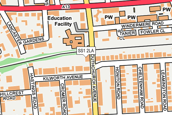
SS1 2LA is located in the Kursaal electoral ward, within the unitary authority of Southend-on-Sea and the English Parliamentary constituency of Rochford and Southend East. The Sub Integrated Care Board (ICB) Location is NHS Mid and South Essex ICB - 99G and the police force is Essex. This postcode has been in use since April 2017.


GetTheData
Source: OS OpenMap – Local (Ordnance Survey)
Source: OS VectorMap District (Ordnance Survey)
Licence: Open Government Licence (requires attribution)
| Easting | 588960 |
| Northing | 185692 |
| Latitude | 51.538498 |
| Longitude | 0.723350 |
GetTheData
Source: Open Postcode Geo
Licence: Open Government Licence
| Country | England |
| Postcode District | SS1 |
➜ See where SS1 is on a map ➜ Where is Southend-on-Sea? | |
GetTheData
Source: Land Registry Price Paid Data
Licence: Open Government Licence
| Ward | Kursaal |
| Constituency | Rochford And Southend East |
GetTheData
Source: ONS Postcode Database
Licence: Open Government Licence
| Southchurch Avenue Cnr (Southchurch Road) | Southchurch | 178m |
| Southchurch Avenue Cnr (Southchurch Road) | Southchurch | 192m |
| Bournemouth Park Road South (Bournemouth Park Road) | Southchurch | 220m |
| Sacred Heart Schools (Southchurch Road) | Southchurch | 267m |
| Nicholson House (Southchurch Road) | Southchurch | 288m |
| Southend East Station | 0.6km |
| Southend Central Station | 0.8km |
| Southend Victoria Station | 0.9km |
GetTheData
Source: NaPTAN
Licence: Open Government Licence
| Percentage of properties with Next Generation Access | 0.0% |
| Percentage of properties with Superfast Broadband | 0.0% |
| Percentage of properties with Ultrafast Broadband | 0.0% |
| Percentage of properties with Full Fibre Broadband | 0.0% |
Superfast Broadband is between 30Mbps and 300Mbps
Ultrafast Broadband is > 300Mbps
| Percentage of properties unable to receive 2Mbps | 0.0% |
| Percentage of properties unable to receive 5Mbps | 0.0% |
| Percentage of properties unable to receive 10Mbps | 0.0% |
| Percentage of properties unable to receive 30Mbps | 100.0% |
GetTheData
Source: Ofcom
Licence: Ofcom Terms of Use (requires attribution)
GetTheData
Source: ONS Postcode Database
Licence: Open Government Licence


➜ Get more ratings from the Food Standards Agency
GetTheData
Source: Food Standards Agency
Licence: FSA terms & conditions
| Last Collection | |||
|---|---|---|---|
| Location | Mon-Fri | Sat | Distance |
| 180 York Road | 17:30 | 11:30 | 215m |
| Lancaster Gardens | 17:30 | 11:30 | 233m |
| Boscombe Road | 18:30 | 11:30 | 358m |
GetTheData
Source: Dracos
Licence: Creative Commons Attribution-ShareAlike
The below table lists the International Territorial Level (ITL) codes (formerly Nomenclature of Territorial Units for Statistics (NUTS) codes) and Local Administrative Units (LAU) codes for SS1 2LA:
| ITL 1 Code | Name |
|---|---|
| TLH | East |
| ITL 2 Code | Name |
| TLH3 | Essex |
| ITL 3 Code | Name |
| TLH31 | Southend-on-Sea |
| LAU 1 Code | Name |
| E06000033 | Southend-on-Sea |
GetTheData
Source: ONS Postcode Directory
Licence: Open Government Licence
The below table lists the Census Output Area (OA), Lower Layer Super Output Area (LSOA), and Middle Layer Super Output Area (MSOA) for SS1 2LA:
| Code | Name | |
|---|---|---|
| OA | E00080079 | |
| LSOA | E01015840 | Southend-on-Sea 014B |
| MSOA | E02003292 | Southend-on-Sea 014 |
GetTheData
Source: ONS Postcode Directory
Licence: Open Government Licence
| SS1 2DS | Kilworth Avenue | 92m |
| SS1 2RP | Southchurch Avenue | 103m |
| SS1 2RW | Southchurch Avenue | 136m |
| SS1 2RY | Honiton Road | 140m |
| SS1 2DT | Kilworth Avenue | 145m |
| SS1 2DU | Cromer Road | 164m |
| SS1 2PF | Southchurch Avenue | 168m |
| SS1 2NR | Southchurch Road | 170m |
| SS1 2UT | Ambleside Drive | 183m |
| SS1 2RF | Windermere Road | 190m |
GetTheData
Source: Open Postcode Geo; Land Registry Price Paid Data
Licence: Open Government Licence