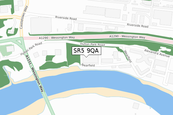
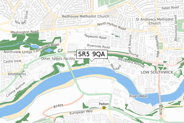
SR5 9QA is located in the Southwick electoral ward, within the metropolitan district of Sunderland and the English Parliamentary constituency of Sunderland Central. The Sub Integrated Care Board (ICB) Location is NHS North East and North Cumbria ICB - 00P and the police force is Northumbria. This postcode has been in use since September 2018.


GetTheData
Source: OS Open Zoomstack (Ordnance Survey)
Licence: Open Government Licence (requires attribution)
Attribution: Contains OS data © Crown copyright and database right 2025
Source: Open Postcode Geo
Licence: Open Government Licence (requires attribution)
Attribution: Contains OS data © Crown copyright and database right 2025; Contains Royal Mail data © Royal Mail copyright and database right 2025; Source: Office for National Statistics licensed under the Open Government Licence v.3.0
| Easting | 437260 |
| Northing | 558340 |
| Latitude | 54.918384 |
| Longitude | -1.420262 |
GetTheData
Source: Open Postcode Geo
Licence: Open Government Licence
| Country | England |
| Postcode District | SR5 |
➜ See where SR5 is on a map ➜ Where is Sunderland? | |
GetTheData
Source: Land Registry Price Paid Data
Licence: Open Government Licence
| Ward | Southwick |
| Constituency | Sunderland Central |
GetTheData
Source: ONS Postcode Database
Licence: Open Government Licence
| Alexandra Avenue-nursery (Alexandra Avenue) | Enterprise Park | 293m |
| Hylton Park Road (Hylton Park) | Enterprise Park | 328m |
| Hylton Park Road (Hylton Park) | Enterprise Park | 350m |
| Alexandra Avenue-business Centre (Alexandra Avenue) | Enterprise Park | 411m |
| North Hylton Rd-industrial Est (North Hylton Road) | Hylton Red House | 479m |
| Pallion (Tyne And Wear Metro Station) (European Way) | Pallion | 649m |
| Millfield (Tyne And Wear Metro Station) (Hylton Road) | Millfield | 1,788m |
| St Peters Station | 2.5km |
| Seaburn Station | 2.5km |
| Sunderland Station | 2.8km |
GetTheData
Source: NaPTAN
Licence: Open Government Licence
GetTheData
Source: ONS Postcode Database
Licence: Open Government Licence


➜ Get more ratings from the Food Standards Agency
GetTheData
Source: Food Standards Agency
Licence: FSA terms & conditions
| Last Collection | |||
|---|---|---|---|
| Location | Mon-Fri | Sat | Distance |
| Freda Street | 17:30 | 12:30 | 732m |
| Pallion Way | 19:00 | 12:15 | 943m |
| Oxford Street Post Office | 17:45 | 12:30 | 1,140m |
GetTheData
Source: Dracos
Licence: Creative Commons Attribution-ShareAlike
The below table lists the International Territorial Level (ITL) codes (formerly Nomenclature of Territorial Units for Statistics (NUTS) codes) and Local Administrative Units (LAU) codes for SR5 9QA:
| ITL 1 Code | Name |
|---|---|
| TLC | North East (England) |
| ITL 2 Code | Name |
| TLC2 | Northumberland, and Tyne and Wear |
| ITL 3 Code | Name |
| TLC23 | Sunderland |
| LAU 1 Code | Name |
| E08000024 | Sunderland |
GetTheData
Source: ONS Postcode Directory
Licence: Open Government Licence
The below table lists the Census Output Area (OA), Lower Layer Super Output Area (LSOA), and Middle Layer Super Output Area (MSOA) for SR5 9QA:
| Code | Name | |
|---|---|---|
| OA | E00044786 | |
| LSOA | E01008820 | Sunderland 005F |
| MSOA | E02001795 | Sunderland 005 |
GetTheData
Source: ONS Postcode Directory
Licence: Open Government Licence
| SR5 3JG | Riverside Road | 210m |
| SR5 3JT | Hepworth Road | 365m |
| SR5 5RG | Radcliffe Road | 542m |
| SR4 6TY | Woodbine Terrace | 543m |
| SR5 5RB | Raleigh Road | 581m |
| SR5 2EW | Broadsheath Terrace | 597m |
| SR5 5RQ | Redcar Road | 632m |
| SR5 5RA | Raleigh Square | 634m |
| SR5 5AE | Pinewood Road | 636m |
| SR5 5RD | Raleigh Road | 637m |
GetTheData
Source: Open Postcode Geo; Land Registry Price Paid Data
Licence: Open Government Licence