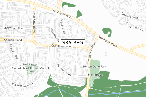
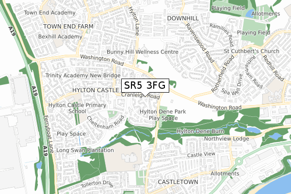
SR5 3FG is located in the Castle electoral ward, within the metropolitan district of Sunderland and the English Parliamentary constituency of Washington and Sunderland West. The Sub Integrated Care Board (ICB) Location is NHS North East and North Cumbria ICB - 00P and the police force is Northumbria. This postcode has been in use since January 2019.


GetTheData
Source: OS Open Zoomstack (Ordnance Survey)
Licence: Open Government Licence (requires attribution)
Attribution: Contains OS data © Crown copyright and database right 2025
Source: Open Postcode Geo
Licence: Open Government Licence (requires attribution)
Attribution: Contains OS data © Crown copyright and database right 2025; Contains Royal Mail data © Royal Mail copyright and database right 2025; Source: Office for National Statistics licensed under the Open Government Licence v.3.0
| Easting | 435556 |
| Northing | 558828 |
| Latitude | 54.922893 |
| Longitude | -1.446784 |
GetTheData
Source: Open Postcode Geo
Licence: Open Government Licence
| Country | England |
| Postcode District | SR5 |
➜ See where SR5 is on a map ➜ Where is Sunderland? | |
GetTheData
Source: Land Registry Price Paid Data
Licence: Open Government Licence
| Ward | Castle |
| Constituency | Washington And Sunderland West |
GetTheData
Source: ONS Postcode Database
Licence: Open Government Licence
5, SUNRISE COURT, CRANLEIGH ROAD, SUNDERLAND, SR5 3FG 2019 16 JUL £115,000 |
GetTheData
Source: HM Land Registry Price Paid Data
Licence: Contains HM Land Registry data © Crown copyright and database right 2025. This data is licensed under the Open Government Licence v3.0.
| Cranleigh Road | Hylton Castle | 36m |
| Cranleigh Road | Hylton Castle | 83m |
| Craigavon Road - Cranleigh Road (Craigavon Road) | Hylton Castle | 131m |
| Washington Road-clinic (Washington Road) | Hylton Castle | 169m |
| Craigavon Road - Washington Road (Craigavon Road) | Hylton Castle | 171m |
| East Boldon Station | 3.1km |
| Seaburn Station | 3.9km |
| Brockley Whins Station | 4.2km |
GetTheData
Source: NaPTAN
Licence: Open Government Licence
GetTheData
Source: ONS Postcode Database
Licence: Open Government Licence


➜ Get more ratings from the Food Standards Agency
GetTheData
Source: Food Standards Agency
Licence: FSA terms & conditions
| Last Collection | |||
|---|---|---|---|
| Location | Mon-Fri | Sat | Distance |
| Maling Park | 16:15 | 10:30 | 1,545m |
| Hylton Post Office | 17:15 | 10:30 | 1,980m |
| Pallion Way | 19:00 | 12:15 | 2,114m |
GetTheData
Source: Dracos
Licence: Creative Commons Attribution-ShareAlike
The below table lists the International Territorial Level (ITL) codes (formerly Nomenclature of Territorial Units for Statistics (NUTS) codes) and Local Administrative Units (LAU) codes for SR5 3FG:
| ITL 1 Code | Name |
|---|---|
| TLC | North East (England) |
| ITL 2 Code | Name |
| TLC2 | Northumberland, and Tyne and Wear |
| ITL 3 Code | Name |
| TLC23 | Sunderland |
| LAU 1 Code | Name |
| E08000024 | Sunderland |
GetTheData
Source: ONS Postcode Directory
Licence: Open Government Licence
The below table lists the Census Output Area (OA), Lower Layer Super Output Area (LSOA), and Middle Layer Super Output Area (MSOA) for SR5 3FG:
| Code | Name | |
|---|---|---|
| OA | E00044151 | |
| LSOA | E01008694 | Sunderland 008B |
| MSOA | E02001798 | Sunderland 008 |
GetTheData
Source: ONS Postcode Directory
Licence: Open Government Licence
| SR5 3PW | Cranleigh Road | 56m |
| SR5 3PQ | Cranleigh Road | 67m |
| SR5 3PN | Cranleigh Road | 71m |
| SR5 3PP | Coleridge Road | 77m |
| SR5 3PG | Cowdray Road | 81m |
| SR5 3PJ | Cranberry Road | 97m |
| SR5 3PH | Cranberry Square | 108m |
| SR5 3PR | Coverley Road | 116m |
| SR5 3PB | Craigavon Road | 134m |
| SR5 3PS | Coverley Road | 135m |
GetTheData
Source: Open Postcode Geo; Land Registry Price Paid Data
Licence: Open Government Licence