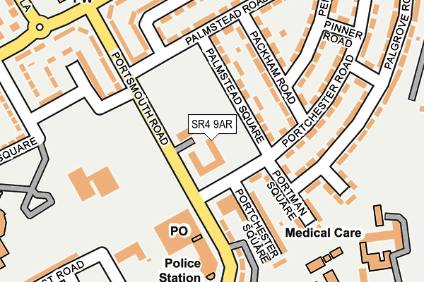
SR4 9AR is located in the St Anne's electoral ward, within the metropolitan district of Sunderland and the English Parliamentary constituency of Washington and Sunderland West. The Sub Integrated Care Board (ICB) Location is NHS North East and North Cumbria ICB - 00P and the police force is Northumbria. This postcode has been in use since December 2000.


GetTheData
Source: OS OpenMap – Local (Ordnance Survey)
Source: OS VectorMap District (Ordnance Survey)
Licence: Open Government Licence (requires attribution)
| Easting | 436037 |
| Northing | 556061 |
| Latitude | 54.897995 |
| Longitude | -1.439625 |
GetTheData
Source: Open Postcode Geo
Licence: Open Government Licence
| Country | England |
| Postcode District | SR4 |
➜ See where SR4 is on a map ➜ Where is Sunderland? | |
GetTheData
Source: Land Registry Price Paid Data
Licence: Open Government Licence
Elevation or altitude of SR4 9AR as distance above sea level:
| Metres | Feet | |
|---|---|---|
| Elevation | 70m | 230ft |
Elevation is measured from the approximate centre of the postcode, to the nearest point on an OS contour line from OS Terrain 50, which has contour spacing of ten vertical metres.
➜ How high above sea level am I? Find the elevation of your current position using your device's GPS.
GetTheData
Source: Open Postcode Elevation
Licence: Open Government Licence
| Ward | St Anne's |
| Constituency | Washington And Sunderland West |
GetTheData
Source: ONS Postcode Database
Licence: Open Government Licence
| Portsmouth Road-shopping Precinct (Portsmouth Road) | Pennywell | 44m |
| Portsmouth Road-portchester Road (Portsmouth Road) | Pennywell | 78m |
| Portsmouth Road-hylton Road (Portsmouth Road) | Pennywell | 163m |
| Portsmouth Road-parkhurst Road (Portsmouth Road) | Pennywell | 188m |
| Parkhurst Road | Pennywell | 202m |
| South Hylton (Tyne And Wear Metro Station) (High Street / Hylton Bank) | South Hylton | 857m |
| Sunderland Station | 3.8km |
| St Peters Station | 3.9km |
| Seaburn Station | 4.9km |
GetTheData
Source: NaPTAN
Licence: Open Government Licence
GetTheData
Source: ONS Postcode Database
Licence: Open Government Licence


➜ Get more ratings from the Food Standards Agency
GetTheData
Source: Food Standards Agency
Licence: FSA terms & conditions
| Last Collection | |||
|---|---|---|---|
| Location | Mon-Fri | Sat | Distance |
| Pennywell Post Office | 16:45 | 10:30 | 129m |
| Hylton Bank | 16:00 | 10:30 | 433m |
| Palgrove Road | 16:15 | 10:30 | 462m |
GetTheData
Source: Dracos
Licence: Creative Commons Attribution-ShareAlike
The below table lists the International Territorial Level (ITL) codes (formerly Nomenclature of Territorial Units for Statistics (NUTS) codes) and Local Administrative Units (LAU) codes for SR4 9AR:
| ITL 1 Code | Name |
|---|---|
| TLC | North East (England) |
| ITL 2 Code | Name |
| TLC2 | Northumberland, and Tyne and Wear |
| ITL 3 Code | Name |
| TLC23 | Sunderland |
| LAU 1 Code | Name |
| E08000024 | Sunderland |
GetTheData
Source: ONS Postcode Directory
Licence: Open Government Licence
The below table lists the Census Output Area (OA), Lower Layer Super Output Area (LSOA), and Middle Layer Super Output Area (MSOA) for SR4 9AR:
| Code | Name | |
|---|---|---|
| OA | E00044767 | |
| LSOA | E01008813 | Sunderland 014C |
| MSOA | E02001804 | Sunderland 014 |
GetTheData
Source: ONS Postcode Directory
Licence: Open Government Licence
| SR4 8EL | Palmstead Square | 119m |
| SR4 8ED | Portchester Road | 135m |
| SR4 9AS | Pennywell Shopping Centre | 138m |
| SR4 8EB | Portman Square | 153m |
| SR4 8EJ | Packham Road | 158m |
| SR4 8EN | Palmstead Road | 169m |
| SR4 9HU | Portsmouth Road | 185m |
| SR4 9AU | Portsmouth Road | 192m |
| SR4 9AT | Portsmouth Road | 196m |
| SR4 8DY | Palgrove Road | 215m |
GetTheData
Source: Open Postcode Geo; Land Registry Price Paid Data
Licence: Open Government Licence