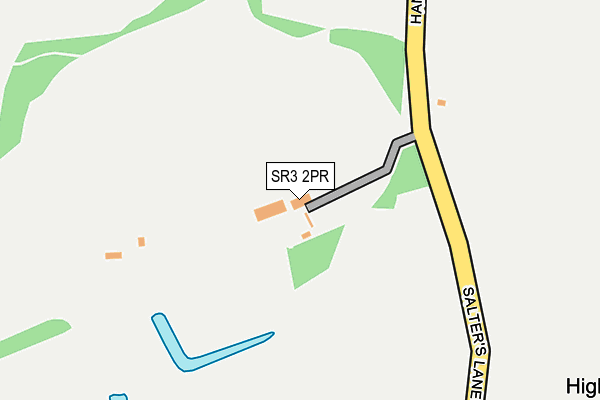
SR3 2PR is located in the Copt Hill electoral ward, within the metropolitan district of Sunderland and the English Parliamentary constituency of Houghton and Sunderland South. The Sub Integrated Care Board (ICB) Location is NHS North East and North Cumbria ICB - 00P and the police force is Northumbria. This postcode has been in use since June 1996.


GetTheData
Source: OS OpenMap – Local (Ordnance Survey)
Source: OS VectorMap District (Ordnance Survey)
Licence: Open Government Licence (requires attribution)
| Easting | 437149 |
| Northing | 550501 |
| Latitude | 54.847953 |
| Longitude | -1.423000 |
GetTheData
Source: Open Postcode Geo
Licence: Open Government Licence
| Country | England |
| Postcode District | SR3 |
➜ See where SR3 is on a map | |
GetTheData
Source: Land Registry Price Paid Data
Licence: Open Government Licence
Elevation or altitude of SR3 2PR as distance above sea level:
| Metres | Feet | |
|---|---|---|
| Elevation | 160m | 525ft |
Elevation is measured from the approximate centre of the postcode, to the nearest point on an OS contour line from OS Terrain 50, which has contour spacing of ten vertical metres.
➜ How high above sea level am I? Find the elevation of your current position using your device's GPS.
GetTheData
Source: Open Postcode Elevation
Licence: Open Government Licence
| Ward | Copt Hill |
| Constituency | Houghton And Sunderland South |
GetTheData
Source: ONS Postcode Database
Licence: Open Government Licence
| Gillas Lane-salters Lane (Gillas Lane) | Houghton-le-spring | 440m |
| Gillas Lane-salters Lane (Gillas Lane) | Houghton-le-spring | 452m |
| Gillas Lane-warden Law (Gillas Lane) | Houghton-le-spring | 658m |
| Gillas Lane-warden Law (Gillas Lane) | Houghton-le-spring | 683m |
| Sharpley Hall Farm (B1404 Seaton Lane) | Seaton | 1,404m |
| Seaham Station | 5km |
GetTheData
Source: NaPTAN
Licence: Open Government Licence
GetTheData
Source: ONS Postcode Database
Licence: Open Government Licence


➜ Get more ratings from the Food Standards Agency
GetTheData
Source: Food Standards Agency
Licence: FSA terms & conditions
| Last Collection | |||
|---|---|---|---|
| Location | Mon-Fri | Sat | Distance |
| Marcross Drive | 17:30 | 12:00 | 1,921m |
| Monarch Avenue | 17:30 | 12:00 | 1,961m |
| Humbledon Park | 17:00 | 11:30 | 2,085m |
GetTheData
Source: Dracos
Licence: Creative Commons Attribution-ShareAlike
The below table lists the International Territorial Level (ITL) codes (formerly Nomenclature of Territorial Units for Statistics (NUTS) codes) and Local Administrative Units (LAU) codes for SR3 2PR:
| ITL 1 Code | Name |
|---|---|
| TLC | North East (England) |
| ITL 2 Code | Name |
| TLC2 | Northumberland, and Tyne and Wear |
| ITL 3 Code | Name |
| TLC23 | Sunderland |
| LAU 1 Code | Name |
| E08000024 | Sunderland |
GetTheData
Source: ONS Postcode Directory
Licence: Open Government Licence
The below table lists the Census Output Area (OA), Lower Layer Super Output Area (LSOA), and Middle Layer Super Output Area (MSOA) for SR3 2PR:
| Code | Name | |
|---|---|---|
| OA | E00044275 | |
| LSOA | E01008719 | Sunderland 035B |
| MSOA | E02001825 | Sunderland 035 |
GetTheData
Source: ONS Postcode Directory
Licence: Open Government Licence
| DH5 8LX | 602m | |
| SR7 0NW | Old Burdon | 987m |
| SR7 0NN | 1210m | |
| SR7 0NP | 1347m | |
| SR3 3BE | Azure Court | 1370m |
| SR3 2NZ | Lacebark | 1456m |
| SR3 2NX | Whitebark | 1473m |
| SR3 2NH | Sheringham Close | 1520m |
| SR3 2NY | Englemann Way | 1526m |
| SR3 2NS | Bristlecone | 1542m |
GetTheData
Source: Open Postcode Geo; Land Registry Price Paid Data
Licence: Open Government Licence