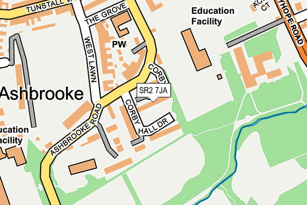
SR2 7JA is located in the St Michael's electoral ward, within the metropolitan district of Sunderland and the English Parliamentary constituency of Sunderland Central. The Sub Integrated Care Board (ICB) Location is NHS North East and North Cumbria ICB - 00P and the police force is Northumbria. This postcode has been in use since June 2017.


GetTheData
Source: OS OpenMap – Local (Ordnance Survey)
Source: OS VectorMap District (Ordnance Survey)
Licence: Open Government Licence (requires attribution)
| Easting | 439695 |
| Northing | 555827 |
| Latitude | 54.895615 |
| Longitude | -1.382623 |
GetTheData
Source: Open Postcode Geo
Licence: Open Government Licence
| Country | England |
| Postcode District | SR2 |
➜ See where SR2 is on a map ➜ Where is Sunderland? | |
GetTheData
Source: Land Registry Price Paid Data
Licence: Open Government Licence
| Ward | St Michael's |
| Constituency | Sunderland Central |
GetTheData
Source: ONS Postcode Database
Licence: Open Government Licence
| Ryhope Road-college (Ryhope Road) | Ashbrooke | 220m |
| Ryhope Road-cedars Court (Ryhope Road) | Ashbrooke | 225m |
| Ryhope Road-mowbray Road (Ryhope Road) | Ashbrooke | 248m |
| Christchurch Bede Tower (Ryhope Road) | Ashbrooke | 263m |
| The Avenue | Sunderland | 263m |
| Park Lane (Tyne And Wear Metro Station) (Park Lane) | Park Lane | 752m |
| University (Tyne And Wear Metro Station) (A183 Chester Road) | University Of Sunderland | 1,015m |
| Sunderland (Tyne And Wear Metro Station) (Station Street) | Sunderland | 1,216m |
| Millfield (Tyne And Wear Metro Station) (Hylton Road) | Millfield | 1,712m |
| Sunderland Station | 1.1km |
| St Peters Station | 1.8km |
| Seaburn Station | 3.8km |
GetTheData
Source: NaPTAN
Licence: Open Government Licence
GetTheData
Source: ONS Postcode Database
Licence: Open Government Licence


➜ Get more ratings from the Food Standards Agency
GetTheData
Source: Food Standards Agency
Licence: FSA terms & conditions
| Last Collection | |||
|---|---|---|---|
| Location | Mon-Fri | Sat | Distance |
| The Avenue | 17:00 | 11:30 | 212m |
| Toward Road | 17:30 | 12:00 | 460m |
| Belevedere Road | 17:15 | 12:30 | 527m |
GetTheData
Source: Dracos
Licence: Creative Commons Attribution-ShareAlike
The below table lists the International Territorial Level (ITL) codes (formerly Nomenclature of Territorial Units for Statistics (NUTS) codes) and Local Administrative Units (LAU) codes for SR2 7JA:
| ITL 1 Code | Name |
|---|---|
| TLC | North East (England) |
| ITL 2 Code | Name |
| TLC2 | Northumberland, and Tyne and Wear |
| ITL 3 Code | Name |
| TLC23 | Sunderland |
| LAU 1 Code | Name |
| E08000024 | Sunderland |
GetTheData
Source: ONS Postcode Directory
Licence: Open Government Licence
The below table lists the Census Output Area (OA), Lower Layer Super Output Area (LSOA), and Middle Layer Super Output Area (MSOA) for SR2 7JA:
| Code | Name | |
|---|---|---|
| OA | E00044383 | |
| LSOA | E01008735 | Sunderland 016B |
| MSOA | E02001806 | Sunderland 016 |
GetTheData
Source: ONS Postcode Directory
Licence: Open Government Licence
| SR2 7HX | Ashbrooke Crescent | 103m |
| SR2 7HL | Ashbrooke Crescent | 121m |
| SR2 7HQ | Ashbrooke Road | 130m |
| SR2 7JB | Corby Gate | 130m |
| SR2 7BP | The Cloisters | 143m |
| SR2 7HG | Ashbrooke Terrace | 163m |
| SR2 7EJ | Acer Court | 163m |
| SR2 7HW | West Lawn | 173m |
| SR2 7NN | The Cloisters | 177m |
| SR2 7ED | Ryhope Road | 180m |
GetTheData
Source: Open Postcode Geo; Land Registry Price Paid Data
Licence: Open Government Licence