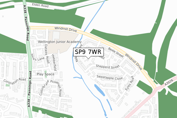
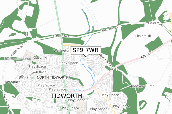
SP9 7WR is located in the Tidworth North & West electoral ward, within the unitary authority of Wiltshire and the English Parliamentary constituency of Devizes. The Sub Integrated Care Board (ICB) Location is NHS Bath and North East Somerset, Swindon and Wiltshire ICB - 92 and the police force is Wiltshire. This postcode has been in use since January 2018.


GetTheData
Source: OS Open Zoomstack (Ordnance Survey)
Licence: Open Government Licence (requires attribution)
Attribution: Contains OS data © Crown copyright and database right 2025
Source: Open Postcode Geo
Licence: Open Government Licence (requires attribution)
Attribution: Contains OS data © Crown copyright and database right 2025; Contains Royal Mail data © Royal Mail copyright and database right 2025; Source: Office for National Statistics licensed under the Open Government Licence v.3.0
| Easting | 423799 |
| Northing | 149757 |
| Latitude | 51.246490 |
| Longitude | -1.660407 |
GetTheData
Source: Open Postcode Geo
Licence: Open Government Licence
| Country | England |
| Postcode District | SP9 |
➜ See where SP9 is on a map ➜ Where is Tidworth? | |
GetTheData
Source: Land Registry Price Paid Data
Licence: Open Government Licence
| Ward | Tidworth North & West |
| Constituency | Devizes |
GetTheData
Source: ONS Postcode Database
Licence: Open Government Licence
4, BLANDFORD CLOSE, TIDWORTH, SP9 7WR 2017 22 DEC £294,240 |
5, BLANDFORD CLOSE, TIDWORTH, SP9 7WR 2017 22 DEC £303,683 |
6, BLANDFORD CLOSE, TIDWORTH, SP9 7WR 2017 22 DEC £304,683 |
GetTheData
Source: HM Land Registry Price Paid Data
Licence: Contains HM Land Registry data © Crown copyright and database right 2025. This data is licensed under the Open Government Licence v3.0.
| Sidbury Hill Avenue (Pennings Road) | Tidworth | 337m |
| Sidbury Hill Avenue (Pennings Road) | Tidworth | 346m |
| Beech Hill Road (Ludgershall Road) | Tidworth | 392m |
| Beech Hill Road (Ludgershall Road) | Tidworth | 399m |
| Kennet Road (Ludgershall Road) | Tidworth | 439m |
GetTheData
Source: NaPTAN
Licence: Open Government Licence
| Percentage of properties with Next Generation Access | 100.0% |
| Percentage of properties with Superfast Broadband | 100.0% |
| Percentage of properties with Ultrafast Broadband | 0.0% |
| Percentage of properties with Full Fibre Broadband | 0.0% |
Superfast Broadband is between 30Mbps and 300Mbps
Ultrafast Broadband is > 300Mbps
| Median download speed | 14.1Mbps |
| Average download speed | 34.3Mbps |
| Maximum download speed | 74.85Mbps |
| Median upload speed | 1.1Mbps |
| Average upload speed | 8.5Mbps |
| Maximum upload speed | 19.89Mbps |
| Percentage of properties unable to receive 2Mbps | 0.0% |
| Percentage of properties unable to receive 5Mbps | 0.0% |
| Percentage of properties unable to receive 10Mbps | 0.0% |
| Percentage of properties unable to receive 30Mbps | 0.0% |
GetTheData
Source: Ofcom
Licence: Ofcom Terms of Use (requires attribution)
GetTheData
Source: ONS Postcode Database
Licence: Open Government Licence


➜ Get more ratings from the Food Standards Agency
GetTheData
Source: Food Standards Agency
Licence: FSA terms & conditions
| Last Collection | |||
|---|---|---|---|
| Location | Mon-Fri | Sat | Distance |
| Ludgershall Road | 16:00 | 11:30 | 439m |
| Zouch Avenue | 16:45 | 08:45 | 514m |
| Sidbury | 16:45 | 08:15 | 858m |
GetTheData
Source: Dracos
Licence: Creative Commons Attribution-ShareAlike
The below table lists the International Territorial Level (ITL) codes (formerly Nomenclature of Territorial Units for Statistics (NUTS) codes) and Local Administrative Units (LAU) codes for SP9 7WR:
| ITL 1 Code | Name |
|---|---|
| TLK | South West (England) |
| ITL 2 Code | Name |
| TLK1 | Gloucestershire, Wiltshire and Bath/Bristol area |
| ITL 3 Code | Name |
| TLK15 | Wiltshire |
| LAU 1 Code | Name |
| E06000054 | Wiltshire |
GetTheData
Source: ONS Postcode Directory
Licence: Open Government Licence
The below table lists the Census Output Area (OA), Lower Layer Super Output Area (LSOA), and Middle Layer Super Output Area (MSOA) for SP9 7WR:
| Code | Name | |
|---|---|---|
| OA | E00162597 | |
| LSOA | E01032698 | Wiltshire 041H |
| MSOA | E02006643 | Wiltshire 041 |
GetTheData
Source: ONS Postcode Directory
Licence: Open Government Licence
| SP9 7FS | Habberfield | 178m |
| SP9 7FP | Oatway Road | 216m |
| SP9 7FU | Pickernell Road | 266m |
| SP9 7GR | Hedge Lane | 268m |
| SP9 7FT | Connolly Way | 282m |
| SP9 7FY | Colling Lane | 288m |
| SP9 7FR | Jones Lane | 306m |
| SP9 7FQ | Franklin Close | 310m |
| SP9 7FX | Sawyer Close | 313m |
| SP9 7FZ | Wheatley Close | 359m |
GetTheData
Source: Open Postcode Geo; Land Registry Price Paid Data
Licence: Open Government Licence