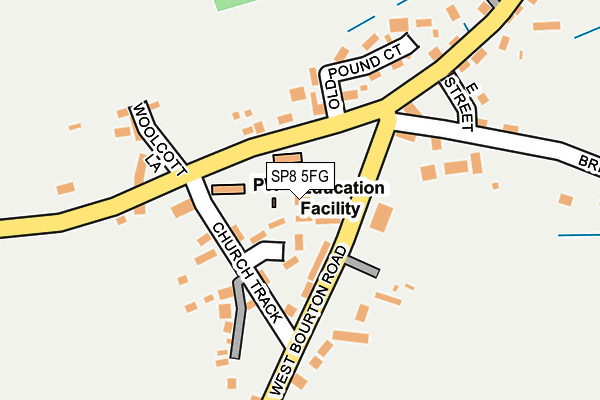
SP8 5FG is located in the Gillingham electoral ward, within the unitary authority of Dorset and the English Parliamentary constituency of North Dorset. The Sub Integrated Care Board (ICB) Location is NHS Dorset ICB - 11J and the police force is Dorset. This postcode has been in use since October 2010.


GetTheData
Source: OS OpenMap – Local (Ordnance Survey)
Source: OS VectorMap District (Ordnance Survey)
Licence: Open Government Licence (requires attribution)
| Easting | 376906 |
| Northing | 130299 |
| Latitude | 51.071550 |
| Longitude | -2.330992 |
GetTheData
Source: Open Postcode Geo
Licence: Open Government Licence
| Country | England |
| Postcode District | SP8 |
➜ See where SP8 is on a map ➜ Where is Bourton? | |
GetTheData
Source: Land Registry Price Paid Data
Licence: Open Government Licence
Elevation or altitude of SP8 5FG as distance above sea level:
| Metres | Feet | |
|---|---|---|
| Elevation | 130m | 427ft |
Elevation is measured from the approximate centre of the postcode, to the nearest point on an OS contour line from OS Terrain 50, which has contour spacing of ten vertical metres.
➜ How high above sea level am I? Find the elevation of your current position using your device's GPS.
GetTheData
Source: Open Postcode Elevation
Licence: Open Government Licence
| Ward | Gillingham |
| Constituency | North Dorset |
GetTheData
Source: ONS Postcode Database
Licence: Open Government Licence
| St Georges School | Bourton | 66m |
| St Georges School | Bourton | 78m |
| War Memorial (West Bourton Road) | Bourton | 103m |
| Village Shop | Bourton | 210m |
| Village Shop | Bourton | 220m |
| Gillingham (Dorset) Station | 5.8km |
GetTheData
Source: NaPTAN
Licence: Open Government Licence
GetTheData
Source: ONS Postcode Database
Licence: Open Government Licence

➜ Get more ratings from the Food Standards Agency
GetTheData
Source: Food Standards Agency
Licence: FSA terms & conditions
| Last Collection | |||
|---|---|---|---|
| Location | Mon-Fri | Sat | Distance |
| White Cross | 12:00 | 09:00 | 1,821m |
| Zeals Post Office | 16:30 | 10:30 | 1,947m |
| Longcross | 12:00 | 10:30 | 2,753m |
GetTheData
Source: Dracos
Licence: Creative Commons Attribution-ShareAlike
The below table lists the International Territorial Level (ITL) codes (formerly Nomenclature of Territorial Units for Statistics (NUTS) codes) and Local Administrative Units (LAU) codes for SP8 5FG:
| ITL 1 Code | Name |
|---|---|
| TLK | South West (England) |
| ITL 2 Code | Name |
| TLK2 | Dorset and Somerset |
| ITL 3 Code | Name |
| TLK25 | Dorset |
| LAU 1 Code | Name |
| E06000059 | Dorset |
GetTheData
Source: ONS Postcode Directory
Licence: Open Government Licence
The below table lists the Census Output Area (OA), Lower Layer Super Output Area (LSOA), and Middle Layer Super Output Area (MSOA) for SP8 5FG:
| Code | Name | |
|---|---|---|
| OA | E00103581 | |
| LSOA | E01020440 | North Dorset 002A |
| MSOA | E02004256 | North Dorset 002 |
GetTheData
Source: ONS Postcode Directory
Licence: Open Government Licence
| SP8 5BP | Church Close | 41m |
| SP8 5BN | 87m | |
| SP8 5DW | Red Lion Yard | 99m |
| SP8 5BL | Mede Close | 111m |
| SP8 5BW | Church Track | 118m |
| SP8 5PQ | 127m | |
| SP8 5BS | 161m | |
| SP8 5BT | Church View | 164m |
| SP8 5ST | Old Pound Court | 169m |
| SP8 5PJ | Brickyard Lane | 177m |
GetTheData
Source: Open Postcode Geo; Land Registry Price Paid Data
Licence: Open Government Licence