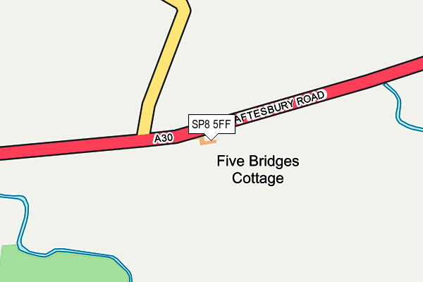
SP8 5FF is located in the Gillingham electoral ward, within the unitary authority of Dorset and the English Parliamentary constituency of North Dorset. The Sub Integrated Care Board (ICB) Location is NHS Dorset ICB - 11J and the police force is Dorset. This postcode has been in use since May 2015.


GetTheData
Source: OS OpenMap – Local (Ordnance Survey)
Source: OS VectorMap District (Ordnance Survey)
Licence: Open Government Licence (requires attribution)
| Easting | 375459 |
| Northing | 121418 |
| Latitude | 50.991625 |
| Longitude | -2.351036 |
GetTheData
Source: Open Postcode Geo
Licence: Open Government Licence
| Country | England |
| Postcode District | SP8 |
➜ See where SP8 is on a map | |
GetTheData
Source: Land Registry Price Paid Data
Licence: Open Government Licence
Elevation or altitude of SP8 5FF as distance above sea level:
| Metres | Feet | |
|---|---|---|
| Elevation | 60m | 197ft |
Elevation is measured from the approximate centre of the postcode, to the nearest point on an OS contour line from OS Terrain 50, which has contour spacing of ten vertical metres.
➜ How high above sea level am I? Find the elevation of your current position using your device's GPS.
GetTheData
Source: Open Postcode Elevation
Licence: Open Government Licence
| Ward | Gillingham |
| Constituency | North Dorset |
GetTheData
Source: ONS Postcode Database
Licence: Open Government Licence
| Five Bridges Picnic Site (Shaftesbury Road) | Lower Nyland | 67m |
| Five Bridges Picnic Site (Shaftesbury Road) | Lower Nyland | 87m |
| Cudlipp Coaches Yard | Henstridge Marsh | 1,431m |
| Factory Farm | Fifehead Magdalen | 1,553m |
| Factory Farm | Fifehead Magdalen | 1,560m |
| Templecombe Station | 4.8km |
GetTheData
Source: NaPTAN
Licence: Open Government Licence
| Percentage of properties with Next Generation Access | 100.0% |
| Percentage of properties with Superfast Broadband | 0.0% |
| Percentage of properties with Ultrafast Broadband | 0.0% |
| Percentage of properties with Full Fibre Broadband | 0.0% |
Superfast Broadband is between 30Mbps and 300Mbps
Ultrafast Broadband is > 300Mbps
| Percentage of properties unable to receive 2Mbps | 0.0% |
| Percentage of properties unable to receive 5Mbps | 100.0% |
| Percentage of properties unable to receive 10Mbps | 100.0% |
| Percentage of properties unable to receive 30Mbps | 100.0% |
GetTheData
Source: Ofcom
Licence: Ofcom Terms of Use (requires attribution)
GetTheData
Source: ONS Postcode Database
Licence: Open Government Licence


➜ Get more ratings from the Food Standards Agency
GetTheData
Source: Food Standards Agency
Licence: FSA terms & conditions
| Last Collection | |||
|---|---|---|---|
| Location | Mon-Fri | Sat | Distance |
| Little Kington | 16:30 | 08:15 | 2,437m |
| Henstridge Post Office | 17:30 | 10:15 | 3,450m |
| Ash Walk | 12:00 | 10:00 | 3,518m |
GetTheData
Source: Dracos
Licence: Creative Commons Attribution-ShareAlike
| Risk of SP8 5FF flooding from rivers and sea | Medium |
| ➜ SP8 5FF flood map | |
GetTheData
Source: Open Flood Risk by Postcode
Licence: Open Government Licence
The below table lists the International Territorial Level (ITL) codes (formerly Nomenclature of Territorial Units for Statistics (NUTS) codes) and Local Administrative Units (LAU) codes for SP8 5FF:
| ITL 1 Code | Name |
|---|---|
| TLK | South West (England) |
| ITL 2 Code | Name |
| TLK2 | Dorset and Somerset |
| ITL 3 Code | Name |
| TLK25 | Dorset |
| LAU 1 Code | Name |
| E06000059 | Dorset |
GetTheData
Source: ONS Postcode Directory
Licence: Open Government Licence
The below table lists the Census Output Area (OA), Lower Layer Super Output Area (LSOA), and Middle Layer Super Output Area (MSOA) for SP8 5FF:
| Code | Name | |
|---|---|---|
| OA | E00103586 | |
| LSOA | E01020440 | North Dorset 002A |
| MSOA | E02004256 | North Dorset 002 |
GetTheData
Source: ONS Postcode Directory
Licence: Open Government Licence
| SP8 5SF | 691m | |
| SP8 5SQ | Overways | 696m |
| BA8 0TE | Shaftesbury Road | 788m |
| BA8 0TF | The Marsh | 944m |
| SP8 5EU | New Town | 1396m |
| SP8 5SJ | 1644m | |
| BA8 0TG | Henstridge Trading Estate | 1665m |
| SP8 5SH | Jubilee Farm Cottages | 1692m |
| SP8 5ET | South Street | 1693m |
| BA8 0TH | Camp Road | 1694m |
GetTheData
Source: Open Postcode Geo; Land Registry Price Paid Data
Licence: Open Government Licence