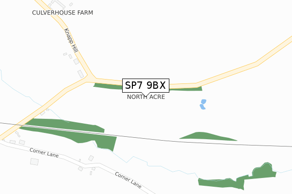
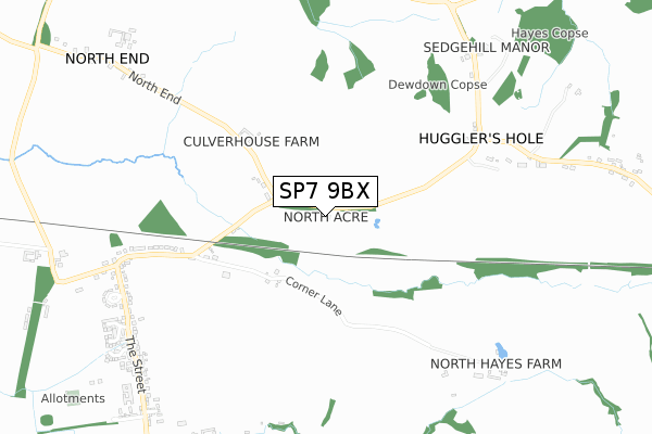
SP7 9BX is located in the Gillingham electoral ward, within the unitary authority of Dorset and the English Parliamentary constituency of North Dorset. The Sub Integrated Care Board (ICB) Location is NHS Dorset ICB - 11J and the police force is Dorset. This postcode has been in use since January 2019.


GetTheData
Source: OS Open Zoomstack (Ordnance Survey)
Licence: Open Government Licence (requires attribution)
Attribution: Contains OS data © Crown copyright and database right 2025
Source: Open Postcode Geo
Licence: Open Government Licence (requires attribution)
Attribution: Contains OS data © Crown copyright and database right 2025; Contains Royal Mail data © Royal Mail copyright and database right 2025; Source: Office for National Statistics licensed under the Open Government Licence v.3.0
| Easting | 385388 |
| Northing | 126805 |
| Latitude | 51.040406 |
| Longitude | -2.209784 |
GetTheData
Source: Open Postcode Geo
Licence: Open Government Licence
| Country | England |
| Postcode District | SP7 |
➜ See where SP7 is on a map | |
GetTheData
Source: Land Registry Price Paid Data
Licence: Open Government Licence
| Ward | Gillingham |
| Constituency | North Dorset |
GetTheData
Source: ONS Postcode Database
Licence: Open Government Licence
| Elm Close (The Street) | Elm Hill | 832m |
| Elm Close (The Street) | Elm Hill | 842m |
| Stainers Mead (The Street) | Elm Hill | 900m |
| Stainers Mead (The Street) | Elm Hill | 909m |
| Paddock Way (The Street) | Motcombe | 1,087m |
| Gillingham (Dorset) Station | 4.5km |
GetTheData
Source: NaPTAN
Licence: Open Government Licence
| Percentage of properties with Next Generation Access | 100.0% |
| Percentage of properties with Superfast Broadband | 0.0% |
| Percentage of properties with Ultrafast Broadband | 0.0% |
| Percentage of properties with Full Fibre Broadband | 0.0% |
Superfast Broadband is between 30Mbps and 300Mbps
Ultrafast Broadband is > 300Mbps
| Percentage of properties unable to receive 2Mbps | 0.0% |
| Percentage of properties unable to receive 5Mbps | 0.0% |
| Percentage of properties unable to receive 10Mbps | 0.0% |
| Percentage of properties unable to receive 30Mbps | 100.0% |
GetTheData
Source: Ofcom
Licence: Ofcom Terms of Use (requires attribution)
GetTheData
Source: ONS Postcode Database
Licence: Open Government Licence


➜ Get more ratings from the Food Standards Agency
GetTheData
Source: Food Standards Agency
Licence: FSA terms & conditions
| Last Collection | |||
|---|---|---|---|
| Location | Mon-Fri | Sat | Distance |
| Motcombe Post Office | 17:00 | 09:45 | 1,232m |
| Milton On Stour Post Office | 17:00 | 11:00 | 3,022m |
| Pensbury | 17:00 | 07:15 | 3,467m |
GetTheData
Source: Dracos
Licence: Creative Commons Attribution-ShareAlike
The below table lists the International Territorial Level (ITL) codes (formerly Nomenclature of Territorial Units for Statistics (NUTS) codes) and Local Administrative Units (LAU) codes for SP7 9BX:
| ITL 1 Code | Name |
|---|---|
| TLK | South West (England) |
| ITL 2 Code | Name |
| TLK2 | Dorset and Somerset |
| ITL 3 Code | Name |
| TLK25 | Dorset |
| LAU 1 Code | Name |
| E06000059 | Dorset |
GetTheData
Source: ONS Postcode Directory
Licence: Open Government Licence
The below table lists the Census Output Area (OA), Lower Layer Super Output Area (LSOA), and Middle Layer Super Output Area (MSOA) for SP7 9BX:
| Code | Name | |
|---|---|---|
| OA | E00103657 | |
| LSOA | E01033158 | North Dorset 002F |
| MSOA | E02004256 | North Dorset 002 |
GetTheData
Source: ONS Postcode Directory
Licence: Open Government Licence
| SP7 9HU | North End | 263m |
| SP7 9HS | Corner Lane | 335m |
| SP7 9HQ | 676m | |
| SP7 9HR | Elm Hill | 764m |
| SP7 9HL | Elm Hill | 836m |
| SP7 9HN | Elm Close | 909m |
| SP7 9QG | Hunters Mead | 920m |
| SP7 9NZ | Shorts Green Courtyard | 943m |
| SP7 9LF | Red House Close | 944m |
| SP7 9QF | Stainers Mead | 955m |
GetTheData
Source: Open Postcode Geo; Land Registry Price Paid Data
Licence: Open Government Licence