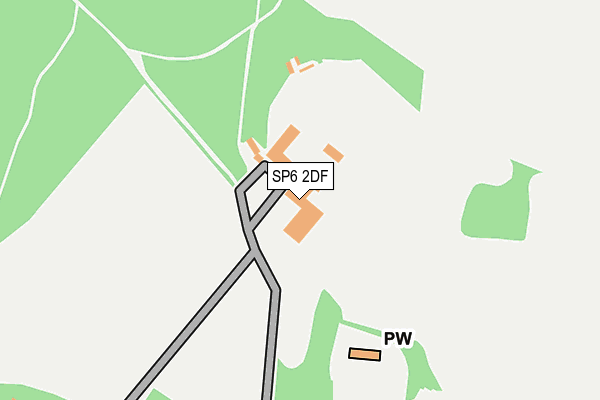
SP6 2DF is located in the Downlands & Forest North electoral ward, within the local authority district of New Forest and the English Parliamentary constituency of New Forest West. The Sub Integrated Care Board (ICB) Location is NHS Hampshire and Isle of Wight ICB - D9Y0V and the police force is Hampshire. This postcode has been in use since January 1980.


GetTheData
Source: OS OpenMap – Local (Ordnance Survey)
Source: OS VectorMap District (Ordnance Survey)
Licence: Open Government Licence (requires attribution)
| Easting | 415265 |
| Northing | 119032 |
| Latitude | 50.970498 |
| Longitude | -1.783964 |
GetTheData
Source: Open Postcode Geo
Licence: Open Government Licence
| Country | England |
| Postcode District | SP6 |
➜ See where SP6 is on a map ➜ Where is Breamore? | |
GetTheData
Source: Land Registry Price Paid Data
Licence: Open Government Licence
Elevation or altitude of SP6 2DF as distance above sea level:
| Metres | Feet | |
|---|---|---|
| Elevation | 60m | 197ft |
Elevation is measured from the approximate centre of the postcode, to the nearest point on an OS contour line from OS Terrain 50, which has contour spacing of ten vertical metres.
➜ How high above sea level am I? Find the elevation of your current position using your device's GPS.
GetTheData
Source: Open Postcode Elevation
Licence: Open Government Licence
| Ward | Downlands & Forest North |
| Constituency | New Forest West |
GetTheData
Source: ONS Postcode Database
Licence: Open Government Licence
| Breamore House Coach Park (Private Grounds To House) | Upper Street | 331m |
| Breamore House Coach Park (Private Grounds To Museum) | Upper Street | 392m |
| Rookery Lane (Upper Street) | Upper Street | 713m |
| Rookery Lane (Upper Street) | Upper Street | 720m |
| Breamore House Turn (Salisbury Road A338) | North Street | 1,109m |
GetTheData
Source: NaPTAN
Licence: Open Government Licence
GetTheData
Source: ONS Postcode Database
Licence: Open Government Licence


➜ Get more ratings from the Food Standards Agency
GetTheData
Source: Food Standards Agency
Licence: FSA terms & conditions
| Last Collection | |||
|---|---|---|---|
| Location | Mon-Fri | Sat | Distance |
| Cosstrees | 16:30 | 07:15 | 684m |
| Breamore Post Office | 18:00 | 11:15 | 1,206m |
| Outwick | 16:30 | 09:00 | 1,351m |
GetTheData
Source: Dracos
Licence: Creative Commons Attribution-ShareAlike
The below table lists the International Territorial Level (ITL) codes (formerly Nomenclature of Territorial Units for Statistics (NUTS) codes) and Local Administrative Units (LAU) codes for SP6 2DF:
| ITL 1 Code | Name |
|---|---|
| TLJ | South East (England) |
| ITL 2 Code | Name |
| TLJ3 | Hampshire and Isle of Wight |
| ITL 3 Code | Name |
| TLJ36 | Central Hampshire |
| LAU 1 Code | Name |
| E07000091 | New Forest |
GetTheData
Source: ONS Postcode Directory
Licence: Open Government Licence
The below table lists the Census Output Area (OA), Lower Layer Super Output Area (LSOA), and Middle Layer Super Output Area (MSOA) for SP6 2DF:
| Code | Name | |
|---|---|---|
| OA | E00116922 | |
| LSOA | E01023012 | New Forest 001B |
| MSOA | E02004779 | New Forest 001 |
GetTheData
Source: ONS Postcode Directory
Licence: Open Government Licence
| SP6 2BY | Upper Street | 617m |
| SP6 2EJ | The Marsh | 824m |
| SP6 2EL | The Marsh | 1082m |
| SP6 2EH | Rectory Lane | 1123m |
| SP6 2DJ | Salisbury Road | 1132m |
| SP6 2EG | Salisbury Road | 1233m |
| SP6 2DW | North Charford | 1242m |
| SP6 2EA | Salisbury Road | 1269m |
| SP6 2EF | The Marsh | 1379m |
| SP6 2BT | Outwick | 1427m |
GetTheData
Source: Open Postcode Geo; Land Registry Price Paid Data
Licence: Open Government Licence