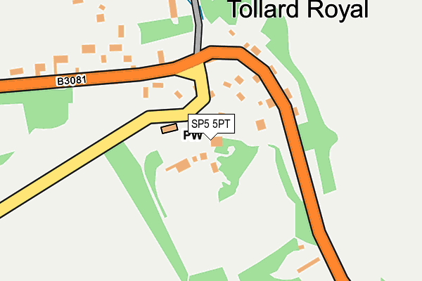
SP5 5PT is located in the Fovant & Chalke Valley electoral ward, within the unitary authority of Wiltshire and the English Parliamentary constituency of South West Wiltshire. The Sub Integrated Care Board (ICB) Location is NHS Bath and North East Somerset, Swindon and Wiltshire ICB - 92 and the police force is Wiltshire. This postcode has been in use since January 1980.


GetTheData
Source: OS OpenMap – Local (Ordnance Survey)
Source: OS VectorMap District (Ordnance Survey)
Licence: Open Government Licence (requires attribution)
| Easting | 394463 |
| Northing | 117698 |
| Latitude | 50.958681 |
| Longitude | -2.080209 |
GetTheData
Source: Open Postcode Geo
Licence: Open Government Licence
| Country | England |
| Postcode District | SP5 |
➜ See where SP5 is on a map ➜ Where is Tollard Royal? | |
GetTheData
Source: Land Registry Price Paid Data
Licence: Open Government Licence
Elevation or altitude of SP5 5PT as distance above sea level:
| Metres | Feet | |
|---|---|---|
| Elevation | 110m | 361ft |
Elevation is measured from the approximate centre of the postcode, to the nearest point on an OS contour line from OS Terrain 50, which has contour spacing of ten vertical metres.
➜ How high above sea level am I? Find the elevation of your current position using your device's GPS.
GetTheData
Source: Open Postcode Elevation
Licence: Open Government Licence
| Ward | Fovant & Chalke Valley |
| Constituency | South West Wiltshire |
GetTheData
Source: ONS Postcode Database
Licence: Open Government Licence
| The Pond (Shaftesbury Road) | Tollard Royal | 128m |
| Tollard Green Cross (Ashmore Road) | Tollard Royal | 1,449m |
| Tollard Green Cross (Ashmore Road) | Tollard Royal | 1,461m |
GetTheData
Source: NaPTAN
Licence: Open Government Licence
GetTheData
Source: ONS Postcode Database
Licence: Open Government Licence


➜ Get more ratings from the Food Standards Agency
GetTheData
Source: Food Standards Agency
Licence: FSA terms & conditions
| Last Collection | |||
|---|---|---|---|
| Location | Mon-Fri | Sat | Distance |
| Ashmore | 16:00 | 09:00 | 3,166m |
| Stubhampton | 09:30 | 09:30 | 4,746m |
| Ludwell Post Office | 16:45 | 11:00 | 6,100m |
GetTheData
Source: Dracos
Licence: Creative Commons Attribution-ShareAlike
The below table lists the International Territorial Level (ITL) codes (formerly Nomenclature of Territorial Units for Statistics (NUTS) codes) and Local Administrative Units (LAU) codes for SP5 5PT:
| ITL 1 Code | Name |
|---|---|
| TLK | South West (England) |
| ITL 2 Code | Name |
| TLK1 | Gloucestershire, Wiltshire and Bath/Bristol area |
| ITL 3 Code | Name |
| TLK15 | Wiltshire |
| LAU 1 Code | Name |
| E06000054 | Wiltshire |
GetTheData
Source: ONS Postcode Directory
Licence: Open Government Licence
The below table lists the Census Output Area (OA), Lower Layer Super Output Area (LSOA), and Middle Layer Super Output Area (MSOA) for SP5 5PT:
| Code | Name | |
|---|---|---|
| OA | E00163157 | |
| LSOA | E01031991 | Wiltshire 061A |
| MSOA | E02006676 | Wiltshire 061 |
GetTheData
Source: ONS Postcode Directory
Licence: Open Government Licence
| SP5 5PW | 77m | |
| SP5 5PP | 133m | |
| SP5 5PR | Benches Lane | 202m |
| SP5 5PS | 444m | |
| SP5 5QW | 1005m | |
| SP5 5PX | 1352m | |
| DT11 8DQ | 2220m | |
| SP5 5RP | 2542m | |
| SP5 5RR | 2594m | |
| DT11 8DE | 2858m |
GetTheData
Source: Open Postcode Geo; Land Registry Price Paid Data
Licence: Open Government Licence