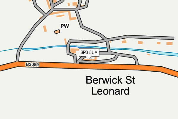
SP3 5UA is located in the Nadder Valley electoral ward, within the unitary authority of Wiltshire and the English Parliamentary constituency of South West Wiltshire. The Sub Integrated Care Board (ICB) Location is NHS Bath and North East Somerset, Swindon and Wiltshire ICB - 92 and the police force is Wiltshire. This postcode has been in use since June 1999.


GetTheData
Source: OS OpenMap – Local (Ordnance Survey)
Source: OS VectorMap District (Ordnance Survey)
Licence: Open Government Licence (requires attribution)
| Easting | 392491 |
| Northing | 133046 |
| Latitude | 51.096670 |
| Longitude | -2.108610 |
GetTheData
Source: Open Postcode Geo
Licence: Open Government Licence
| Country | England |
| Postcode District | SP3 |
➜ See where SP3 is on a map ➜ Where is Berwick St Leonard? | |
GetTheData
Source: Land Registry Price Paid Data
Licence: Open Government Licence
Elevation or altitude of SP3 5UA as distance above sea level:
| Metres | Feet | |
|---|---|---|
| Elevation | 110m | 361ft |
Elevation is measured from the approximate centre of the postcode, to the nearest point on an OS contour line from OS Terrain 50, which has contour spacing of ten vertical metres.
➜ How high above sea level am I? Find the elevation of your current position using your device's GPS.
GetTheData
Source: Open Postcode Elevation
Licence: Open Government Licence
| Ward | Nadder Valley |
| Constituency | South West Wiltshire |
GetTheData
Source: ONS Postcode Database
Licence: Open Government Licence
| Berwick Courtyard (B3089) | Berwick St Leonard | 58m |
| Berwick Courtyard (B3089) | Berwick St Leonard | 60m |
| Berwick Lay By (B2089) | Berwick St Leonard | 189m |
| Berwick Lay By (B3089) | Berwick St Leonard | 201m |
| All Saints' Church (Tisbury Road) | Fonthill Bishop | 1,045m |
| Tisbury Station | 4.5km |
GetTheData
Source: NaPTAN
Licence: Open Government Licence
GetTheData
Source: ONS Postcode Database
Licence: Open Government Licence


➜ Get more ratings from the Food Standards Agency
GetTheData
Source: Food Standards Agency
Licence: FSA terms & conditions
| Last Collection | |||
|---|---|---|---|
| Location | Mon-Fri | Sat | Distance |
| Fonthill Street | 16:15 | 10:00 | 2,305m |
| Knoyle Down Farm | 16:30 | 09:45 | 2,848m |
| Tisbury Post Office | 16:45 | 10:30 | 4,228m |
GetTheData
Source: Dracos
Licence: Creative Commons Attribution-ShareAlike
The below table lists the International Territorial Level (ITL) codes (formerly Nomenclature of Territorial Units for Statistics (NUTS) codes) and Local Administrative Units (LAU) codes for SP3 5UA:
| ITL 1 Code | Name |
|---|---|
| TLK | South West (England) |
| ITL 2 Code | Name |
| TLK1 | Gloucestershire, Wiltshire and Bath/Bristol area |
| ITL 3 Code | Name |
| TLK15 | Wiltshire |
| LAU 1 Code | Name |
| E06000054 | Wiltshire |
GetTheData
Source: ONS Postcode Directory
Licence: Open Government Licence
The below table lists the Census Output Area (OA), Lower Layer Super Output Area (LSOA), and Middle Layer Super Output Area (MSOA) for SP3 5UA:
| Code | Name | |
|---|---|---|
| OA | E00163257 | |
| LSOA | E01032010 | Wiltshire 050A |
| MSOA | E02006665 | Wiltshire 050 |
GetTheData
Source: ONS Postcode Directory
Licence: Open Government Licence
| SP3 6QL | Greenwich | 852m |
| SP3 6ET | 975m | |
| SP3 5SQ | The Rings | 1151m |
| SP3 6EJ | 1176m | |
| SP3 6EA | 1196m | |
| SP3 5SH | 1229m | |
| SP3 6EB | The Dene | 1235m |
| SP3 6DZ | School Lane | 1250m |
| SP3 6EG | 1275m | |
| SP3 6ER | 1278m |
GetTheData
Source: Open Postcode Geo; Land Registry Price Paid Data
Licence: Open Government Licence