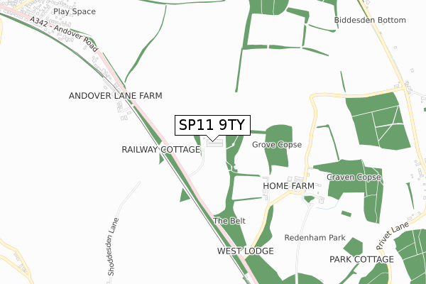
SP11 9TY is located in the Bellinger electoral ward, within the local authority district of Test Valley and the English Parliamentary constituency of North West Hampshire. The Sub Integrated Care Board (ICB) Location is NHS Hampshire and Isle of Wight ICB - D9Y0V and the police force is Hampshire. This postcode has been in use since February 2020.


GetTheData
Source: OS Open Zoomstack (Ordnance Survey)
Licence: Open Government Licence (requires attribution)
Attribution: Contains OS data © Crown copyright and database right 2025
Source: Open Postcode Geo
Licence: Open Government Licence (requires attribution)
Attribution: Contains OS data © Crown copyright and database right 2025; Contains Royal Mail data © Royal Mail copyright and database right 2025; Source: Office for National Statistics licensed under the Open Government Licence v.3.0
| Easting | 428795 |
| Northing | 149697 |
| Latitude | 51.245721 |
| Longitude | -1.588837 |
GetTheData
Source: Open Postcode Geo
Licence: Open Government Licence
| Country | England |
| Postcode District | SP11 |
➜ See where SP11 is on a map | |
GetTheData
Source: Land Registry Price Paid Data
Licence: Open Government Licence
| Ward | Bellinger |
| Constituency | North West Hampshire |
GetTheData
Source: ONS Postcode Database
Licence: Open Government Licence
| Shoddesden Lane (Andover Road) | Little Shoddesden | 253m |
| Shoddesden Lane (Andover Road) | Little Shoddesden | 261m |
| West Lodge (Andover Road) | Little Shoddesden | 720m |
| West Lodge (Andover Road) | Little Shoddesden | 727m |
| Biddesden House (Biddesden Lane) | Ludgershall | 1,098m |
GetTheData
Source: NaPTAN
Licence: Open Government Licence
GetTheData
Source: ONS Postcode Database
Licence: Open Government Licence

➜ Get more ratings from the Food Standards Agency
GetTheData
Source: Food Standards Agency
Licence: FSA terms & conditions
| Last Collection | |||
|---|---|---|---|
| Location | Mon-Fri | Sat | Distance |
| Great Shoddesden | 16:45 | 09:00 | 1,310m |
| Biddesden | 16:30 | 10:45 | 1,316m |
| Faberstown | 17:30 | 12:15 | 1,413m |
GetTheData
Source: Dracos
Licence: Creative Commons Attribution-ShareAlike
The below table lists the International Territorial Level (ITL) codes (formerly Nomenclature of Territorial Units for Statistics (NUTS) codes) and Local Administrative Units (LAU) codes for SP11 9TY:
| ITL 1 Code | Name |
|---|---|
| TLJ | South East (England) |
| ITL 2 Code | Name |
| TLJ3 | Hampshire and Isle of Wight |
| ITL 3 Code | Name |
| TLJ36 | Central Hampshire |
| LAU 1 Code | Name |
| E07000093 | Test Valley |
GetTheData
Source: ONS Postcode Directory
Licence: Open Government Licence
The below table lists the Census Output Area (OA), Lower Layer Super Output Area (LSOA), and Middle Layer Super Output Area (MSOA) for SP11 9TY:
| Code | Name | |
|---|---|---|
| OA | E00168078 | |
| LSOA | E01023198 | Test Valley 007D |
| MSOA | E02004820 | Test Valley 007 |
GetTheData
Source: ONS Postcode Directory
Licence: Open Government Licence
| SP11 9PE | Andover Road | 660m |
| SP11 9LW | 1133m | |
| SP11 9PD | Andover Road | 1151m |
| SP11 9PB | Pretoria Road | 1179m |
| SP11 9PJ | Biddesden Lane | 1186m |
| SP11 9AN | 1203m | |
| SP11 9PA | Graspan Road | 1212m |
| SP11 9AW | 1227m | |
| SP11 9NY | Graspan Road | 1249m |
| SP11 9PS | St Nicholas Close | 1269m |
GetTheData
Source: Open Postcode Geo; Land Registry Price Paid Data
Licence: Open Government Licence