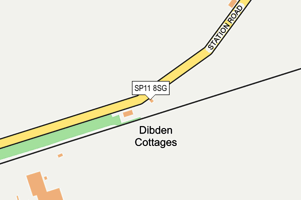
SP11 8SG is located in the Anna electoral ward, within the local authority district of Test Valley and the English Parliamentary constituency of North West Hampshire. The Sub Integrated Care Board (ICB) Location is NHS Hampshire and Isle of Wight ICB - D9Y0V and the police force is Hampshire. This postcode has been in use since June 1996.


GetTheData
Source: OS OpenMap – Local (Ordnance Survey)
Source: OS VectorMap District (Ordnance Survey)
Licence: Open Government Licence (requires attribution)
| Easting | 427298 |
| Northing | 141528 |
| Latitude | 51.172345 |
| Longitude | -1.610914 |
GetTheData
Source: Open Postcode Geo
Licence: Open Government Licence
| Country | England |
| Postcode District | SP11 |
➜ See where SP11 is on a map | |
GetTheData
Source: Land Registry Price Paid Data
Licence: Open Government Licence
Elevation or altitude of SP11 8SG as distance above sea level:
| Metres | Feet | |
|---|---|---|
| Elevation | 100m | 328ft |
Elevation is measured from the approximate centre of the postcode, to the nearest point on an OS contour line from OS Terrain 50, which has contour spacing of ten vertical metres.
➜ How high above sea level am I? Find the elevation of your current position using your device's GPS.
GetTheData
Source: Open Postcode Elevation
Licence: Open Government Licence
| Ward | Anna |
| Constituency | North West Hampshire |
GetTheData
Source: ONS Postcode Database
Licence: Open Government Licence
| Grateley Village (High Street) | Grateley | 672m |
| Shire Horse (Wallop Road) | Grateley | 799m |
| Shire Horse (Wallop Road) | Grateley | 830m |
| Station (Station Road) | Grateley | 835m |
| Salisbury Road (Streetway Road) | Palestine | 919m |
| Grateley Station | 0.7km |
GetTheData
Source: NaPTAN
Licence: Open Government Licence
GetTheData
Source: ONS Postcode Database
Licence: Open Government Licence


➜ Get more ratings from the Food Standards Agency
GetTheData
Source: Food Standards Agency
Licence: FSA terms & conditions
| Last Collection | |||
|---|---|---|---|
| Location | Mon-Fri | Sat | Distance |
| Grateley Post Office | 16:00 | 11:15 | 664m |
| Station Road | 16:00 | 11:00 | 821m |
| Palestine | 16:00 | 09:45 | 1,613m |
GetTheData
Source: Dracos
Licence: Creative Commons Attribution-ShareAlike
The below table lists the International Territorial Level (ITL) codes (formerly Nomenclature of Territorial Units for Statistics (NUTS) codes) and Local Administrative Units (LAU) codes for SP11 8SG:
| ITL 1 Code | Name |
|---|---|
| TLJ | South East (England) |
| ITL 2 Code | Name |
| TLJ3 | Hampshire and Isle of Wight |
| ITL 3 Code | Name |
| TLJ36 | Central Hampshire |
| LAU 1 Code | Name |
| E07000093 | Test Valley |
GetTheData
Source: ONS Postcode Directory
Licence: Open Government Licence
The below table lists the Census Output Area (OA), Lower Layer Super Output Area (LSOA), and Middle Layer Super Output Area (MSOA) for SP11 8SG:
| Code | Name | |
|---|---|---|
| OA | E00117665 | |
| LSOA | E01023159 | Test Valley 007A |
| MSOA | E02004820 | Test Valley 007 |
GetTheData
Source: ONS Postcode Directory
Licence: Open Government Licence
| SP11 8LB | Station Road | 51m |
| SP11 8JZ | Manor Farm Cottages | 482m |
| SP11 8HZ | 522m | |
| SP11 8JS | Church Lane | 548m |
| SP11 8TA | Pond Lane | 562m |
| SP11 8JY | West End Cottages | 577m |
| SP11 8JT | High Street | 584m |
| SP11 7EF | Old Stockbridge Road | 585m |
| SP11 8JR | 603m | |
| SP11 8QX | Old Home Farm Barns | 654m |
GetTheData
Source: Open Postcode Geo; Land Registry Price Paid Data
Licence: Open Government Licence