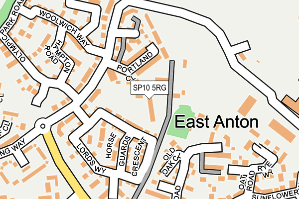
SP10 5RG is located in the Andover Romans electoral ward, within the local authority district of Test Valley and the English Parliamentary constituency of North West Hampshire. The Sub Integrated Care Board (ICB) Location is NHS Hampshire and Isle of Wight ICB - D9Y0V and the police force is Hampshire. This postcode has been in use since June 2002.


GetTheData
Source: OS OpenMap – Local (Ordnance Survey)
Source: OS VectorMap District (Ordnance Survey)
Licence: Open Government Licence (requires attribution)
| Easting | 437094 |
| Northing | 147837 |
| Latitude | 51.228519 |
| Longitude | -1.470136 |
GetTheData
Source: Open Postcode Geo
Licence: Open Government Licence
| Country | England |
| Postcode District | SP10 |
➜ See where SP10 is on a map ➜ Where is East Anton? | |
GetTheData
Source: Land Registry Price Paid Data
Licence: Open Government Licence
Elevation or altitude of SP10 5RG as distance above sea level:
| Metres | Feet | |
|---|---|---|
| Elevation | 80m | 262ft |
Elevation is measured from the approximate centre of the postcode, to the nearest point on an OS contour line from OS Terrain 50, which has contour spacing of ten vertical metres.
➜ How high above sea level am I? Find the elevation of your current position using your device's GPS.
GetTheData
Source: Open Postcode Elevation
Licence: Open Government Licence
| Ward | Andover Romans |
| Constituency | North West Hampshire |
GetTheData
Source: ONS Postcode Database
Licence: Open Government Licence
| Woolwich Way | East Anton | 105m |
| Woolwich Way | East Anton | 119m |
| Unknown (East Anton Farm Road) | East Anton | 188m |
| Unknown (East Anton Farm Road) | East Anton | 196m |
| Community Centre (East Anton Farm Road) | East Anton | 198m |
| Andover Station | 2.4km |
GetTheData
Source: NaPTAN
Licence: Open Government Licence
GetTheData
Source: ONS Postcode Database
Licence: Open Government Licence


➜ Get more ratings from the Food Standards Agency
GetTheData
Source: Food Standards Agency
Licence: FSA terms & conditions
| Last Collection | |||
|---|---|---|---|
| Location | Mon-Fri | Sat | Distance |
| Knights Enham | 17:15 | 11:15 | 646m |
| Smannel Road | 17:15 | 12:00 | 702m |
| King Arthurs Way Post Office | 18:30 | 12:00 | 988m |
GetTheData
Source: Dracos
Licence: Creative Commons Attribution-ShareAlike
The below table lists the International Territorial Level (ITL) codes (formerly Nomenclature of Territorial Units for Statistics (NUTS) codes) and Local Administrative Units (LAU) codes for SP10 5RG:
| ITL 1 Code | Name |
|---|---|
| TLJ | South East (England) |
| ITL 2 Code | Name |
| TLJ3 | Hampshire and Isle of Wight |
| ITL 3 Code | Name |
| TLJ36 | Central Hampshire |
| LAU 1 Code | Name |
| E07000093 | Test Valley |
GetTheData
Source: ONS Postcode Directory
Licence: Open Government Licence
The below table lists the Census Output Area (OA), Lower Layer Super Output Area (LSOA), and Middle Layer Super Output Area (MSOA) for SP10 5RG:
| Code | Name | |
|---|---|---|
| OA | E00168066 | |
| LSOA | E01023155 | Test Valley 003A |
| MSOA | E02004816 | Test Valley 003 |
GetTheData
Source: ONS Postcode Directory
Licence: Open Government Licence
| SP11 6AB | 50m | |
| SP11 6WP | Portland Close | 66m |
| SP11 6FA | Lords Way | 82m |
| SP11 6AD | East Anton Cottages | 100m |
| SP11 6FU | Horse Guards Crescent | 112m |
| SP11 6QZ | Old Oak Close | 119m |
| SP11 6FB | Hyde Park Walk | 120m |
| SP11 6FQ | Lords Way | 145m |
| SP11 6WQ | Hadleigh Close | 155m |
| SP11 6SD | Hampton Road | 162m |
GetTheData
Source: Open Postcode Geo; Land Registry Price Paid Data
Licence: Open Government Licence