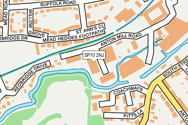
SP10 2NJ is located in the Andover Winton electoral ward, within the local authority district of Test Valley and the English Parliamentary constituency of North West Hampshire. The Sub Integrated Care Board (ICB) Location is NHS Hampshire and Isle of Wight ICB - D9Y0V and the police force is Hampshire. This postcode has been in use since January 1993.


GetTheData
Source: OS OpenMap – Local (Ordnance Survey)
Source: OS VectorMap District (Ordnance Survey)
Licence: Open Government Licence (requires attribution)
| Easting | 435999 |
| Northing | 144968 |
| Latitude | 51.202796 |
| Longitude | -1.486117 |
GetTheData
Source: Open Postcode Geo
Licence: Open Government Licence
| Country | England |
| Postcode District | SP10 |
➜ See where SP10 is on a map ➜ Where is Andover? | |
GetTheData
Source: Land Registry Price Paid Data
Licence: Open Government Licence
Elevation or altitude of SP10 2NJ as distance above sea level:
| Metres | Feet | |
|---|---|---|
| Elevation | 60m | 197ft |
Elevation is measured from the approximate centre of the postcode, to the nearest point on an OS contour line from OS Terrain 50, which has contour spacing of ten vertical metres.
➜ How high above sea level am I? Find the elevation of your current position using your device's GPS.
GetTheData
Source: Open Postcode Elevation
Licence: Open Government Licence
| Ward | Andover Winton |
| Constituency | North West Hampshire |
GetTheData
Source: ONS Postcode Database
Licence: Open Government Licence
| Pitts Lane (Barlows Lane) | Andover | 206m |
| Barlows Lane (Anton Road) | Andover | 267m |
| St Anns Close (Suffolk Road) | Andover | 273m |
| Anton Junior School (Barlows Lane) | Andover | 273m |
| Willow Grove (Suffolk Road) | Andover | 277m |
| Andover Station | 1.1km |
GetTheData
Source: NaPTAN
Licence: Open Government Licence
GetTheData
Source: ONS Postcode Database
Licence: Open Government Licence


➜ Get more ratings from the Food Standards Agency
GetTheData
Source: Food Standards Agency
Licence: FSA terms & conditions
| Last Collection | |||
|---|---|---|---|
| Location | Mon-Fri | Sat | Distance |
| South Street | 17:30 | 12:00 | 398m |
| Andover Post Office | 19:00 | 13:00 | 460m |
| Anton Road | 17:30 | 12:00 | 498m |
GetTheData
Source: Dracos
Licence: Creative Commons Attribution-ShareAlike
The below table lists the International Territorial Level (ITL) codes (formerly Nomenclature of Territorial Units for Statistics (NUTS) codes) and Local Administrative Units (LAU) codes for SP10 2NJ:
| ITL 1 Code | Name |
|---|---|
| TLJ | South East (England) |
| ITL 2 Code | Name |
| TLJ3 | Hampshire and Isle of Wight |
| ITL 3 Code | Name |
| TLJ36 | Central Hampshire |
| LAU 1 Code | Name |
| E07000093 | Test Valley |
GetTheData
Source: ONS Postcode Directory
Licence: Open Government Licence
The below table lists the Census Output Area (OA), Lower Layer Super Output Area (LSOA), and Middle Layer Super Output Area (MSOA) for SP10 2NJ:
| Code | Name | |
|---|---|---|
| OA | E00117962 | |
| LSOA | E01023218 | Test Valley 006E |
| MSOA | E02004819 | Test Valley 006 |
GetTheData
Source: ONS Postcode Directory
Licence: Open Government Licence
| SP10 2LB | Mead Hedges | 97m |
| SP10 2LA | St Anns Close | 127m |
| SP10 2SJ | Coachways | 135m |
| SP10 2HY | Pitts Lane | 202m |
| SP10 2JZ | Willow Grove | 209m |
| SP10 2JX | Suffolk Road | 230m |
| SP10 2JA | Bentall Place | 234m |
| SP10 2HA | Barlows Lane | 239m |
| SP10 2LF | Redbridge Drive | 247m |
| SP10 2JU | Suffolk Road | 260m |
GetTheData
Source: Open Postcode Geo; Land Registry Price Paid Data
Licence: Open Government Licence