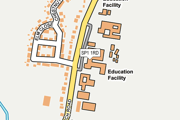
SP1 1RD is located in the Laverstock electoral ward, within the unitary authority of Wiltshire and the English Parliamentary constituency of Salisbury. The Sub Integrated Care Board (ICB) Location is NHS Bath and North East Somerset, Swindon and Wiltshire ICB - 92 and the police force is Wiltshire. This postcode has been in use since January 1980.


GetTheData
Source: OS OpenMap – Local (Ordnance Survey)
Source: OS VectorMap District (Ordnance Survey)
Licence: Open Government Licence (requires attribution)
| Easting | 416112 |
| Northing | 131232 |
| Latitude | 51.080186 |
| Longitude | -1.771372 |
GetTheData
Source: Open Postcode Geo
Licence: Open Government Licence
| Country | England |
| Postcode District | SP1 |
➜ See where SP1 is on a map ➜ Where is Salisbury? | |
GetTheData
Source: Land Registry Price Paid Data
Licence: Open Government Licence
Elevation or altitude of SP1 1RD as distance above sea level:
| Metres | Feet | |
|---|---|---|
| Elevation | 60m | 197ft |
Elevation is measured from the approximate centre of the postcode, to the nearest point on an OS contour line from OS Terrain 50, which has contour spacing of ten vertical metres.
➜ How high above sea level am I? Find the elevation of your current position using your device's GPS.
GetTheData
Source: Open Postcode Elevation
Licence: Open Government Licence
| Ward | Laverstock |
| Constituency | Salisbury |
GetTheData
Source: ONS Postcode Database
Licence: Open Government Licence
| The Three Schools (School Grounds) | Laverstock | 30m |
| The Three Schools (Church Road) | Laverstock | 60m |
| The Three Schools (Church Road) | Laverstock | 63m |
| St Andrews School (Church Road) | Laverstock | 209m |
| Bishops Mead (Church Road) | Laverstock | 292m |
| Salisbury Station | 2.7km |
GetTheData
Source: NaPTAN
Licence: Open Government Licence
GetTheData
Source: ONS Postcode Database
Licence: Open Government Licence


➜ Get more ratings from the Food Standards Agency
GetTheData
Source: Food Standards Agency
Licence: FSA terms & conditions
| Last Collection | |||
|---|---|---|---|
| Location | Mon-Fri | Sat | Distance |
| Laverstock Post Office | 17:15 | 12:00 | 154m |
| The Green | 16:30 | 12:00 | 475m |
| Church Road | 17:00 | 12:00 | 481m |
GetTheData
Source: Dracos
Licence: Creative Commons Attribution-ShareAlike
The below table lists the International Territorial Level (ITL) codes (formerly Nomenclature of Territorial Units for Statistics (NUTS) codes) and Local Administrative Units (LAU) codes for SP1 1RD:
| ITL 1 Code | Name |
|---|---|
| TLK | South West (England) |
| ITL 2 Code | Name |
| TLK1 | Gloucestershire, Wiltshire and Bath/Bristol area |
| ITL 3 Code | Name |
| TLK15 | Wiltshire |
| LAU 1 Code | Name |
| E06000054 | Wiltshire |
GetTheData
Source: ONS Postcode Directory
Licence: Open Government Licence
The below table lists the Census Output Area (OA), Lower Layer Super Output Area (LSOA), and Middle Layer Super Output Area (MSOA) for SP1 1RD:
| Code | Name | |
|---|---|---|
| OA | E00163269 | |
| LSOA | E01032012 | Wiltshire 057C |
| MSOA | E02006672 | Wiltshire 057 |
GetTheData
Source: ONS Postcode Directory
Licence: Open Government Licence
| SP1 1QY | Church Road | 116m |
| SP1 1QU | Church Road | 142m |
| SP1 1SA | Elm Close | 159m |
| SP1 1SL | Chestnut Close | 213m |
| SP1 1QX | Church Road | 246m |
| SP1 1SE | Dalewood Rise | 270m |
| SP1 1QZ | Church Road | 303m |
| SP1 1SB | Woodland Way | 307m |
| SP1 1RU | Bishops Mead | 317m |
| SP1 1SF | Dalewood Rise | 337m |
GetTheData
Source: Open Postcode Geo; Land Registry Price Paid Data
Licence: Open Government Licence