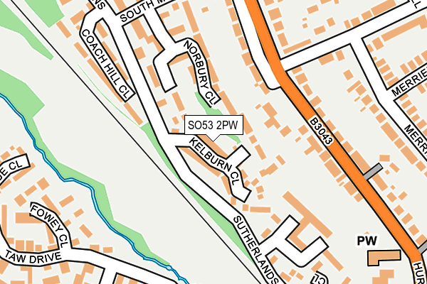
SO53 2PW lies on Kelburn Close in Chandler's Ford, Eastleigh. SO53 2PW is located in the Chandler's Ford electoral ward, within the local authority district of Eastleigh and the English Parliamentary constituency of Winchester. The Sub Integrated Care Board (ICB) Location is NHS Hampshire and Isle of Wight ICB - D9Y0V and the police force is Hampshire. This postcode has been in use since December 1994.


GetTheData
Source: OS OpenMap – Local (Ordnance Survey)
Source: OS VectorMap District (Ordnance Survey)
Licence: Open Government Licence (requires attribution)
| Easting | 442968 |
| Northing | 121106 |
| Latitude | 50.987759 |
| Longitude | -1.389205 |
GetTheData
Source: Open Postcode Geo
Licence: Open Government Licence
| Street | Kelburn Close |
| Locality | Chandler's Ford |
| Town/City | Eastleigh |
| Country | England |
| Postcode District | SO53 |
➜ See where SO53 is on a map ➜ Where is Chandler's Ford? | |
GetTheData
Source: Land Registry Price Paid Data
Licence: Open Government Licence
Elevation or altitude of SO53 2PW as distance above sea level:
| Metres | Feet | |
|---|---|---|
| Elevation | 30m | 98ft |
Elevation is measured from the approximate centre of the postcode, to the nearest point on an OS contour line from OS Terrain 50, which has contour spacing of ten vertical metres.
➜ How high above sea level am I? Find the elevation of your current position using your device's GPS.
GetTheData
Source: Open Postcode Elevation
Licence: Open Government Licence
| Ward | Chandler's Ford |
| Constituency | Winchester |
GetTheData
Source: ONS Postcode Database
Licence: Open Government Licence
| Kelburn Close (Sutherlands Way) | Chandler's Ford | 109m |
| Kelburn Close (Sutherlands Way) | Chandler's Ford | 131m |
| Brownhill Road (Hursley Road) | Chandler's Ford | 139m |
| Kerry Close (Sutherlands Way) | Chandler's Ford | 202m |
| Rusland Close (South Millers Dale) | Chandler's Ford | 217m |
| Chandlers Ford Station | 0.5km |
| Eastleigh Station | 3.4km |
| Southampton Airport Parkway Station | 4.5km |
GetTheData
Source: NaPTAN
Licence: Open Government Licence
| Percentage of properties with Next Generation Access | 100.0% |
| Percentage of properties with Superfast Broadband | 87.5% |
| Percentage of properties with Ultrafast Broadband | 75.0% |
| Percentage of properties with Full Fibre Broadband | 0.0% |
Superfast Broadband is between 30Mbps and 300Mbps
Ultrafast Broadband is > 300Mbps
| Median download speed | 34.8Mbps |
| Average download speed | 49.3Mbps |
| Maximum download speed | 200.00Mbps |
| Median upload speed | 6.4Mbps |
| Average upload speed | 5.8Mbps |
| Maximum upload speed | 17.77Mbps |
| Percentage of properties unable to receive 2Mbps | 0.0% |
| Percentage of properties unable to receive 5Mbps | 0.0% |
| Percentage of properties unable to receive 10Mbps | 0.0% |
| Percentage of properties unable to receive 30Mbps | 12.5% |
GetTheData
Source: Ofcom
Licence: Ofcom Terms of Use (requires attribution)
Estimated total energy consumption in SO53 2PW by fuel type, 2015.
| Consumption (kWh) | 155,551 |
|---|---|
| Meter count | 16 |
| Mean (kWh/meter) | 9,722 |
| Median (kWh/meter) | 9,322 |
| Consumption (kWh) | 52,570 |
|---|---|
| Meter count | 16 |
| Mean (kWh/meter) | 3,286 |
| Median (kWh/meter) | 3,045 |
GetTheData
Source: Postcode level gas estimates: 2015 (experimental)
Source: Postcode level electricity estimates: 2015 (experimental)
Licence: Open Government Licence
GetTheData
Source: ONS Postcode Database
Licence: Open Government Licence

➜ Get more ratings from the Food Standards Agency
GetTheData
Source: Food Standards Agency
Licence: FSA terms & conditions
| Last Collection | |||
|---|---|---|---|
| Location | Mon-Fri | Sat | Distance |
| Kelburn Close | 17:00 | 11:30 | 51m |
| Hursley Road South | 17:30 | 11:30 | 415m |
| Hursley Road | 17:30 | 11:30 | 466m |
GetTheData
Source: Dracos
Licence: Creative Commons Attribution-ShareAlike
The below table lists the International Territorial Level (ITL) codes (formerly Nomenclature of Territorial Units for Statistics (NUTS) codes) and Local Administrative Units (LAU) codes for SO53 2PW:
| ITL 1 Code | Name |
|---|---|
| TLJ | South East (England) |
| ITL 2 Code | Name |
| TLJ3 | Hampshire and Isle of Wight |
| ITL 3 Code | Name |
| TLJ35 | South Hampshire |
| LAU 1 Code | Name |
| E07000086 | Eastleigh |
GetTheData
Source: ONS Postcode Directory
Licence: Open Government Licence
The below table lists the Census Output Area (OA), Lower Layer Super Output Area (LSOA), and Middle Layer Super Output Area (MSOA) for SO53 2PW:
| Code | Name | |
|---|---|---|
| OA | E00115205 | |
| LSOA | E01022665 | Eastleigh 003E |
| MSOA | E02004714 | Eastleigh 003 |
GetTheData
Source: ONS Postcode Directory
Licence: Open Government Licence
| SO53 2PU | Kelburn Close | 58m |
| SO53 1PZ | Norbury Close | 126m |
| SO53 2FT | Hursley Road | 176m |
| SO53 1UA | Coach Hill Close | 199m |
| SO53 2FR | Brownhill Road | 201m |
| SO53 1JD | Hursley Road | 213m |
| SO53 4QZ | Shannon Way | 233m |
| SO53 4SQ | Fowey Close | 243m |
| SO53 2PQ | Kerry Close | 243m |
| SO53 1JB | Hursley Road | 246m |
GetTheData
Source: Open Postcode Geo; Land Registry Price Paid Data
Licence: Open Government Licence