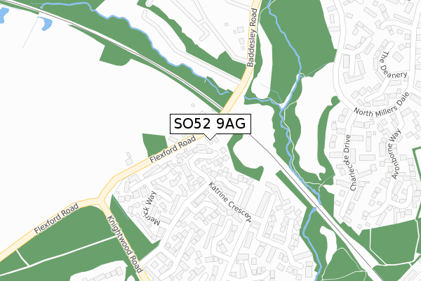
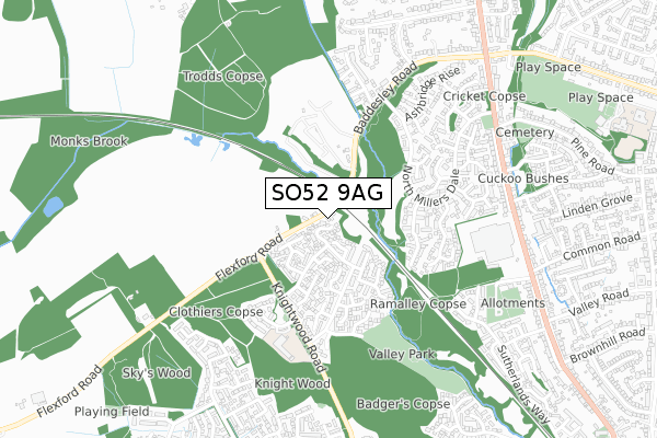
SO52 9AG is located in the Valley Park electoral ward, within the local authority district of Test Valley and the English Parliamentary constituency of Romsey and Southampton North. The Sub Integrated Care Board (ICB) Location is NHS Hampshire and Isle of Wight ICB - D9Y0V and the police force is Hampshire. This postcode has been in use since October 2018.


GetTheData
Source: OS Open Zoomstack (Ordnance Survey)
Licence: Open Government Licence (requires attribution)
Attribution: Contains OS data © Crown copyright and database right 2024
Source: Open Postcode Geo
Licence: Open Government Licence (requires attribution)
Attribution: Contains OS data © Crown copyright and database right 2024; Contains Royal Mail data © Royal Mail copyright and database right 2024; Source: Office for National Statistics licensed under the Open Government Licence v.3.0
| Easting | 442119 |
| Northing | 121777 |
| Latitude | 50.993847 |
| Longitude | -1.401213 |
GetTheData
Source: Open Postcode Geo
Licence: Open Government Licence
| Country | England |
| Postcode District | SO52 |
➜ See where SO52 is on a map ➜ Where is Chandler's Ford? | |
GetTheData
Source: Land Registry Price Paid Data
Licence: Open Government Licence
| Ward | Valley Park |
| Constituency | Romsey And Southampton North |
GetTheData
Source: ONS Postcode Database
Licence: Open Government Licence
| Baddesley Bridge (Baddesley Road) | Flexford | 343m |
| Baddesley Bridge (Baddesley Road) | Flexford | 349m |
| Katrine Crescent (Knightwood Road) | Flexford | 367m |
| Katrine Crescent (Knightwood Road) | Flexford | 368m |
| Nature Reserve (North Millers Dale) | Flexford | 406m |
| Chandlers Ford Station | 1.6km |
| Eastleigh Station | 4.5km |
| Southampton Airport Parkway Station | 5.5km |
GetTheData
Source: NaPTAN
Licence: Open Government Licence
| Percentage of properties with Next Generation Access | 100.0% |
| Percentage of properties with Superfast Broadband | 75.0% |
| Percentage of properties with Ultrafast Broadband | 0.0% |
| Percentage of properties with Full Fibre Broadband | 0.0% |
Superfast Broadband is between 30Mbps and 300Mbps
Ultrafast Broadband is > 300Mbps
| Percentage of properties unable to receive 2Mbps | 0.0% |
| Percentage of properties unable to receive 5Mbps | 0.0% |
| Percentage of properties unable to receive 10Mbps | 0.0% |
| Percentage of properties unable to receive 30Mbps | 25.0% |
GetTheData
Source: Ofcom
Licence: Ofcom Terms of Use (requires attribution)
GetTheData
Source: ONS Postcode Database
Licence: Open Government Licence


➜ Get more ratings from the Food Standards Agency
GetTheData
Source: Food Standards Agency
Licence: FSA terms & conditions
| Last Collection | |||
|---|---|---|---|
| Location | Mon-Fri | Sat | Distance |
| Katrine Crescent | 16:00 | 11:30 | 305m |
| Beechwood Crescent | 17:00 | 11:30 | 723m |
| North Millers Dale | 17:00 | 11:30 | 741m |
GetTheData
Source: Dracos
Licence: Creative Commons Attribution-ShareAlike
The below table lists the International Territorial Level (ITL) codes (formerly Nomenclature of Territorial Units for Statistics (NUTS) codes) and Local Administrative Units (LAU) codes for SO52 9AG:
| ITL 1 Code | Name |
|---|---|
| TLJ | South East (England) |
| ITL 2 Code | Name |
| TLJ3 | Hampshire and Isle of Wight |
| ITL 3 Code | Name |
| TLJ36 | Central Hampshire |
| LAU 1 Code | Name |
| E07000093 | Test Valley |
GetTheData
Source: ONS Postcode Directory
Licence: Open Government Licence
The below table lists the Census Output Area (OA), Lower Layer Super Output Area (LSOA), and Middle Layer Super Output Area (MSOA) for SO52 9AG:
| Code | Name | |
|---|---|---|
| OA | E00117838 | |
| LSOA | E01023193 | Test Valley 012D |
| MSOA | E02004825 | Test Valley 012 |
GetTheData
Source: ONS Postcode Directory
Licence: Open Government Licence
| SO53 4SR | Medway Drive | 67m |
| SO53 4QU | Bere Close | 151m |
| SO53 4SS | Partry Close | 157m |
| SO53 4QT | Merrick Way | 180m |
| SO53 4RW | Ouse Close | 186m |
| SO53 4RN | Thetford Gardens | 268m |
| SO53 4SG | Crummock Road | 288m |
| SO53 4RU | Tees Close | 313m |
| SO53 4SH | Leven Close | 364m |
| SO53 4QY | Swale Drive | 384m |
GetTheData
Source: Open Postcode Geo; Land Registry Price Paid Data
Licence: Open Government Licence