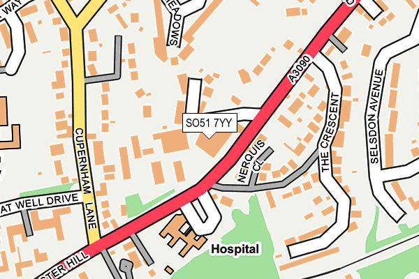
SO51 7YY is located in the Romsey Cupernham electoral ward, within the local authority district of Test Valley and the English Parliamentary constituency of Romsey and Southampton North. The Sub Integrated Care Board (ICB) Location is NHS Hampshire and Isle of Wight ICB - D9Y0V and the police force is Hampshire. This postcode has been in use since January 1986.


GetTheData
Source: OS OpenMap – Local (Ordnance Survey)
Source: OS VectorMap District (Ordnance Survey)
Licence: Open Government Licence (requires attribution)
| Easting | 436490 |
| Northing | 121675 |
| Latitude | 50.993321 |
| Longitude | -1.481437 |
GetTheData
Source: Open Postcode Geo
Licence: Open Government Licence
| Country | England |
| Postcode District | SO51 |
➜ See where SO51 is on a map ➜ Where is Romsey? | |
GetTheData
Source: Land Registry Price Paid Data
Licence: Open Government Licence
Elevation or altitude of SO51 7YY as distance above sea level:
| Metres | Feet | |
|---|---|---|
| Elevation | 30m | 98ft |
Elevation is measured from the approximate centre of the postcode, to the nearest point on an OS contour line from OS Terrain 50, which has contour spacing of ten vertical metres.
➜ How high above sea level am I? Find the elevation of your current position using your device's GPS.
GetTheData
Source: Open Postcode Elevation
Licence: Open Government Licence
| Ward | Romsey Cupernham |
| Constituency | Romsey And Southampton North |
GetTheData
Source: ONS Postcode Database
Licence: Open Government Licence
| Romsey Hospital (Winchester Hill) | Romsey | 92m |
| The Crescent (Winchester Hill) | Romsey | 152m |
| Great Well Drive (Cupernham Lane) | Romsey | 182m |
| Great Well Drive (Cupernham Lane) | Romsey | 191m |
| The Crescent (Winchester Hill) | Romsey | 223m |
| Romsey Station | 0.8km |
| Mottisfont & Dunbridge Station | 6.4km |
GetTheData
Source: NaPTAN
Licence: Open Government Licence
GetTheData
Source: ONS Postcode Database
Licence: Open Government Licence


➜ Get more ratings from the Food Standards Agency
GetTheData
Source: Food Standards Agency
Licence: FSA terms & conditions
| Last Collection | |||
|---|---|---|---|
| Location | Mon-Fri | Sat | Distance |
| Mile Hill | 17:00 | 11:45 | 151m |
| Great Well Drive | 17:15 | 11:30 | 407m |
| Viney Avenue | 17:00 | 11:45 | 480m |
GetTheData
Source: Dracos
Licence: Creative Commons Attribution-ShareAlike
The below table lists the International Territorial Level (ITL) codes (formerly Nomenclature of Territorial Units for Statistics (NUTS) codes) and Local Administrative Units (LAU) codes for SO51 7YY:
| ITL 1 Code | Name |
|---|---|
| TLJ | South East (England) |
| ITL 2 Code | Name |
| TLJ3 | Hampshire and Isle of Wight |
| ITL 3 Code | Name |
| TLJ36 | Central Hampshire |
| LAU 1 Code | Name |
| E07000093 | Test Valley |
GetTheData
Source: ONS Postcode Directory
Licence: Open Government Licence
The below table lists the Census Output Area (OA), Lower Layer Super Output Area (LSOA), and Middle Layer Super Output Area (MSOA) for SO51 7YY:
| Code | Name | |
|---|---|---|
| OA | E00117753 | |
| LSOA | E01023176 | Test Valley 010C |
| MSOA | E02004823 | Test Valley 010 |
GetTheData
Source: ONS Postcode Directory
Licence: Open Government Licence
| SO51 7NA | Bow Lane | 60m |
| SO51 7LU | Nerquis Close | 63m |
| SO51 7ND | Winchester Hill | 67m |
| SO51 7NH | Winchester Hill | 126m |
| SO51 7JH | Cupernham Lane | 154m |
| SO51 7NG | The Crescent | 159m |
| SO51 7LT | Ashley Meadows | 170m |
| SO51 7NF | Winchester Hill | 209m |
| SO51 7JJ | Cupernham Lane | 236m |
| SO51 7NJ | Winchester Hill | 242m |
GetTheData
Source: Open Postcode Geo; Land Registry Price Paid Data
Licence: Open Government Licence