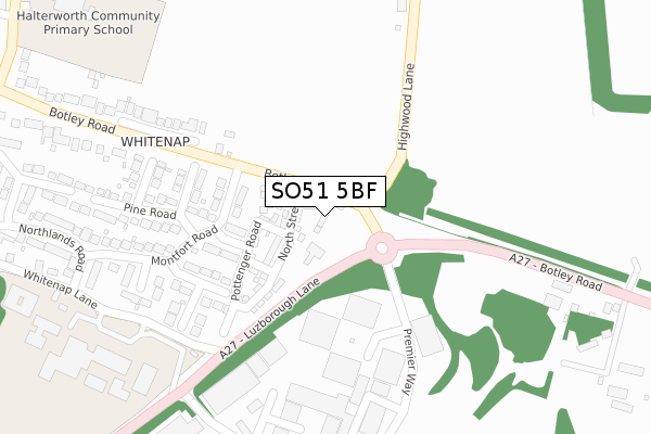
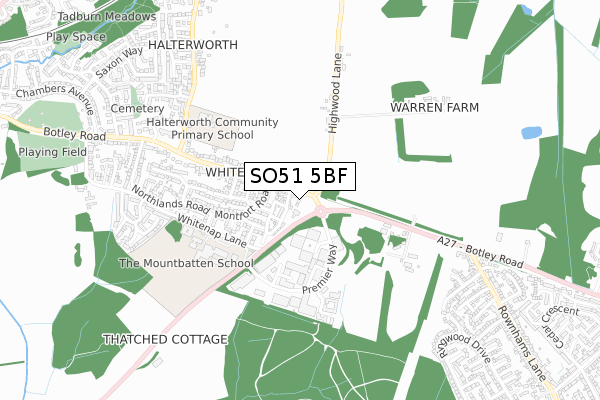
SO51 5BF is located in the Romsey Tadburn electoral ward, within the local authority district of Test Valley and the English Parliamentary constituency of Romsey and Southampton North. The Sub Integrated Care Board (ICB) Location is NHS Hampshire and Isle of Wight ICB - D9Y0V and the police force is Hampshire. This postcode has been in use since December 2018.


GetTheData
Source: OS Open Zoomstack (Ordnance Survey)
Licence: Open Government Licence (requires attribution)
Attribution: Contains OS data © Crown copyright and database right 2025
Source: Open Postcode Geo
Licence: Open Government Licence (requires attribution)
Attribution: Contains OS data © Crown copyright and database right 2025; Contains Royal Mail data © Royal Mail copyright and database right 2025; Source: Office for National Statistics licensed under the Open Government Licence v.3.0
| Easting | 437723 |
| Northing | 120789 |
| Latitude | 50.985268 |
| Longitude | -1.463951 |
GetTheData
Source: Open Postcode Geo
Licence: Open Government Licence
| Country | England |
| Postcode District | SO51 |
➜ See where SO51 is on a map ➜ Where is Romsey? | |
GetTheData
Source: Land Registry Price Paid Data
Licence: Open Government Licence
| Ward | Romsey Tadburn |
| Constituency | Romsey And Southampton North |
GetTheData
Source: ONS Postcode Database
Licence: Open Government Licence
| Montfort Road (Botley Road) | Whitenap | 101m |
| Montfort Road (Botley Road) | Whitenap | 169m |
| The Mountbatten School | Whitenap | 377m |
| Halterworth Lane (Botley Road) | Whitenap | 446m |
| Montfort College (Botley Road) | Whitenap | 573m |
| Romsey Station | 2.2km |
GetTheData
Source: NaPTAN
Licence: Open Government Licence
| Percentage of properties with Next Generation Access | 100.0% |
| Percentage of properties with Superfast Broadband | 100.0% |
| Percentage of properties with Ultrafast Broadband | 100.0% |
| Percentage of properties with Full Fibre Broadband | 100.0% |
Superfast Broadband is between 30Mbps and 300Mbps
Ultrafast Broadband is > 300Mbps
| Percentage of properties unable to receive 2Mbps | 0.0% |
| Percentage of properties unable to receive 5Mbps | 0.0% |
| Percentage of properties unable to receive 10Mbps | 0.0% |
| Percentage of properties unable to receive 30Mbps | 0.0% |
GetTheData
Source: Ofcom
Licence: Ofcom Terms of Use (requires attribution)
GetTheData
Source: ONS Postcode Database
Licence: Open Government Licence

➜ Get more ratings from the Food Standards Agency
GetTheData
Source: Food Standards Agency
Licence: FSA terms & conditions
| Last Collection | |||
|---|---|---|---|
| Location | Mon-Fri | Sat | Distance |
| Abbey Park Industrial Estate | 366m | ||
| Abbey Park Industrial Estate | 18:30 | 11:00 | 368m |
| Whitenap Post Office | 17:15 | 12:00 | 695m |
GetTheData
Source: Dracos
Licence: Creative Commons Attribution-ShareAlike
The below table lists the International Territorial Level (ITL) codes (formerly Nomenclature of Territorial Units for Statistics (NUTS) codes) and Local Administrative Units (LAU) codes for SO51 5BF:
| ITL 1 Code | Name |
|---|---|
| TLJ | South East (England) |
| ITL 2 Code | Name |
| TLJ3 | Hampshire and Isle of Wight |
| ITL 3 Code | Name |
| TLJ36 | Central Hampshire |
| LAU 1 Code | Name |
| E07000093 | Test Valley |
GetTheData
Source: ONS Postcode Directory
Licence: Open Government Licence
The below table lists the Census Output Area (OA), Lower Layer Super Output Area (LSOA), and Middle Layer Super Output Area (MSOA) for SO51 5BF:
| Code | Name | |
|---|---|---|
| OA | E00117912 | |
| LSOA | E01023207 | Test Valley 010D |
| MSOA | E02004823 | Test Valley 010 |
GetTheData
Source: ONS Postcode Directory
Licence: Open Government Licence
| SO51 5SP | Chestnut Close | 163m |
| SO51 5SL | Montfort Road | 167m |
| SO51 5SJ | Alder Close | 203m |
| SO51 5SQ | Birch Close | 242m |
| SO51 5SG | Pine Road | 291m |
| SO51 5SU | Elm Tree Gardens | 293m |
| SO51 5SH | Rowan Close | 301m |
| SO51 5SF | Montfort Road | 305m |
| SO51 9DG | Premier Way | 310m |
| SO51 9DQ | Premier Way | 311m |
GetTheData
Source: Open Postcode Geo; Land Registry Price Paid Data
Licence: Open Government Licence