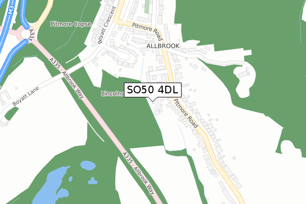
SO50 4DL is located in the Eastleigh North electoral ward, within the local authority district of Eastleigh and the English Parliamentary constituency of Eastleigh. The Sub Integrated Care Board (ICB) Location is NHS Hampshire and Isle of Wight ICB - D9Y0V and the police force is Hampshire. This postcode has been in use since November 2019.


GetTheData
Source: OS Open Zoomstack (Ordnance Survey)
Licence: Open Government Licence (requires attribution)
Attribution: Contains OS data © Crown copyright and database right 2025
Source: Open Postcode Geo
Licence: Open Government Licence (requires attribution)
Attribution: Contains OS data © Crown copyright and database right 2025; Contains Royal Mail data © Royal Mail copyright and database right 2025; Source: Office for National Statistics licensed under the Open Government Licence v.3.0
| Easting | 445630 |
| Northing | 121717 |
| Latitude | 50.993041 |
| Longitude | -1.351195 |
GetTheData
Source: Open Postcode Geo
Licence: Open Government Licence
| Country | England |
| Postcode District | SO50 |
➜ See where SO50 is on a map ➜ Where is Eastleigh? | |
GetTheData
Source: Land Registry Price Paid Data
Licence: Open Government Licence
| Ward | Eastleigh North |
| Constituency | Eastleigh |
GetTheData
Source: ONS Postcode Database
Licence: Open Government Licence
1, TREETOPS, ALLBROOK, EASTLEIGH, SO50 4DL 2024 4 JUL £642,000 |
5, TREETOPS, ALLBROOK, EASTLEIGH, SO50 4DL 2024 30 MAY £600,000 |
3, TREETOPS, ALLBROOK, EASTLEIGH, SO50 4DL 2020 4 DEC £517,000 |
2, TREETOPS, ALLBROOK, EASTLEIGH, SO50 4DL 2020 20 OCT £495,000 |
6, TREETOPS, ALLBROOK, EASTLEIGH, SO50 4DL 2020 10 AUG £565,000 |
8, TREETOPS, ALLBROOK, EASTLEIGH, SO50 4DL 2020 13 FEB £570,000 |
7, TREETOPS, ALLBROOK, EASTLEIGH, SO50 4DL 2020 3 JAN £560,000 |
4, TREETOPS, ALLBROOK, EASTLEIGH, SO50 4DL 2019 12 DEC £555,000 |
1, TREETOPS, ALLBROOK, EASTLEIGH, SO50 4DL 2019 11 DEC £570,000 |
5, TREETOPS, ALLBROOK, EASTLEIGH, SO50 4DL 2019 13 NOV £550,000 |
GetTheData
Source: HM Land Registry Price Paid Data
Licence: Contains HM Land Registry data © Crown copyright and database right 2025. This data is licensed under the Open Government Licence v3.0.
| Pitmore Road | Allbrook | 104m |
| Pitmore Road | Allbrook | 151m |
| Lincolns Rise (Pitmore Road) | Allbrook | 252m |
| Lincolns Rise (Pitmore Road) | Otterbourne | 269m |
| Pitmore Road | Allbrook | 311m |
| Chandlers Ford Station | 2.6km |
| Eastleigh Station | 2.6km |
| Shawford Station | 3.6km |
GetTheData
Source: NaPTAN
Licence: Open Government Licence
GetTheData
Source: ONS Postcode Database
Licence: Open Government Licence


➜ Get more ratings from the Food Standards Agency
GetTheData
Source: Food Standards Agency
Licence: FSA terms & conditions
| Last Collection | |||
|---|---|---|---|
| Location | Mon-Fri | Sat | Distance |
| Pitmore Road | 17:15 | 11:45 | 242m |
| Otterbourne Hill | 16:30 | 09:30 | 651m |
| Allbrook Hill | 17:15 | 11:45 | 742m |
GetTheData
Source: Dracos
Licence: Creative Commons Attribution-ShareAlike
The below table lists the International Territorial Level (ITL) codes (formerly Nomenclature of Territorial Units for Statistics (NUTS) codes) and Local Administrative Units (LAU) codes for SO50 4DL:
| ITL 1 Code | Name |
|---|---|
| TLJ | South East (England) |
| ITL 2 Code | Name |
| TLJ3 | Hampshire and Isle of Wight |
| ITL 3 Code | Name |
| TLJ35 | South Hampshire |
| LAU 1 Code | Name |
| E07000086 | Eastleigh |
GetTheData
Source: ONS Postcode Directory
Licence: Open Government Licence
The below table lists the Census Output Area (OA), Lower Layer Super Output Area (LSOA), and Middle Layer Super Output Area (MSOA) for SO50 4DL:
| Code | Name | |
|---|---|---|
| OA | E00115251 | |
| LSOA | E01022676 | Eastleigh 002D |
| MSOA | E02004713 | Eastleigh 002 |
GetTheData
Source: ONS Postcode Directory
Licence: Open Government Licence
| SO50 4BZ | Winters Place | 79m |
| SO50 4LT | Pitmore Road | 91m |
| SO50 4LS | Pitmore Road | 103m |
| SO50 4LN | Maypole Villas | 182m |
| SO50 4JL | Pitmore Close | 205m |
| SO21 2HZ | 231m | |
| SO50 4LX | Pitmore Road | 282m |
| SO50 4LP | Boyatt Crescent | 331m |
| SO50 4LR | Lincolns Rise | 349m |
| SO21 2HY | Park Lane | 396m |
GetTheData
Source: Open Postcode Geo; Land Registry Price Paid Data
Licence: Open Government Licence