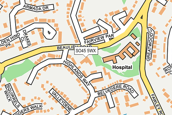
SO45 5WX is located in the Hythe Central electoral ward, within the local authority district of New Forest and the English Parliamentary constituency of New Forest East. The Sub Integrated Care Board (ICB) Location is NHS Hampshire and Isle of Wight ICB - D9Y0V and the police force is Hampshire. This postcode has been in use since December 1994.


GetTheData
Source: OS OpenMap – Local (Ordnance Survey)
Source: OS VectorMap District (Ordnance Survey)
Licence: Open Government Licence (requires attribution)
| Easting | 441999 |
| Northing | 106731 |
| Latitude | 50.858572 |
| Longitude | -1.404661 |
GetTheData
Source: Open Postcode Geo
Licence: Open Government Licence
| Country | England |
| Postcode District | SO45 |
➜ See where SO45 is on a map ➜ Where is Hythe? | |
GetTheData
Source: Land Registry Price Paid Data
Licence: Open Government Licence
Elevation or altitude of SO45 5WX as distance above sea level:
| Metres | Feet | |
|---|---|---|
| Elevation | 30m | 98ft |
Elevation is measured from the approximate centre of the postcode, to the nearest point on an OS contour line from OS Terrain 50, which has contour spacing of ten vertical metres.
➜ How high above sea level am I? Find the elevation of your current position using your device's GPS.
GetTheData
Source: Open Postcode Elevation
Licence: Open Government Licence
| Ward | Hythe Central |
| Constituency | New Forest East |
GetTheData
Source: ONS Postcode Database
Licence: Open Government Licence
| Hythe Hospital (Beaulieu Road) | Dibden Purlieu | 89m |
| Highlands Way | Dibden Purlieu | 120m |
| Hythe Hospital (Beaulieu Road) | Dibden Purlieu | 120m |
| Mullins Lane Roundabout (Beaulieu Road) | Dibden Purlieu | 250m |
| Deerleap Way (Langdown Lawn) | Hythe | 342m |
| Southampton Town Quay | 4.1km |
| Netley Station | 4.8km |
| Woolston Station | 4.9km |
GetTheData
Source: NaPTAN
Licence: Open Government Licence
GetTheData
Source: ONS Postcode Database
Licence: Open Government Licence


➜ Get more ratings from the Food Standards Agency
GetTheData
Source: Food Standards Agency
Licence: FSA terms & conditions
| Last Collection | |||
|---|---|---|---|
| Location | Mon-Fri | Sat | Distance |
| Fairview Parade Post Office | 17:30 | 11:45 | 74m |
| Upper Mullins Lane | 16:00 | 09:15 | 336m |
| Fairview Drive | 16:00 | 09:15 | 512m |
GetTheData
Source: Dracos
Licence: Creative Commons Attribution-ShareAlike
The below table lists the International Territorial Level (ITL) codes (formerly Nomenclature of Territorial Units for Statistics (NUTS) codes) and Local Administrative Units (LAU) codes for SO45 5WX:
| ITL 1 Code | Name |
|---|---|
| TLJ | South East (England) |
| ITL 2 Code | Name |
| TLJ3 | Hampshire and Isle of Wight |
| ITL 3 Code | Name |
| TLJ36 | Central Hampshire |
| LAU 1 Code | Name |
| E07000091 | New Forest |
GetTheData
Source: ONS Postcode Directory
Licence: Open Government Licence
The below table lists the Census Output Area (OA), Lower Layer Super Output Area (LSOA), and Middle Layer Super Output Area (MSOA) for SO45 5WX:
| Code | Name | |
|---|---|---|
| OA | E00117057 | |
| LSOA | E01023038 | New Forest 009C |
| MSOA | E02004787 | New Forest 009 |
GetTheData
Source: ONS Postcode Directory
Licence: Open Government Licence
| SO45 4HY | Highlands Way | 49m |
| SO45 4HX | Highlands Way | 86m |
| SO45 4HZ | Highlands Close | 93m |
| SO45 4NS | Beaulieu Road | 115m |
| SO45 4NG | Valleydene | 150m |
| SO45 5GU | Beaulieu Road | 184m |
| SO45 4NP | Belvedere Road | 186m |
| SO45 5GW | Langdown Lawn Close | 187m |
| SO45 5BQ | Golden Hind Park | 197m |
| SO45 4NL | Belmont Close | 205m |
GetTheData
Source: Open Postcode Geo; Land Registry Price Paid Data
Licence: Open Government Licence