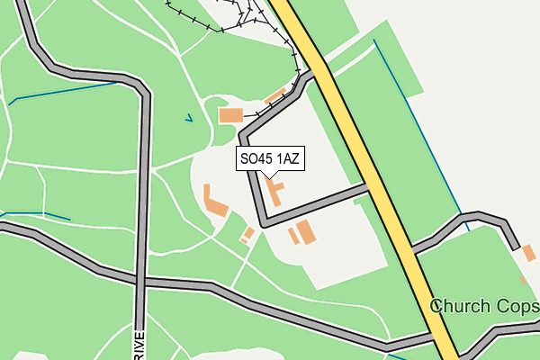
SO45 1AZ is located in the Forest & Solent electoral ward, within the local authority district of New Forest and the English Parliamentary constituency of New Forest East. The Sub Integrated Care Board (ICB) Location is NHS Hampshire and Isle of Wight ICB - D9Y0V and the police force is Hampshire. This postcode has been in use since December 1994.


GetTheData
Source: OS OpenMap – Local (Ordnance Survey)
Source: OS VectorMap District (Ordnance Survey)
Licence: Open Government Licence (requires attribution)
| Easting | 442415 |
| Northing | 100533 |
| Latitude | 50.802809 |
| Longitude | -1.399466 |
GetTheData
Source: Open Postcode Geo
Licence: Open Government Licence
| Country | England |
| Postcode District | SO45 |
➜ See where SO45 is on a map | |
GetTheData
Source: Land Registry Price Paid Data
Licence: Open Government Licence
Elevation or altitude of SO45 1AZ as distance above sea level:
| Metres | Feet | |
|---|---|---|
| Elevation | 20m | 66ft |
Elevation is measured from the approximate centre of the postcode, to the nearest point on an OS contour line from OS Terrain 50, which has contour spacing of ten vertical metres.
➜ How high above sea level am I? Find the elevation of your current position using your device's GPS.
GetTheData
Source: Open Postcode Elevation
Licence: Open Government Licence
| Ward | Forest & Solent |
| Constituency | New Forest East |
GetTheData
Source: ONS Postcode Database
Licence: Open Government Licence
| Exbury Gardens (Private Grounds At Exbury) | Exbury | 313m |
| Exbury Gardens (Junction With Summer Lane) | Exbury | 485m |
| Exbury Gardens (Junction With Summer Lane) | Exbury | 493m |
| Visitor Car Park (Access Road To Car Park) | Bucklers Hard | 1,577m |
GetTheData
Source: NaPTAN
Licence: Open Government Licence
GetTheData
Source: ONS Postcode Database
Licence: Open Government Licence


➜ Get more ratings from the Food Standards Agency
GetTheData
Source: Food Standards Agency
Licence: FSA terms & conditions
| Last Collection | |||
|---|---|---|---|
| Location | Mon-Fri | Sat | Distance |
| Exbury Gardens | 16:00 | 54m | |
| Exbury Stores | 16:00 | 09:00 | 487m |
| Kings Ride | 16:30 | 07:15 | 1,800m |
GetTheData
Source: Dracos
Licence: Creative Commons Attribution-ShareAlike
The below table lists the International Territorial Level (ITL) codes (formerly Nomenclature of Territorial Units for Statistics (NUTS) codes) and Local Administrative Units (LAU) codes for SO45 1AZ:
| ITL 1 Code | Name |
|---|---|
| TLJ | South East (England) |
| ITL 2 Code | Name |
| TLJ3 | Hampshire and Isle of Wight |
| ITL 3 Code | Name |
| TLJ36 | Central Hampshire |
| LAU 1 Code | Name |
| E07000091 | New Forest |
GetTheData
Source: ONS Postcode Directory
Licence: Open Government Licence
The below table lists the Census Output Area (OA), Lower Layer Super Output Area (LSOA), and Middle Layer Super Output Area (MSOA) for SO45 1AZ:
| Code | Name | |
|---|---|---|
| OA | E00116868 | |
| LSOA | E01022999 | New Forest 017B |
| MSOA | E02004795 | New Forest 017 |
GetTheData
Source: ONS Postcode Directory
Licence: Open Government Licence
| SO45 1AF | 436m | |
| SO45 1AH | 546m | |
| SO42 7XD | Bucklers Hard | 1458m |
| SO45 1XJ | West Common | 1670m |
| SO45 1SP | Foresters Gate | 1703m |
| SO45 1XL | West Common | 1735m |
| SO45 1ZL | Charnwood Way | 1762m |
| SO45 1ZN | Kings Ride | 1835m |
| SO45 1ZQ | Sherwood Way | 1859m |
| SO45 1ZR | Bowland Way | 1872m |
GetTheData
Source: Open Postcode Geo; Land Registry Price Paid Data
Licence: Open Government Licence