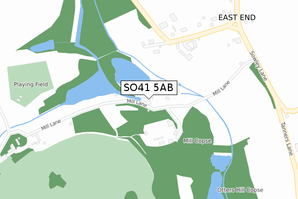
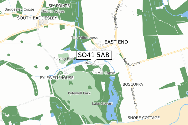
SO41 5AB is located in the Forest & Solent electoral ward, within the local authority district of New Forest and the English Parliamentary constituency of New Forest East. The Sub Integrated Care Board (ICB) Location is NHS Hampshire and Isle of Wight ICB - D9Y0V and the police force is Hampshire. This postcode has been in use since April 2020.


GetTheData
Source: OS Open Zoomstack (Ordnance Survey)
Licence: Open Government Licence (requires attribution)
Attribution: Contains OS data © Crown copyright and database right 2025
Source: Open Postcode Geo
Licence: Open Government Licence (requires attribution)
Attribution: Contains OS data © Crown copyright and database right 2025; Contains Royal Mail data © Royal Mail copyright and database right 2025; Source: Office for National Statistics licensed under the Open Government Licence v.3.0
| Easting | 435856 |
| Northing | 96034 |
| Latitude | 50.762786 |
| Longitude | -1.492968 |
GetTheData
Source: Open Postcode Geo
Licence: Open Government Licence
| Country | England |
| Postcode District | SO41 |
➜ See where SO41 is on a map | |
GetTheData
Source: Land Registry Price Paid Data
Licence: Open Government Licence
| Ward | Forest & Solent |
| Constituency | New Forest East |
GetTheData
Source: ONS Postcode Database
Licence: Open Government Licence
| The School (South Baddesley Road) | South Baddesley | 873m |
| The School (South Baddesley Road) | South Baddesley | 878m |
| Bridge Farm (Lymington Road) | Norleywood | 1,184m |
| Bridge Farm (Lymington Road) | Norleywood | 1,185m |
| Norleywood Cottages (Norleywood Road) | Norleywood | 1,489m |
| Lymington Pier Station | 2.6km |
| Lymington Town Station | 3.1km |
GetTheData
Source: NaPTAN
Licence: Open Government Licence
GetTheData
Source: ONS Postcode Database
Licence: Open Government Licence


➜ Get more ratings from the Food Standards Agency
GetTheData
Source: Food Standards Agency
Licence: FSA terms & conditions
| Last Collection | |||
|---|---|---|---|
| Location | Mon-Fri | Sat | Distance |
| East End Green | 16:45 | 10:15 | 395m |
| South Baddesley | 16:45 | 10:15 | 869m |
| Norley Wood | 16:30 | 09:30 | 1,459m |
GetTheData
Source: Dracos
Licence: Creative Commons Attribution-ShareAlike
The below table lists the International Territorial Level (ITL) codes (formerly Nomenclature of Territorial Units for Statistics (NUTS) codes) and Local Administrative Units (LAU) codes for SO41 5AB:
| ITL 1 Code | Name |
|---|---|
| TLJ | South East (England) |
| ITL 2 Code | Name |
| TLJ3 | Hampshire and Isle of Wight |
| ITL 3 Code | Name |
| TLJ36 | Central Hampshire |
| LAU 1 Code | Name |
| E07000091 | New Forest |
GetTheData
Source: ONS Postcode Directory
Licence: Open Government Licence
The below table lists the Census Output Area (OA), Lower Layer Super Output Area (LSOA), and Middle Layer Super Output Area (MSOA) for SO41 5AB:
| Code | Name | |
|---|---|---|
| OA | E00116810 | |
| LSOA | E01022990 | New Forest 017A |
| MSOA | E02004795 | New Forest 017 |
GetTheData
Source: ONS Postcode Directory
Licence: Open Government Licence
| SO41 5SN | Private Road | 162m |
| SO41 5SL | Lymington Road | 301m |
| SO41 5SP | Tanners Lane | 612m |
| SO41 5SY | Lymington Road | 787m |
| SO41 5RP | 996m | |
| SO41 5SX | Broomhill Cottages | 1440m |
| SO41 5RS | 1494m | |
| SO41 5RR | 1499m | |
| SO41 5SU | Rowes Lane | 1499m |
| SO41 5RQ | Brook Hill | 1542m |
GetTheData
Source: Open Postcode Geo; Land Registry Price Paid Data
Licence: Open Government Licence