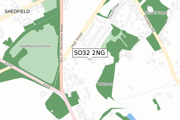
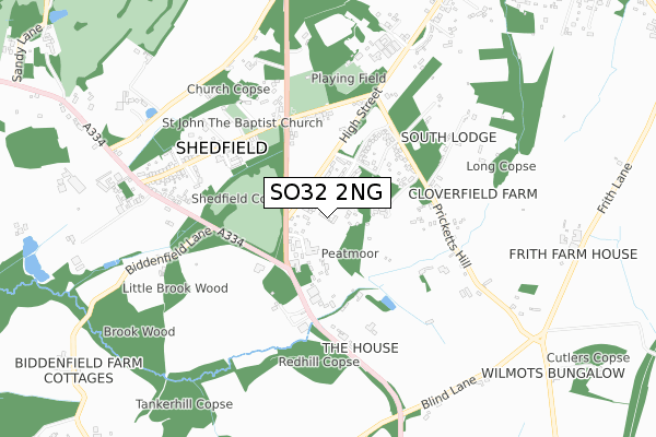
SO32 2NG is located in the Whiteley and Shedfield electoral ward, within the local authority district of Winchester and the English Parliamentary constituency of Meon Valley. The Sub Integrated Care Board (ICB) Location is NHS Hampshire and Isle of Wight ICB - D9Y0V and the police force is Hampshire. This postcode has been in use since November 2017.


GetTheData
Source: OS Open Zoomstack (Ordnance Survey)
Licence: Open Government Licence (requires attribution)
Attribution: Contains OS data © Crown copyright and database right 2025
Source: Open Postcode Geo
Licence: Open Government Licence (requires attribution)
Attribution: Contains OS data © Crown copyright and database right 2025; Contains Royal Mail data © Royal Mail copyright and database right 2025; Source: Office for National Statistics licensed under the Open Government Licence v.3.0
| Easting | 456474 |
| Northing | 112939 |
| Latitude | 50.913155 |
| Longitude | -1.198053 |
GetTheData
Source: Open Postcode Geo
Licence: Open Government Licence
| Country | England |
| Postcode District | SO32 |
➜ See where SO32 is on a map ➜ Where is Shedfield? | |
GetTheData
Source: Land Registry Price Paid Data
Licence: Open Government Licence
| Ward | Whiteley And Shedfield |
| Constituency | Meon Valley |
GetTheData
Source: ONS Postcode Database
Licence: Open Government Licence
| Ashley Manor (B2177 Winchester Road) | Shedfield | 190m |
| Ashley Manor (B2177 Winchester Road) | Shedfield | 218m |
| Shedfield Common (A334) | Shedfield | 293m |
| Shedfield Common (A334) | Shedfield | 297m |
| Church Road (B2177 Winchester Road) | Shedfield | 353m |
| Botley Station | 4.3km |
| Swanwick Station | 6.3km |
GetTheData
Source: NaPTAN
Licence: Open Government Licence
| Percentage of properties with Next Generation Access | 100.0% |
| Percentage of properties with Superfast Broadband | 100.0% |
| Percentage of properties with Ultrafast Broadband | 0.0% |
| Percentage of properties with Full Fibre Broadband | 0.0% |
Superfast Broadband is between 30Mbps and 300Mbps
Ultrafast Broadband is > 300Mbps
| Median download speed | 17.6Mbps |
| Average download speed | 16.6Mbps |
| Maximum download speed | 24.99Mbps |
| Median upload speed | 5.7Mbps |
| Average upload speed | 4.8Mbps |
| Maximum upload speed | 7.12Mbps |
| Percentage of properties unable to receive 2Mbps | 0.0% |
| Percentage of properties unable to receive 5Mbps | 0.0% |
| Percentage of properties unable to receive 10Mbps | 0.0% |
| Percentage of properties unable to receive 30Mbps | 0.0% |
GetTheData
Source: Ofcom
Licence: Ofcom Terms of Use (requires attribution)
GetTheData
Source: ONS Postcode Database
Licence: Open Government Licence


➜ Get more ratings from the Food Standards Agency
GetTheData
Source: Food Standards Agency
Licence: FSA terms & conditions
| Last Collection | |||
|---|---|---|---|
| Location | Mon-Fri | Sat | Distance |
| Church Road | 16:30 | 09:30 | 419m |
| Shedfield Post Office | 16:45 | 09:45 | 650m |
| Blind Lane | 16:45 | 07:30 | 870m |
GetTheData
Source: Dracos
Licence: Creative Commons Attribution-ShareAlike
The below table lists the International Territorial Level (ITL) codes (formerly Nomenclature of Territorial Units for Statistics (NUTS) codes) and Local Administrative Units (LAU) codes for SO32 2NG:
| ITL 1 Code | Name |
|---|---|
| TLJ | South East (England) |
| ITL 2 Code | Name |
| TLJ3 | Hampshire and Isle of Wight |
| ITL 3 Code | Name |
| TLJ36 | Central Hampshire |
| LAU 1 Code | Name |
| E07000094 | Winchester |
GetTheData
Source: ONS Postcode Directory
Licence: Open Government Licence
The below table lists the Census Output Area (OA), Lower Layer Super Output Area (LSOA), and Middle Layer Super Output Area (MSOA) for SO32 2NG:
| Code | Name | |
|---|---|---|
| OA | E00118241 | |
| LSOA | E01023271 | Winchester 013B |
| MSOA | E02004841 | Winchester 013 |
GetTheData
Source: ONS Postcode Directory
Licence: Open Government Licence
| SO32 2JF | Winchester Road | 84m |
| SO32 2JD | Heathlands | 148m |
| SO32 2JE | Turkey Island | 262m |
| SO32 2JB | Upper Church Road | 401m |
| SO32 2JW | Pricketts Hill | 480m |
| SO32 2HY | Church Road | 507m |
| SO32 2HX | Sloane Park | 521m |
| SO32 2TA | St Johns Lane | 536m |
| SO32 2JA | Winchester Road | 549m |
| SO32 2JG | Botley Road | 633m |
GetTheData
Source: Open Postcode Geo; Land Registry Price Paid Data
Licence: Open Government Licence