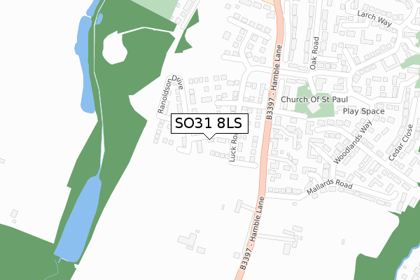
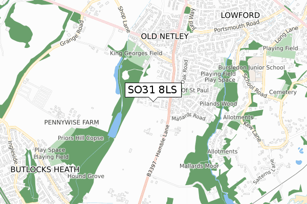
SO31 8LS is located in the Bursledon & Hound North electoral ward, within the local authority district of Eastleigh and the English Parliamentary constituency of Eastleigh. The Sub Integrated Care Board (ICB) Location is NHS Hampshire and Isle of Wight ICB - D9Y0V and the police force is Hampshire. This postcode has been in use since November 2018.


GetTheData
Source: OS Open Zoomstack (Ordnance Survey)
Licence: Open Government Licence (requires attribution)
Attribution: Contains OS data © Crown copyright and database right 2025
Source: Open Postcode Geo
Licence: Open Government Licence (requires attribution)
Attribution: Contains OS data © Crown copyright and database right 2025; Contains Royal Mail data © Royal Mail copyright and database right 2025; Source: Office for National Statistics licensed under the Open Government Licence v.3.0
| Easting | 447473 |
| Northing | 109615 |
| Latitude | 50.884073 |
| Longitude | -1.326510 |
GetTheData
Source: Open Postcode Geo
Licence: Open Government Licence
| Country | England |
| Postcode District | SO31 |
➜ See where SO31 is on a map ➜ Where is Bursledon? | |
GetTheData
Source: Land Registry Price Paid Data
Licence: Open Government Licence
| Ward | Bursledon & Hound North |
| Constituency | Eastleigh |
GetTheData
Source: ONS Postcode Database
Licence: Open Government Licence
| Chamberlayne Road (Hamble Lane) | Lowford | 186m |
| Chamberlayne Road | Lowford | 276m |
| Priors Hill Lane (Pound Road) | Lowford | 374m |
| Priors Hill Lane (Pound Road) | Lowford | 383m |
| Lowford Hill (Hamble Lane) | Lowford | 481m |
| Hamble Station | 1.4km |
| Netley Station | 1.5km |
| Bursledon Station | 1.5km |
GetTheData
Source: NaPTAN
Licence: Open Government Licence
| Percentage of properties with Next Generation Access | 100.0% |
| Percentage of properties with Superfast Broadband | 100.0% |
| Percentage of properties with Ultrafast Broadband | 52.6% |
| Percentage of properties with Full Fibre Broadband | 52.6% |
Superfast Broadband is between 30Mbps and 300Mbps
Ultrafast Broadband is > 300Mbps
| Percentage of properties unable to receive 2Mbps | 0.0% |
| Percentage of properties unable to receive 5Mbps | 0.0% |
| Percentage of properties unable to receive 10Mbps | 0.0% |
| Percentage of properties unable to receive 30Mbps | 0.0% |
GetTheData
Source: Ofcom
Licence: Ofcom Terms of Use (requires attribution)
GetTheData
Source: ONS Postcode Database
Licence: Open Government Licence


➜ Get more ratings from the Food Standards Agency
GetTheData
Source: Food Standards Agency
Licence: FSA terms & conditions
| Last Collection | |||
|---|---|---|---|
| Location | Mon-Fri | Sat | Distance |
| Pilands Wood | 16:30 | 09:00 | 272m |
| Pound Road | 16:30 | 09:00 | 468m |
| Reeves Way | 16:00 | 09:00 | 575m |
GetTheData
Source: Dracos
Licence: Creative Commons Attribution-ShareAlike
The below table lists the International Territorial Level (ITL) codes (formerly Nomenclature of Territorial Units for Statistics (NUTS) codes) and Local Administrative Units (LAU) codes for SO31 8LS:
| ITL 1 Code | Name |
|---|---|
| TLJ | South East (England) |
| ITL 2 Code | Name |
| TLJ3 | Hampshire and Isle of Wight |
| ITL 3 Code | Name |
| TLJ35 | South Hampshire |
| LAU 1 Code | Name |
| E07000086 | Eastleigh |
GetTheData
Source: ONS Postcode Directory
Licence: Open Government Licence
The below table lists the Census Output Area (OA), Lower Layer Super Output Area (LSOA), and Middle Layer Super Output Area (MSOA) for SO31 8LS:
| Code | Name | |
|---|---|---|
| OA | E00115339 | |
| LSOA | E01022689 | Eastleigh 015B |
| MSOA | E02004726 | Eastleigh 015 |
GetTheData
Source: ONS Postcode Directory
Licence: Open Government Licence
| SO31 8EL | Hamble Lane | 156m |
| SO31 8EA | Hamble Lane | 208m |
| SO31 8EJ | Mallards Road | 241m |
| SO31 8LE | Sycamore Close | 255m |
| SO31 8DS | Boundary Road | 300m |
| SO31 8FG | Priors Hill Lane | 347m |
| SO31 8JS | Pound Road | 385m |
| SO31 8EH | Mallards Road | 386m |
| SO31 8FF | Pound Road | 405m |
| SO31 8FE | Pound Road | 428m |
GetTheData
Source: Open Postcode Geo; Land Registry Price Paid Data
Licence: Open Government Licence