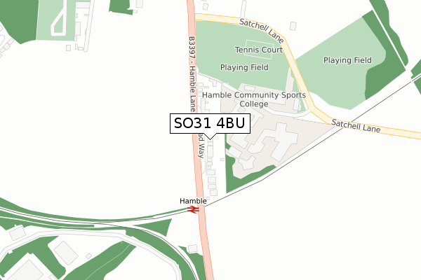
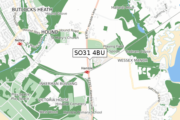
SO31 4BU is located in the Hamble & Netley electoral ward, within the local authority district of Eastleigh and the English Parliamentary constituency of Eastleigh. The Sub Integrated Care Board (ICB) Location is NHS Hampshire and Isle of Wight ICB - D9Y0V and the police force is Hampshire. This postcode has been in use since August 2018.


GetTheData
Source: OS Open Zoomstack (Ordnance Survey)
Licence: Open Government Licence (requires attribution)
Attribution: Contains OS data © Crown copyright and database right 2025
Source: Open Postcode Geo
Licence: Open Government Licence (requires attribution)
Attribution: Contains OS data © Crown copyright and database right 2025; Contains Royal Mail data © Royal Mail copyright and database right 2025; Source: Office for National Statistics licensed under the Open Government Licence v.3.0
| Easting | 447300 |
| Northing | 107839 |
| Latitude | 50.868117 |
| Longitude | -1.329199 |
GetTheData
Source: Open Postcode Geo
Licence: Open Government Licence
| Country | England |
| Postcode District | SO31 |
➜ See where SO31 is on a map | |
GetTheData
Source: Land Registry Price Paid Data
Licence: Open Government Licence
| Ward | Hamble & Netley |
| Constituency | Eastleigh |
GetTheData
Source: ONS Postcode Database
Licence: Open Government Licence
| Sports Ground (Hamble Lane) | Hamble-le-rice | 109m |
| Post Box (Hamble Lane) | Hamble-le-rice | 124m |
| Verdon Avenue (Hamble Lane) | Hamble-le-rice | 467m |
| Verdon Avenue (Hamble Lane) | Hamble-le-rice | 483m |
| Hamble Lane School (Hamble Lane) | Hound | 579m |
| Hamble Station | 0.4km |
| Netley Station | 1.2km |
| Bursledon Station | 2.4km |
GetTheData
Source: NaPTAN
Licence: Open Government Licence
GetTheData
Source: ONS Postcode Database
Licence: Open Government Licence


➜ Get more ratings from the Food Standards Agency
GetTheData
Source: Food Standards Agency
Licence: FSA terms & conditions
| Last Collection | |||
|---|---|---|---|
| Location | Mon-Fri | Sat | Distance |
| Coronation Parade Post Office | 17:30 | 10:30 | 669m |
| Sydney Crescent | 16:30 | 08:00 | 690m |
| Hound Lane | 16:30 | 08:00 | 699m |
GetTheData
Source: Dracos
Licence: Creative Commons Attribution-ShareAlike
The below table lists the International Territorial Level (ITL) codes (formerly Nomenclature of Territorial Units for Statistics (NUTS) codes) and Local Administrative Units (LAU) codes for SO31 4BU:
| ITL 1 Code | Name |
|---|---|
| TLJ | South East (England) |
| ITL 2 Code | Name |
| TLJ3 | Hampshire and Isle of Wight |
| ITL 3 Code | Name |
| TLJ35 | South Hampshire |
| LAU 1 Code | Name |
| E07000086 | Eastleigh |
GetTheData
Source: ONS Postcode Directory
Licence: Open Government Licence
The below table lists the Census Output Area (OA), Lower Layer Super Output Area (LSOA), and Middle Layer Super Output Area (MSOA) for SO31 4BU:
| Code | Name | |
|---|---|---|
| OA | E00115325 | |
| LSOA | E01022690 | Eastleigh 015C |
| MSOA | E02004726 | Eastleigh 015 |
GetTheData
Source: ONS Postcode Directory
Licence: Open Government Licence
| SO31 4HU | Hamble Lane | 167m |
| SO31 4NL | Hamble Lane | 272m |
| SO31 4RU | Tutor Close | 507m |
| SO31 4HX | Verdon Avenue | 531m |
| SO31 4BT | Broad Way | 532m |
| SO31 4HW | Verdon Avenue | 567m |
| SO31 4JQ | Sydney Avenue | 605m |
| SO31 4HT | Hamble Lane | 612m |
| SO31 4JU | Kings Avenue | 632m |
| SO31 4JP | Sydney Avenue | 648m |
GetTheData
Source: Open Postcode Geo; Land Registry Price Paid Data
Licence: Open Government Licence