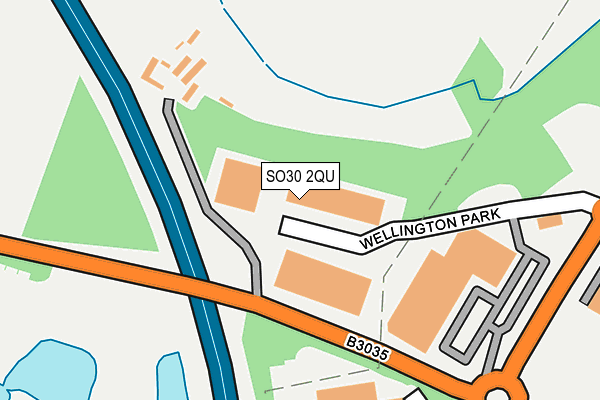
SO30 2QU lies on Wellington Park in Hedge End, Southampton. SO30 2QU is located in the West End North electoral ward, within the local authority district of Eastleigh and the English Parliamentary constituency of Eastleigh. The Sub Integrated Care Board (ICB) Location is NHS Hampshire and Isle of Wight ICB - D9Y0V and the police force is Hampshire. This postcode has been in use since December 2000.


GetTheData
Source: OS OpenMap – Local (Ordnance Survey)
Source: OS VectorMap District (Ordnance Survey)
Licence: Open Government Licence (requires attribution)
| Easting | 448271 |
| Northing | 114364 |
| Latitude | 50.926709 |
| Longitude | -1.314540 |
GetTheData
Source: Open Postcode Geo
Licence: Open Government Licence
| Street | Wellington Park |
| Locality | Hedge End |
| Town/City | Southampton |
| Country | England |
| Postcode District | SO30 |
➜ See where SO30 is on a map ➜ Where is Hedge End? | |
GetTheData
Source: Land Registry Price Paid Data
Licence: Open Government Licence
Elevation or altitude of SO30 2QU as distance above sea level:
| Metres | Feet | |
|---|---|---|
| Elevation | 40m | 131ft |
Elevation is measured from the approximate centre of the postcode, to the nearest point on an OS contour line from OS Terrain 50, which has contour spacing of ten vertical metres.
➜ How high above sea level am I? Find the elevation of your current position using your device's GPS.
GetTheData
Source: Open Postcode Elevation
Licence: Open Government Licence
| Ward | West End North |
| Constituency | Eastleigh |
GetTheData
Source: ONS Postcode Database
Licence: Open Government Licence
| Bradbeers Retail Pk (Tollbar Way) | Wildern | 278m |
| Bradbeers Retail Pk (Tollbar Way) | Wildern | 279m |
| Tollbar Way | West End | 304m |
| Dawson Lodge | West End | 326m |
| Tollbar Way | West End | 346m |
| Hedge End Station | 1.5km |
| Botley Station | 4.1km |
| Southampton Airport Parkway Station | 4.3km |
GetTheData
Source: NaPTAN
Licence: Open Government Licence
GetTheData
Source: ONS Postcode Database
Licence: Open Government Licence


➜ Get more ratings from the Food Standards Agency
GetTheData
Source: Food Standards Agency
Licence: FSA terms & conditions
| Last Collection | |||
|---|---|---|---|
| Location | Mon-Fri | Sat | Distance |
| Herald Industrial Estate | 17:30 | 12:15 | 426m |
| Moorgreen | 16:45 | 07:30 | 752m |
| Sainsburys | 17:30 | 11:45 | 767m |
GetTheData
Source: Dracos
Licence: Creative Commons Attribution-ShareAlike
The below table lists the International Territorial Level (ITL) codes (formerly Nomenclature of Territorial Units for Statistics (NUTS) codes) and Local Administrative Units (LAU) codes for SO30 2QU:
| ITL 1 Code | Name |
|---|---|
| TLJ | South East (England) |
| ITL 2 Code | Name |
| TLJ3 | Hampshire and Isle of Wight |
| ITL 3 Code | Name |
| TLJ35 | South Hampshire |
| LAU 1 Code | Name |
| E07000086 | Eastleigh |
GetTheData
Source: ONS Postcode Directory
Licence: Open Government Licence
The below table lists the Census Output Area (OA), Lower Layer Super Output Area (LSOA), and Middle Layer Super Output Area (MSOA) for SO30 2QU:
| Code | Name | |
|---|---|---|
| OA | E00115463 | |
| LSOA | E01022713 | Eastleigh 009A |
| MSOA | E02004720 | Eastleigh 009 |
GetTheData
Source: ONS Postcode Directory
Licence: Open Government Licence
| SO30 2QY | Tollbar Way | 253m |
| SO30 2JU | Mescott Meadows | 440m |
| SO30 2JT | Mescott Meadows | 495m |
| SO30 2JX | Whites Way | 560m |
| SO30 2JS | Gammon Close | 588m |
| SO30 2JY | Whites Way | 591m |
| SO30 2LF | Pomeroy Crescent | 611m |
| SO30 2LN | Hansen Gardens | 624m |
| SO30 2LP | Lebburn Meadows | 627m |
| SO30 3JR | Monarch Way | 671m |
GetTheData
Source: Open Postcode Geo; Land Registry Price Paid Data
Licence: Open Government Licence