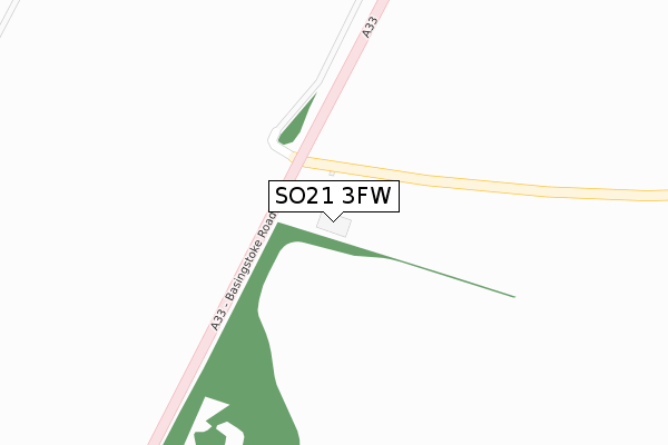
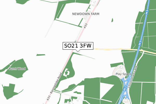
SO21 3FW is located in the Alresford and Itchen Valley electoral ward, within the local authority district of Winchester and the English Parliamentary constituency of Winchester. The Sub Integrated Care Board (ICB) Location is NHS Hampshire and Isle of Wight ICB - D9Y0V and the police force is Hampshire. This postcode has been in use since January 2019.


GetTheData
Source: OS Open Zoomstack (Ordnance Survey)
Licence: Open Government Licence (requires attribution)
Attribution: Contains OS data © Crown copyright and database right 2025
Source: Open Postcode Geo
Licence: Open Government Licence (requires attribution)
Attribution: Contains OS data © Crown copyright and database right 2025; Contains Royal Mail data © Royal Mail copyright and database right 2025; Source: Office for National Statistics licensed under the Open Government Licence v.3.0
| Easting | 451542 |
| Northing | 136289 |
| Latitude | 51.123569 |
| Longitude | -1.264888 |
GetTheData
Source: Open Postcode Geo
Licence: Open Government Licence
| Country | England |
| Postcode District | SO21 |
➜ See where SO21 is on a map | |
GetTheData
Source: Land Registry Price Paid Data
Licence: Open Government Licence
| Ward | Alresford And Itchen Valley |
| Constituency | Winchester |
GetTheData
Source: ONS Postcode Database
Licence: Open Government Licence
| Lunways Inn (Basingstoke Road) | Micheldever | 80m |
| Lunways Inn (A33) | Micheldever | 148m |
| Micheldever Turn (Winchester Road) | Micheldever | 1,547m |
GetTheData
Source: NaPTAN
Licence: Open Government Licence
GetTheData
Source: ONS Postcode Database
Licence: Open Government Licence


➜ Get more ratings from the Food Standards Agency
GetTheData
Source: Food Standards Agency
Licence: FSA terms & conditions
| Last Collection | |||
|---|---|---|---|
| Location | Mon-Fri | Sat | Distance |
| Newdown | 16:00 | 08:30 | 2,815m |
| Martyr Worthy | 16:00 | 07:00 | 3,370m |
| Chilland | 16:00 | 07:00 | 3,492m |
GetTheData
Source: Dracos
Licence: Creative Commons Attribution-ShareAlike
The below table lists the International Territorial Level (ITL) codes (formerly Nomenclature of Territorial Units for Statistics (NUTS) codes) and Local Administrative Units (LAU) codes for SO21 3FW:
| ITL 1 Code | Name |
|---|---|
| TLJ | South East (England) |
| ITL 2 Code | Name |
| TLJ3 | Hampshire and Isle of Wight |
| ITL 3 Code | Name |
| TLJ36 | Central Hampshire |
| LAU 1 Code | Name |
| E07000094 | Winchester |
GetTheData
Source: ONS Postcode Directory
Licence: Open Government Licence
The below table lists the Census Output Area (OA), Lower Layer Super Output Area (LSOA), and Middle Layer Super Output Area (MSOA) for SO21 3FW:
| Code | Name | |
|---|---|---|
| OA | E00118065 | |
| LSOA | E01023236 | Winchester 002A |
| MSOA | E02004830 | Winchester 002 |
GetTheData
Source: ONS Postcode Directory
Licence: Open Government Licence
| SO21 3BT | 677m | |
| SO21 1AG | 864m | |
| SO21 1AE | Burntwood | 2145m |
| SO21 1AR | Bridgetts Lane | 2303m |
| SO21 3DQ | Hawthorn Close | 2549m |
| SO21 3AA | 2567m | |
| SO21 3DG | Winchester Road | 2658m |
| SO21 3DA | 2741m | |
| SO21 1AQ | 2754m | |
| SO21 3DJ | Southbrook Cottages | 2768m |
GetTheData
Source: Open Postcode Geo; Land Registry Price Paid Data
Licence: Open Government Licence