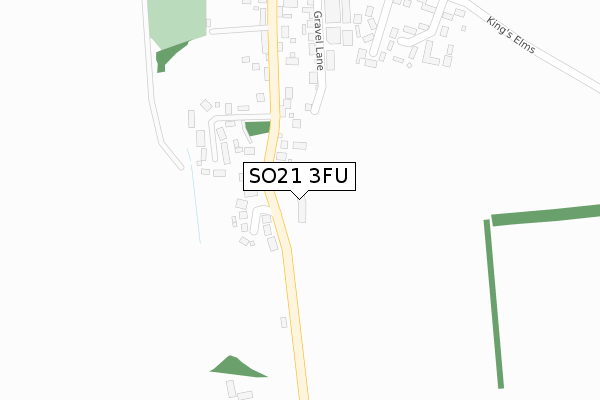
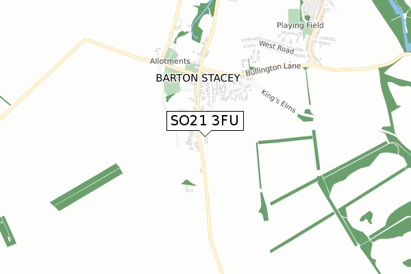
SO21 3FU is located in the Harewood electoral ward, within the local authority district of Test Valley and the English Parliamentary constituency of Romsey and Southampton North. The Sub Integrated Care Board (ICB) Location is NHS Hampshire and Isle of Wight ICB - D9Y0V and the police force is Hampshire. This postcode has been in use since October 2019.


GetTheData
Source: OS Open Zoomstack (Ordnance Survey)
Licence: Open Government Licence (requires attribution)
Attribution: Contains OS data © Crown copyright and database right 2025
Source: Open Postcode Geo
Licence: Open Government Licence (requires attribution)
Attribution: Contains OS data © Crown copyright and database right 2025; Contains Royal Mail data © Royal Mail copyright and database right 2025; Source: Office for National Statistics licensed under the Open Government Licence v.3.0
| Easting | 443541 |
| Northing | 140720 |
| Latitude | 51.164072 |
| Longitude | -1.378672 |
GetTheData
Source: Open Postcode Geo
Licence: Open Government Licence
| Country | England |
| Postcode District | SO21 |
➜ See where SO21 is on a map ➜ Where is Barton Stacey? | |
GetTheData
Source: Land Registry Price Paid Data
Licence: Open Government Licence
| Ward | Harewood |
| Constituency | Romsey And Southampton North |
GetTheData
Source: ONS Postcode Database
Licence: Open Government Licence
2021 17 SEP £1,250,000 |
2, BEADON MEADOW, BARTON STACEY, WINCHESTER, SO21 3FU 2020 22 JUL £1,025,000 |
4, BEADON MEADOW, BARTON STACEY, WINCHESTER, SO21 3FU 2020 2 APR £1,050,000 |
3, BEADON MEADOW, BARTON STACEY, WINCHESTER, SO21 3FU 2020 21 FEB £1,010,000 |
5, BEADON MEADOW, BARTON STACEY, WINCHESTER, SO21 3FU 2020 17 FEB £1,060,000 |
2019 18 DEC £985,000 |
GetTheData
Source: HM Land Registry Price Paid Data
Licence: Contains HM Land Registry data © Crown copyright and database right 2025. This data is licensed under the Open Government Licence v3.0.
| The Swan (Main Road Through Barton Stacey) | Barton Stacey | 276m |
| Wades House (Main Road Through Barton Stacey) | Barton Stacey | 286m |
| Wades House (Main Road Through Barton Stacey) | Barton Stacey | 323m |
| The Swan (Main Road Through Barton Stacey) | Barton Stacey | 342m |
| Kings Elms (Bullington Lane) | Barton Stacey | 399m |
GetTheData
Source: NaPTAN
Licence: Open Government Licence
GetTheData
Source: ONS Postcode Database
Licence: Open Government Licence


➜ Get more ratings from the Food Standards Agency
GetTheData
Source: Food Standards Agency
Licence: FSA terms & conditions
| Last Collection | |||
|---|---|---|---|
| Location | Mon-Fri | Sat | Distance |
| Barton Stacey Post Office | 16:45 | 10:00 | 364m |
| Little Chef | 16:30 | 09:15 | 1,876m |
| Lower Bullington | 16:15 | 07:45 | 1,945m |
GetTheData
Source: Dracos
Licence: Creative Commons Attribution-ShareAlike
The below table lists the International Territorial Level (ITL) codes (formerly Nomenclature of Territorial Units for Statistics (NUTS) codes) and Local Administrative Units (LAU) codes for SO21 3FU:
| ITL 1 Code | Name |
|---|---|
| TLJ | South East (England) |
| ITL 2 Code | Name |
| TLJ3 | Hampshire and Isle of Wight |
| ITL 3 Code | Name |
| TLJ36 | Central Hampshire |
| LAU 1 Code | Name |
| E07000093 | Test Valley |
GetTheData
Source: ONS Postcode Directory
Licence: Open Government Licence
The below table lists the Census Output Area (OA), Lower Layer Super Output Area (LSOA), and Middle Layer Super Output Area (MSOA) for SO21 3FU:
| Code | Name | |
|---|---|---|
| OA | E00117775 | |
| LSOA | E01023178 | Test Valley 008C |
| MSOA | E02004821 | Test Valley 008 |
GetTheData
Source: ONS Postcode Directory
Licence: Open Government Licence
| SO21 3FR | Ringbourne Copse | 175m |
| SO21 3RH | 184m | |
| SO21 3RL | 232m | |
| SO21 3RQ | Gravel Lane | 295m |
| SO21 3RG | Kings Elms | 337m |
| SO21 3RN | Longmead | 346m |
| SO21 3RW | Wareham Cottages | 362m |
| SO21 3RF | 439m | |
| SO21 3FF | Kings Elms | 441m |
| SO21 3RT | 496m |
GetTheData
Source: Open Postcode Geo; Land Registry Price Paid Data
Licence: Open Government Licence