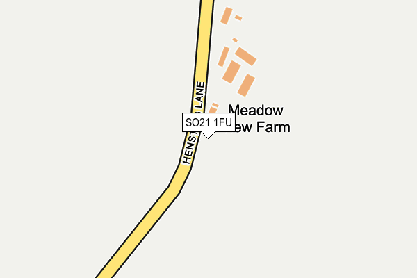
SO21 1FU is located in the Upper Meon Valley electoral ward, within the local authority district of Winchester and the English Parliamentary constituency of Meon Valley. The Sub Integrated Care Board (ICB) Location is NHS Hampshire and Isle of Wight ICB - D9Y0V and the police force is Hampshire. This postcode has been in use since February 2017.


GetTheData
Source: OS OpenMap – Local (Ordnance Survey)
Source: OS VectorMap District (Ordnance Survey)
Licence: Open Government Licence (requires attribution)
| Easting | 450202 |
| Northing | 122968 |
| Latitude | 51.003911 |
| Longitude | -1.285881 |
GetTheData
Source: Open Postcode Geo
Licence: Open Government Licence
| Country | England |
| Postcode District | SO21 |
➜ See where SO21 is on a map | |
GetTheData
Source: Land Registry Price Paid Data
Licence: Open Government Licence
| Ward | Upper Meon Valley |
| Constituency | Meon Valley |
GetTheData
Source: ONS Postcode Database
Licence: Open Government Licence
| The Ship Inn (Whites Hill) | Owslebury | 1,020m |
| The Ship Inn (Main Road) | Owslebury | 1,036m |
| St Andrews Church (Main Road) | Owslebury | 1,321m |
| St Andrews Church (Main Road) | Owslebury | 1,326m |
| Beech Grove (Main Road) | Owslebury | 1,510m |
| Shawford Station | 3.6km |
| Eastleigh Station | 5.9km |
GetTheData
Source: NaPTAN
Licence: Open Government Licence
GetTheData
Source: ONS Postcode Database
Licence: Open Government Licence


➜ Get more ratings from the Food Standards Agency
GetTheData
Source: Food Standards Agency
Licence: FSA terms & conditions
| Last Collection | |||
|---|---|---|---|
| Location | Mon-Fri | Sat | Distance |
| Hensting | 16:00 | 08:00 | 1,056m |
| Owslebury | 16:00 | 09:00 | 1,408m |
| Marwell | 16:00 | 07:15 | 1,730m |
GetTheData
Source: Dracos
Licence: Creative Commons Attribution-ShareAlike
The below table lists the International Territorial Level (ITL) codes (formerly Nomenclature of Territorial Units for Statistics (NUTS) codes) and Local Administrative Units (LAU) codes for SO21 1FU:
| ITL 1 Code | Name |
|---|---|
| TLJ | South East (England) |
| ITL 2 Code | Name |
| TLJ3 | Hampshire and Isle of Wight |
| ITL 3 Code | Name |
| TLJ36 | Central Hampshire |
| LAU 1 Code | Name |
| E07000094 | Winchester |
GetTheData
Source: ONS Postcode Directory
Licence: Open Government Licence
The below table lists the Census Output Area (OA), Lower Layer Super Output Area (LSOA), and Middle Layer Super Output Area (MSOA) for SO21 1FU:
| Code | Name | |
|---|---|---|
| OA | E00118115 | |
| LSOA | E01023246 | Winchester 010E |
| MSOA | E02004838 | Winchester 010 |
GetTheData
Source: ONS Postcode Directory
Licence: Open Government Licence
| SO21 1LE | Hensting Lane | 638m |
| SO21 1LT | Whites Hill | 881m |
| SO21 1JL | Whaddon Lane | 985m |
| SO21 1JJ | Whaddon Lane | 1024m |
| SO21 1LU | Main Road | 1243m |
| SO21 1ET | Main Road | 1264m |
| SO21 1LR | Pitcot Lane | 1435m |
| SO21 1QX | 1478m | |
| SO21 1LS | Beech Grove | 1479m |
| SO21 1JH | 1486m |
GetTheData
Source: Open Postcode Geo; Land Registry Price Paid Data
Licence: Open Government Licence