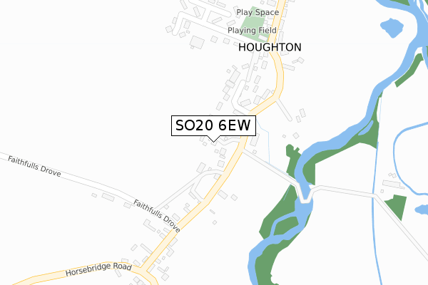
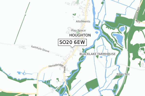
SO20 6EW is located in the Mid Test electoral ward, within the local authority district of Test Valley and the English Parliamentary constituency of Romsey and Southampton North. The Sub Integrated Care Board (ICB) Location is NHS Hampshire and Isle of Wight ICB - D9Y0V and the police force is Hampshire. This postcode has been in use since November 2017.


GetTheData
Source: OS Open Zoomstack (Ordnance Survey)
Licence: Open Government Licence (requires attribution)
Attribution: Contains OS data © Crown copyright and database right 2025
Source: Open Postcode Geo
Licence: Open Government Licence (requires attribution)
Attribution: Contains OS data © Crown copyright and database right 2025; Contains Royal Mail data © Royal Mail copyright and database right 2025; Source: Office for National Statistics licensed under the Open Government Licence v.3.0
| Easting | 434066 |
| Northing | 131879 |
| Latitude | 51.085216 |
| Longitude | -1.515005 |
GetTheData
Source: Open Postcode Geo
Licence: Open Government Licence
| Country | England |
| Postcode District | SO20 |
➜ See where SO20 is on a map ➜ Where is Houghton? | |
GetTheData
Source: Land Registry Price Paid Data
Licence: Open Government Licence
| Ward | Mid Test |
| Constituency | Romsey And Southampton North |
GetTheData
Source: ONS Postcode Database
Licence: Open Government Licence
WOODBRIDGE HOUSE, THE ORCHARDS, HOUGHTON, STOCKBRIDGE, SO20 6EW 2019 17 SEP £995,000 |
BROAD OAK, THE ORCHARDS, HOUGHTON, STOCKBRIDGE, SO20 6EW 2018 22 MAY £775,000 |
REDWOOD, THE ORCHARDS, HOUGHTON, STOCKBRIDGE, SO20 6EW 2018 12 JAN £860,000 |
FAIRVIEW, THE ORCHARDS, HOUGHTON, STOCKBRIDGE, SO20 6EW 2018 12 JAN £898,000 |
BOURNE HOUSE, THE ORCHARDS, HOUGHTON, STOCKBRIDGE, SO20 6EW 2017 30 NOV £1,072,800 |
BOWDEN HOUSE, THE ORCHARDS, HOUGHTON, STOCKBRIDGE, SO20 6EW 2017 17 NOV £1,100,000 |
KENTS ORCHARD, THE ORCHARDS, HOUGHTON, STOCKBRIDGE, SO20 6EW 2015 13 APR £1,570,000 |
KENTS ORCHARD, THE ORCHARDS, HOUGHTON, STOCKBRIDGE, SO20 6EW 1995 30 JAN £289,000 |
GetTheData
Source: HM Land Registry Price Paid Data
Licence: Contains HM Land Registry data © Crown copyright and database right 2025. This data is licensed under the Open Government Licence v3.0.
| Houghton Corner (Unamed Road From Stockbridge) | Bossington | 262m |
| Houghton Corner (Unamed Road From Stockbridge) | Bossington | 263m |
| Village Hall (Unamed Road From Stockbridge) | Houghton | 284m |
| Village Hall (Unamed Road From Stockbridge) | Houghton | 285m |
| Houghton Corner (Horsebridge Road) | Bossington | 367m |
GetTheData
Source: NaPTAN
Licence: Open Government Licence
| Percentage of properties with Next Generation Access | 100.0% |
| Percentage of properties with Superfast Broadband | 100.0% |
| Percentage of properties with Ultrafast Broadband | 0.0% |
| Percentage of properties with Full Fibre Broadband | 0.0% |
Superfast Broadband is between 30Mbps and 300Mbps
Ultrafast Broadband is > 300Mbps
| Median download speed | 78.1Mbps |
| Average download speed | 67.3Mbps |
| Maximum download speed | 80.00Mbps |
| Median upload speed | 20.0Mbps |
| Average upload speed | 17.0Mbps |
| Maximum upload speed | 20.00Mbps |
| Percentage of properties unable to receive 2Mbps | 0.0% |
| Percentage of properties unable to receive 5Mbps | 0.0% |
| Percentage of properties unable to receive 10Mbps | 0.0% |
| Percentage of properties unable to receive 30Mbps | 0.0% |
GetTheData
Source: Ofcom
Licence: Ofcom Terms of Use (requires attribution)
GetTheData
Source: ONS Postcode Database
Licence: Open Government Licence


➜ Get more ratings from the Food Standards Agency
GetTheData
Source: Food Standards Agency
Licence: FSA terms & conditions
| Last Collection | |||
|---|---|---|---|
| Location | Mon-Fri | Sat | Distance |
| Kings Somborne Post Office | 16:30 | 10:30 | 2,270m |
| Winchester Road | 16:00 | 10:30 | 2,441m |
| Broughton Post Office | 16:45 | 10:15 | 3,295m |
GetTheData
Source: Dracos
Licence: Creative Commons Attribution-ShareAlike
The below table lists the International Territorial Level (ITL) codes (formerly Nomenclature of Territorial Units for Statistics (NUTS) codes) and Local Administrative Units (LAU) codes for SO20 6EW:
| ITL 1 Code | Name |
|---|---|
| TLJ | South East (England) |
| ITL 2 Code | Name |
| TLJ3 | Hampshire and Isle of Wight |
| ITL 3 Code | Name |
| TLJ36 | Central Hampshire |
| LAU 1 Code | Name |
| E07000093 | Test Valley |
GetTheData
Source: ONS Postcode Directory
Licence: Open Government Licence
The below table lists the Census Output Area (OA), Lower Layer Super Output Area (LSOA), and Middle Layer Super Output Area (MSOA) for SO20 6EW:
| Code | Name | |
|---|---|---|
| OA | E00117710 | |
| LSOA | E01023166 | Test Valley 009A |
| MSOA | E02004822 | Test Valley 009 |
GetTheData
Source: ONS Postcode Directory
Licence: Open Government Licence
| SO20 6LS | Chapel Close | 142m |
| SO20 6LU | 170m | |
| SO20 6LT | 171m | |
| SO20 6LR | South View Cottages | 247m |
| SO20 6LP | Stevens Drove | 282m |
| SO20 6LW | 347m | |
| SO20 6FY | Horsebridge Road | 368m |
| SO20 6LL | Village Road | 445m |
| SO20 6LY | 462m | |
| SO20 6LN | 601m |
GetTheData
Source: Open Postcode Geo; Land Registry Price Paid Data
Licence: Open Government Licence