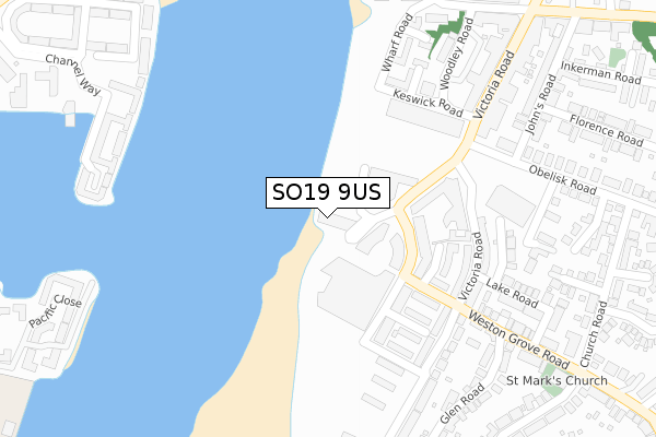
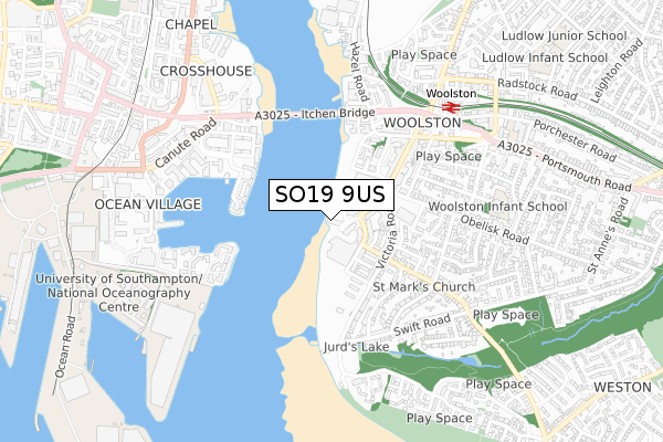
SO19 9US is located in the Woolston electoral ward, within the unitary authority of Southampton and the English Parliamentary constituency of Southampton, Itchen. The Sub Integrated Care Board (ICB) Location is NHS Hampshire and Isle of Wight ICB - D9Y0V and the police force is Hampshire. This postcode has been in use since January 2018.


GetTheData
Source: OS Open Zoomstack (Ordnance Survey)
Licence: Open Government Licence (requires attribution)
Attribution: Contains OS data © Crown copyright and database right 2025
Source: Open Postcode Geo
Licence: Open Government Licence (requires attribution)
Attribution: Contains OS data © Crown copyright and database right 2025; Contains Royal Mail data © Royal Mail copyright and database right 2025; Source: Office for National Statistics licensed under the Open Government Licence v.3.0
| Easting | 443457 |
| Northing | 110817 |
| Latitude | 50.895196 |
| Longitude | -1.383454 |
GetTheData
Source: Open Postcode Geo
Licence: Open Government Licence
| Country | England |
| Postcode District | SO19 |
➜ See where SO19 is on a map ➜ Where is Southampton? | |
GetTheData
Source: Land Registry Price Paid Data
Licence: Open Government Licence
| Ward | Woolston |
| Constituency | Southampton, Itchen |
GetTheData
Source: ONS Postcode Database
Licence: Open Government Licence
| Centenary Quay (John Thorneycroft Road) | Woolston | 118m |
| Centenary Quay (John Thorneycroft Road) | Woolston | 150m |
| The Ship Inn (Vosper Road) | Woolston | 189m |
| Health Clinic (Woodley Road) | Woolston | 271m |
| The Ship Inn (Victoria Road) | Woolston | 271m |
| Woolston Station | 0.6km |
| Sholing Station | 1.3km |
| Southampton Town Quay | 1.6km |
GetTheData
Source: NaPTAN
Licence: Open Government Licence
| Percentage of properties with Next Generation Access | 100.0% |
| Percentage of properties with Superfast Broadband | 100.0% |
| Percentage of properties with Ultrafast Broadband | 100.0% |
| Percentage of properties with Full Fibre Broadband | 100.0% |
Superfast Broadband is between 30Mbps and 300Mbps
Ultrafast Broadband is > 300Mbps
Ofcom does not currently provide download speed data for SO19 9US. This is because there are less than four broadband connections in this postcode.
Ofcom does not currently provide upload speed data for SO19 9US. This is because there are less than four broadband connections in this postcode.
| Percentage of properties unable to receive 2Mbps | 0.0% |
| Percentage of properties unable to receive 5Mbps | 0.0% |
| Percentage of properties unable to receive 10Mbps | 0.0% |
| Percentage of properties unable to receive 30Mbps | 0.0% |
GetTheData
Source: Ofcom
Licence: Ofcom Terms of Use (requires attribution)
GetTheData
Source: ONS Postcode Database
Licence: Open Government Licence


➜ Get more ratings from the Food Standards Agency
GetTheData
Source: Food Standards Agency
Licence: FSA terms & conditions
| Last Collection | |||
|---|---|---|---|
| Location | Mon-Fri | Sat | Distance |
| Victoria Road | 17:45 | 12:00 | 273m |
| Woolston Post Office | 19:00 | 12:00 | 510m |
| Obelisk Road | 17:30 | 12:00 | 512m |
GetTheData
Source: Dracos
Licence: Creative Commons Attribution-ShareAlike
| Risk of SO19 9US flooding from rivers and sea | High |
| ➜ SO19 9US flood map | |
GetTheData
Source: Open Flood Risk by Postcode
Licence: Open Government Licence
The below table lists the International Territorial Level (ITL) codes (formerly Nomenclature of Territorial Units for Statistics (NUTS) codes) and Local Administrative Units (LAU) codes for SO19 9US:
| ITL 1 Code | Name |
|---|---|
| TLJ | South East (England) |
| ITL 2 Code | Name |
| TLJ3 | Hampshire and Isle of Wight |
| ITL 3 Code | Name |
| TLJ32 | Southampton |
| LAU 1 Code | Name |
| E06000045 | Southampton |
GetTheData
Source: ONS Postcode Directory
Licence: Open Government Licence
The below table lists the Census Output Area (OA), Lower Layer Super Output Area (LSOA), and Middle Layer Super Output Area (MSOA) for SO19 9US:
| Code | Name | |
|---|---|---|
| OA | E00087254 | |
| LSOA | E01017276 | Southampton 031C |
| MSOA | E02003579 | Southampton 031 |
GetTheData
Source: ONS Postcode Directory
Licence: Open Government Licence
| SO19 9UE | Centenary Plaza | 69m |
| SO19 9UD | Centenary Plaza | 79m |
| SO19 9SY | John Thornycroft Road | 136m |
| SO19 9SZ | John Thornycroft Road | 154m |
| SO19 9TW | John Thornycroft Road | 157m |
| SO19 9TS | John Thornycroft Road | 157m |
| SO19 9TQ | John Thornycroft Road | 158m |
| SO19 9UH | John Thornycroft Road | 159m |
| SO19 9SP | John Thornycroft Road | 169m |
| SO19 9SS | Vosper Road | 197m |
GetTheData
Source: Open Postcode Geo; Land Registry Price Paid Data
Licence: Open Government Licence