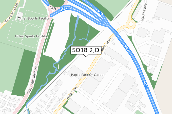
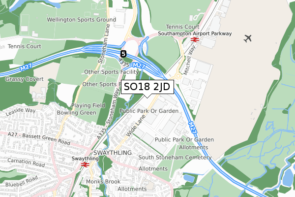
SO18 2JD is located in the Swaythling electoral ward, within the unitary authority of Southampton and the English Parliamentary constituency of Romsey and Southampton North. The Sub Integrated Care Board (ICB) Location is NHS Hampshire and Isle of Wight ICB - D9Y0V and the police force is Hampshire. This postcode has been in use since November 2018.


GetTheData
Source: OS Open Zoomstack (Ordnance Survey)
Licence: Open Government Licence (requires attribution)
Attribution: Contains OS data © Crown copyright and database right 2025
Source: Open Postcode Geo
Licence: Open Government Licence (requires attribution)
Attribution: Contains OS data © Crown copyright and database right 2025; Contains Royal Mail data © Royal Mail copyright and database right 2025; Source: Office for National Statistics licensed under the Open Government Licence v.3.0
| Easting | 444389 |
| Northing | 116406 |
| Latitude | 50.945382 |
| Longitude | -1.369523 |
GetTheData
Source: Open Postcode Geo
Licence: Open Government Licence
| Country | England |
| Postcode District | SO18 |
➜ See where SO18 is on a map ➜ Where is Southampton? | |
GetTheData
Source: Land Registry Price Paid Data
Licence: Open Government Licence
| Ward | Swaythling |
| Constituency | Romsey And Southampton North |
GetTheData
Source: ONS Postcode Database
Licence: Open Government Licence
| Ford's (Wide Lane) | Swaythling | 48m |
| Ford's (Wide Lane) | Swaythling | 87m |
| Walnut Avenue (Wide Lane) | Swaythling | 269m |
| Walnut Avenue (Wide Lane) | Swaythling | 316m |
| Monks Way (Mansbridge Road) | Mansbridge | 492m |
| Swaythling Station | 0.7km |
| Southampton Airport Parkway Station | 0.8km |
| St Denys Station | 2.9km |
GetTheData
Source: NaPTAN
Licence: Open Government Licence
GetTheData
Source: ONS Postcode Database
Licence: Open Government Licence

➜ Get more ratings from the Food Standards Agency
GetTheData
Source: Food Standards Agency
Licence: FSA terms & conditions
| Last Collection | |||
|---|---|---|---|
| Location | Mon-Fri | Sat | Distance |
| Wide Lane Post Office | 16:30 | 12:30 | 467m |
| Southampton Mail Centre | 19:30 | 14:00 | 591m |
| Octavia Road | 16:00 | 12:30 | 704m |
GetTheData
Source: Dracos
Licence: Creative Commons Attribution-ShareAlike
The below table lists the International Territorial Level (ITL) codes (formerly Nomenclature of Territorial Units for Statistics (NUTS) codes) and Local Administrative Units (LAU) codes for SO18 2JD:
| ITL 1 Code | Name |
|---|---|
| TLJ | South East (England) |
| ITL 2 Code | Name |
| TLJ3 | Hampshire and Isle of Wight |
| ITL 3 Code | Name |
| TLJ32 | Southampton |
| LAU 1 Code | Name |
| E06000045 | Southampton |
GetTheData
Source: ONS Postcode Directory
Licence: Open Government Licence
The below table lists the Census Output Area (OA), Lower Layer Super Output Area (LSOA), and Middle Layer Super Output Area (MSOA) for SO18 2JD:
| Code | Name | |
|---|---|---|
| OA | E00087223 | |
| LSOA | E01017265 | Southampton 003B |
| MSOA | E02003551 | Southampton 003 |
GetTheData
Source: ONS Postcode Directory
Licence: Open Government Licence
| SO18 2HJ | Wide Lane | 176m |
| SO18 2HQ | Claudeen Close | 219m |
| SO18 2HH | Wide Lane | 270m |
| SO18 2QJ | Claudeen Close | 281m |
| SO18 2HS | Walnut Avenue | 287m |
| SO18 2HN | Wide Lane | 337m |
| SO18 2HP | Mardon Close | 342m |
| SO18 2QU | Walnut Avenue | 352m |
| SO18 2HR | Northleigh Corner | 354m |
| SO18 2HL | Wide Lane | 396m |
GetTheData
Source: Open Postcode Geo; Land Registry Price Paid Data
Licence: Open Government Licence