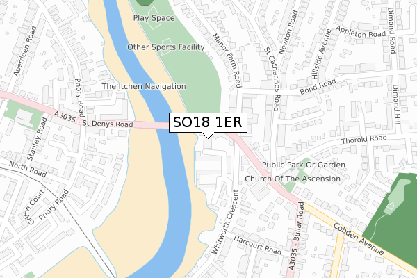
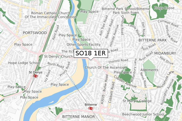
SO18 1ER is located in the Bitterne Park electoral ward, within the unitary authority of Southampton and the English Parliamentary constituency of Southampton, Itchen. The Sub Integrated Care Board (ICB) Location is NHS Hampshire and Isle of Wight ICB - D9Y0V and the police force is Hampshire. This postcode has been in use since December 2018.


GetTheData
Source: OS Open Zoomstack (Ordnance Survey)
Licence: Open Government Licence (requires attribution)
Attribution: Contains OS data © Crown copyright and database right 2025
Source: Open Postcode Geo
Licence: Open Government Licence (requires attribution)
Attribution: Contains OS data © Crown copyright and database right 2025; Contains Royal Mail data © Royal Mail copyright and database right 2025; Source: Office for National Statistics licensed under the Open Government Licence v.3.0
| Easting | 443892 |
| Northing | 114040 |
| Latitude | 50.924144 |
| Longitude | -1.376882 |
GetTheData
Source: Open Postcode Geo
Licence: Open Government Licence
| Country | England |
| Postcode District | SO18 |
➜ See where SO18 is on a map ➜ Where is Southampton? | |
GetTheData
Source: Land Registry Price Paid Data
Licence: Open Government Licence
| Ward | Bitterne Park |
| Constituency | Southampton, Itchen |
GetTheData
Source: ONS Postcode Database
Licence: Open Government Licence
| Triangle (St Denys' Road) | Bitterne Park | 30m |
| Triangle (Bitterne Park Triangle) | Bitterne Park | 59m |
| Triangle (Bitterne Park Triangle) | Bitterne Park | 98m |
| Cobden Avenue (St Catherine's Road) | Bitterne Park | 171m |
| United Reformed Church (Cobden Avenue) | Bitterne Park | 173m |
| Bitterne Station | 0.7km |
| St Denys Station | 0.8km |
| Swaythling Station | 1.9km |
GetTheData
Source: NaPTAN
Licence: Open Government Licence
| Percentage of properties with Next Generation Access | 100.0% |
| Percentage of properties with Superfast Broadband | 100.0% |
| Percentage of properties with Ultrafast Broadband | 100.0% |
| Percentage of properties with Full Fibre Broadband | 100.0% |
Superfast Broadband is between 30Mbps and 300Mbps
Ultrafast Broadband is > 300Mbps
| Percentage of properties unable to receive 2Mbps | 0.0% |
| Percentage of properties unable to receive 5Mbps | 0.0% |
| Percentage of properties unable to receive 10Mbps | 0.0% |
| Percentage of properties unable to receive 30Mbps | 0.0% |
GetTheData
Source: Ofcom
Licence: Ofcom Terms of Use (requires attribution)
GetTheData
Source: ONS Postcode Database
Licence: Open Government Licence

➜ Get more ratings from the Food Standards Agency
GetTheData
Source: Food Standards Agency
Licence: FSA terms & conditions
| Last Collection | |||
|---|---|---|---|
| Location | Mon-Fri | Sat | Distance |
| Bitterne Park Post Office | 16:00 | 11:30 | 115m |
| Priory Road | 17:30 | 11:15 | 296m |
| Macnaughton Road | 16:00 | 10:15 | 310m |
GetTheData
Source: Dracos
Licence: Creative Commons Attribution-ShareAlike
The below table lists the International Territorial Level (ITL) codes (formerly Nomenclature of Territorial Units for Statistics (NUTS) codes) and Local Administrative Units (LAU) codes for SO18 1ER:
| ITL 1 Code | Name |
|---|---|
| TLJ | South East (England) |
| ITL 2 Code | Name |
| TLJ3 | Hampshire and Isle of Wight |
| ITL 3 Code | Name |
| TLJ32 | Southampton |
| LAU 1 Code | Name |
| E06000045 | Southampton |
GetTheData
Source: ONS Postcode Directory
Licence: Open Government Licence
The below table lists the Census Output Area (OA), Lower Layer Super Output Area (LSOA), and Middle Layer Super Output Area (MSOA) for SO18 1ER:
| Code | Name | |
|---|---|---|
| OA | E00086757 | |
| LSOA | E01017177 | Southampton 014D |
| MSOA | E02003562 | Southampton 014 |
GetTheData
Source: ONS Postcode Directory
Licence: Open Government Licence
| SO18 1FZ | The Triangle | 40m |
| SO18 1UH | Riverdene Place | 80m |
| SO18 1NP | Manor Farm Road | 99m |
| SO18 1FY | Cobden Avenue | 99m |
| SO18 1NN | Manor Farm Road | 102m |
| SO18 1UG | Riverdene Place | 117m |
| SO18 1DL | Cobden Rise | 133m |
| SO18 1LJ | St Catherines Road | 147m |
| SO18 1LL | St Catherines Road | 186m |
| SO18 1GA | Whitworth Crescent | 197m |
GetTheData
Source: Open Postcode Geo; Land Registry Price Paid Data
Licence: Open Government Licence