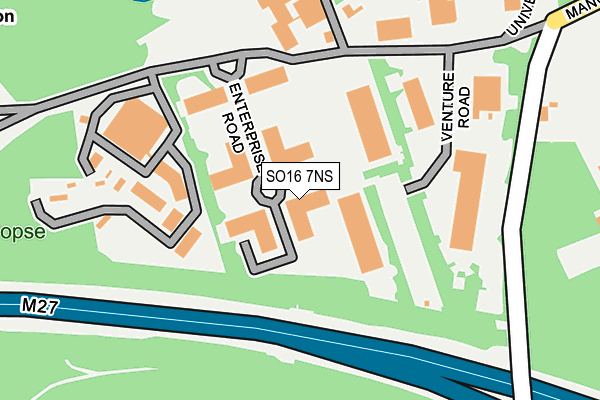
SO16 7NS is located in the Chilworth, Nursling & Rownhams electoral ward, within the local authority district of Test Valley and the English Parliamentary constituency of Romsey and Southampton North. The Sub Integrated Care Board (ICB) Location is NHS Hampshire and Isle of Wight ICB - D9Y0V and the police force is Hampshire. This postcode has been in use since December 1994.


GetTheData
Source: OS OpenMap – Local (Ordnance Survey)
Source: OS VectorMap District (Ordnance Survey)
Licence: Open Government Licence (requires attribution)
| Easting | 440492 |
| Northing | 118119 |
| Latitude | 50.961071 |
| Longitude | -1.424801 |
GetTheData
Source: Open Postcode Geo
Licence: Open Government Licence
| Country | England |
| Postcode District | SO16 |
➜ See where SO16 is on a map | |
GetTheData
Source: Land Registry Price Paid Data
Licence: Open Government Licence
Elevation or altitude of SO16 7NS as distance above sea level:
| Metres | Feet | |
|---|---|---|
| Elevation | 80m | 262ft |
Elevation is measured from the approximate centre of the postcode, to the nearest point on an OS contour line from OS Terrain 50, which has contour spacing of ten vertical metres.
➜ How high above sea level am I? Find the elevation of your current position using your device's GPS.
GetTheData
Source: Open Postcode Elevation
Licence: Open Government Licence
| Ward | Chilworth, Nursling & Rownhams |
| Constituency | Romsey And Southampton North |
GetTheData
Source: ONS Postcode Database
Licence: Open Government Licence
| Science Park (University Parkway) | Chilworth Old Village | 158m |
| The Chilworth Arms (Chilworth Road) | Chilworth | 680m |
| Rother House (Chilworth Road) | Chilworth Old Village | 682m |
| Rother House | Chilworth Old Village | 689m |
| The Chilworth Arms (Chilworth Road) | Chilworth | 714m |
| Chandlers Ford Station | 3.8km |
| Swaythling Station | 4.1km |
| Southampton Airport Parkway Station | 4.5km |
GetTheData
Source: NaPTAN
Licence: Open Government Licence
GetTheData
Source: ONS Postcode Database
Licence: Open Government Licence


➜ Get more ratings from the Food Standards Agency
GetTheData
Source: Food Standards Agency
Licence: FSA terms & conditions
| Last Collection | |||
|---|---|---|---|
| Location | Mon-Fri | Sat | Distance |
| Chilworth Research Centre | 17:00 | 11:00 | 147m |
| Chilworth Church | 17:30 | 11:15 | 661m |
| Chilworth Road | 16:00 | 11:00 | 937m |
GetTheData
Source: Dracos
Licence: Creative Commons Attribution-ShareAlike
The below table lists the International Territorial Level (ITL) codes (formerly Nomenclature of Territorial Units for Statistics (NUTS) codes) and Local Administrative Units (LAU) codes for SO16 7NS:
| ITL 1 Code | Name |
|---|---|
| TLJ | South East (England) |
| ITL 2 Code | Name |
| TLJ3 | Hampshire and Isle of Wight |
| ITL 3 Code | Name |
| TLJ36 | Central Hampshire |
| LAU 1 Code | Name |
| E07000093 | Test Valley |
GetTheData
Source: ONS Postcode Directory
Licence: Open Government Licence
The below table lists the Census Output Area (OA), Lower Layer Super Output Area (LSOA), and Middle Layer Super Output Area (MSOA) for SO16 7NS:
| Code | Name | |
|---|---|---|
| OA | E00117728 | |
| LSOA | E01023171 | Test Valley 015B |
| MSOA | E02004828 | Test Valley 015 |
GetTheData
Source: ONS Postcode Directory
Licence: Open Government Licence
| SO16 7JE | Manor Road | 395m |
| SO16 7JH | Chilworth Drove | 441m |
| SO16 7JJ | Chilworth Close | 516m |
| SO16 7JP | Chilworth Old Village | 634m |
| SO16 7LD | Woodside Crescent | 697m |
| SO16 7JN | Chilworth Road | 727m |
| SO16 7JG | Lordswood Lane | 798m |
| SO16 7LB | Woodside | 842m |
| SO16 7JZ | Chilworth Road | 851m |
| SO16 7LA | Chilworth Road | 894m |
GetTheData
Source: Open Postcode Geo; Land Registry Price Paid Data
Licence: Open Government Licence