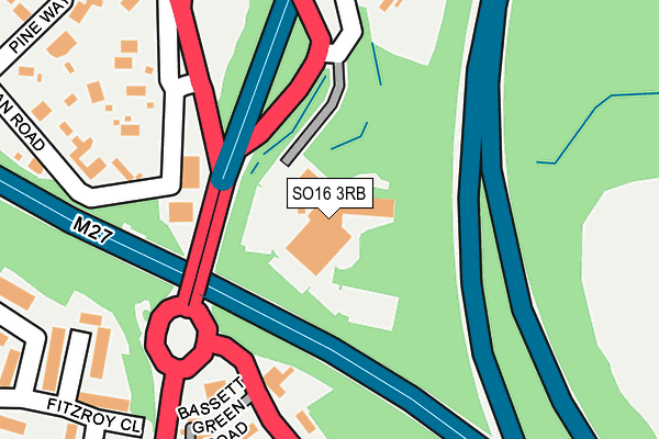
SO16 3RB is located in the Chilworth, Nursling & Rownhams electoral ward, within the local authority district of Test Valley and the English Parliamentary constituency of Romsey and Southampton North. The Sub Integrated Care Board (ICB) Location is NHS Hampshire and Isle of Wight ICB - D9Y0V and the police force is Hampshire. This postcode has been in use since December 1994.


GetTheData
Source: OS OpenMap – Local (Ordnance Survey)
Source: OS VectorMap District (Ordnance Survey)
Licence: Open Government Licence (requires attribution)
| Easting | 442096 |
| Northing | 117242 |
| Latitude | 50.953079 |
| Longitude | -1.402074 |
GetTheData
Source: Open Postcode Geo
Licence: Open Government Licence
| Country | England |
| Postcode District | SO16 |
➜ See where SO16 is on a map | |
GetTheData
Source: Land Registry Price Paid Data
Licence: Open Government Licence
Elevation or altitude of SO16 3RB as distance above sea level:
| Metres | Feet | |
|---|---|---|
| Elevation | 70m | 230ft |
Elevation is measured from the approximate centre of the postcode, to the nearest point on an OS contour line from OS Terrain 50, which has contour spacing of ten vertical metres.
➜ How high above sea level am I? Find the elevation of your current position using your device's GPS.
GetTheData
Source: Open Postcode Elevation
Licence: Open Government Licence
| Ward | Chilworth, Nursling & Rownhams |
| Constituency | Romsey And Southampton North |
GetTheData
Source: ONS Postcode Database
Licence: Open Government Licence
| Hilton Hotel (A27) | Chilworth | 115m |
| Chilworth Roundabout (Bassett Avenue) | Bassett | 194m |
| Birch Road (Bournemouth Road) | Chilworth | 360m |
| Saxholm Way (Bassett Avenue) | Bassett | 391m |
| Birch Road (Bournemouth Road) | Chilworth | 424m |
| Swaythling Station | 2.2km |
| Southampton Airport Parkway Station | 2.7km |
| St Denys Station | 3.6km |
GetTheData
Source: NaPTAN
Licence: Open Government Licence
GetTheData
Source: ONS Postcode Database
Licence: Open Government Licence


➜ Get more ratings from the Food Standards Agency
GetTheData
Source: Food Standards Agency
Licence: FSA terms & conditions
| Last Collection | |||
|---|---|---|---|
| Location | Mon-Fri | Sat | Distance |
| Bassett Heath Avenue | 16:00 | 11:00 | 385m |
| Bassett Wood Road | 17:30 | 11:15 | 388m |
| Pine Walk | 16:00 | 11:00 | 400m |
GetTheData
Source: Dracos
Licence: Creative Commons Attribution-ShareAlike
The below table lists the International Territorial Level (ITL) codes (formerly Nomenclature of Territorial Units for Statistics (NUTS) codes) and Local Administrative Units (LAU) codes for SO16 3RB:
| ITL 1 Code | Name |
|---|---|
| TLJ | South East (England) |
| ITL 2 Code | Name |
| TLJ3 | Hampshire and Isle of Wight |
| ITL 3 Code | Name |
| TLJ36 | Central Hampshire |
| LAU 1 Code | Name |
| E07000093 | Test Valley |
GetTheData
Source: ONS Postcode Directory
Licence: Open Government Licence
The below table lists the Census Output Area (OA), Lower Layer Super Output Area (LSOA), and Middle Layer Super Output Area (MSOA) for SO16 3RB:
| Code | Name | |
|---|---|---|
| OA | E00117729 | |
| LSOA | E01023171 | Test Valley 015B |
| MSOA | E02004828 | Test Valley 015 |
GetTheData
Source: ONS Postcode Directory
Licence: Open Government Licence
| SO16 3PF | The Haven | 215m |
| SO16 7JQ | Chilworth Road | 216m |
| SO16 7HG | Roman Road | 234m |
| SO16 3NF | Bassett Green Road | 253m |
| SO16 7LW | Fitzroy Close | 266m |
| SO16 7GD | Lingwood Close | 268m |
| SO16 7GF | Lingwood Close | 300m |
| SO16 7FX | Bassett Avenue | 311m |
| SO16 7GE | Lingwood Close | 313m |
| SO16 7GG | Lingwood Close | 339m |
GetTheData
Source: Open Postcode Geo; Land Registry Price Paid Data
Licence: Open Government Licence