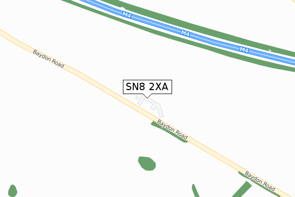
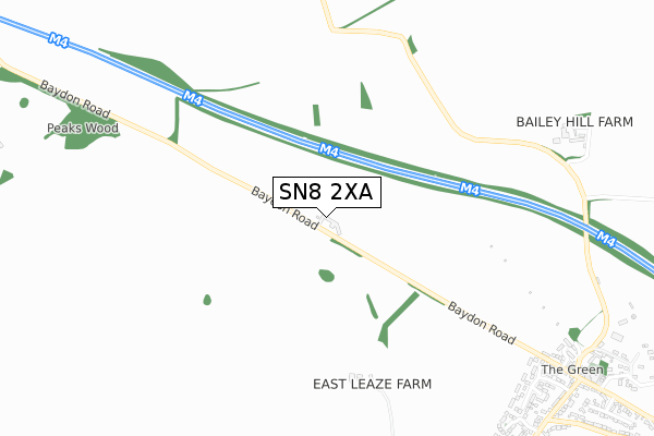
SN8 2XA is located in the Aldbourne & Ramsbury electoral ward, within the unitary authority of Wiltshire and the English Parliamentary constituency of Devizes. The Sub Integrated Care Board (ICB) Location is NHS Bath and North East Somerset, Swindon and Wiltshire ICB - 92 and the police force is Wiltshire. This postcode has been in use since October 2018.


GetTheData
Source: OS Open Zoomstack (Ordnance Survey)
Licence: Open Government Licence (requires attribution)
Attribution: Contains OS data © Crown copyright and database right 2025
Source: Open Postcode Geo
Licence: Open Government Licence (requires attribution)
Attribution: Contains OS data © Crown copyright and database right 2025; Contains Royal Mail data © Royal Mail copyright and database right 2025; Source: Office for National Statistics licensed under the Open Government Licence v.3.0
| Easting | 427105 |
| Northing | 178641 |
| Latitude | 51.506057 |
| Longitude | -1.610848 |
GetTheData
Source: Open Postcode Geo
Licence: Open Government Licence
| Country | England |
| Postcode District | SN8 |
➜ See where SN8 is on a map | |
GetTheData
Source: Land Registry Price Paid Data
Licence: Open Government Licence
| Ward | Aldbourne & Ramsbury |
| Constituency | Devizes |
GetTheData
Source: ONS Postcode Database
Licence: Open Government Licence
| Downsmead (Aldbourne Road) | Baydon | 1,136m |
| Downsmead (Aldbourne Road) | Baydon | 1,148m |
| North Field (Aldbourne Road) | Baydon | 1,561m |
| North Field (Aldbourne Road) | Baydon | 1,568m |
GetTheData
Source: NaPTAN
Licence: Open Government Licence
GetTheData
Source: ONS Postcode Database
Licence: Open Government Licence


➜ Get more ratings from the Food Standards Agency
GetTheData
Source: Food Standards Agency
Licence: FSA terms & conditions
| Last Collection | |||
|---|---|---|---|
| Location | Mon-Fri | Sat | Distance |
| Baydon Post Office | 16:00 | 10:15 | 1,070m |
| Aldbourne Post Office | 16:15 | 10:30 | 3,116m |
| Ashdown Park | 16:30 | 08:15 | 3,238m |
GetTheData
Source: Dracos
Licence: Creative Commons Attribution-ShareAlike
The below table lists the International Territorial Level (ITL) codes (formerly Nomenclature of Territorial Units for Statistics (NUTS) codes) and Local Administrative Units (LAU) codes for SN8 2XA:
| ITL 1 Code | Name |
|---|---|
| TLK | South West (England) |
| ITL 2 Code | Name |
| TLK1 | Gloucestershire, Wiltshire and Bath/Bristol area |
| ITL 3 Code | Name |
| TLK15 | Wiltshire |
| LAU 1 Code | Name |
| E06000054 | Wiltshire |
GetTheData
Source: ONS Postcode Directory
Licence: Open Government Licence
The below table lists the Census Output Area (OA), Lower Layer Super Output Area (LSOA), and Middle Layer Super Output Area (MSOA) for SN8 2XA:
| Code | Name | |
|---|---|---|
| OA | E00162565 | |
| LSOA | E01031873 | Wiltshire 012C |
| MSOA | E02006634 | Wiltshire 012 |
GetTheData
Source: ONS Postcode Directory
Licence: Open Government Licence
| SN8 2LJ | Russley Green | 1024m |
| SN8 2JP | Ermin Street | 1036m |
| SN8 2LQ | Downsmead | 1044m |
| SN8 2FL | Ridgeway View | 1066m |
| SN8 2FF | Newtons Walk | 1068m |
| SN8 2LH | Fiveways | 1086m |
| SN8 2HT | Beech Terrace | 1099m |
| SN8 2HZ | Aldbourne Road | 1120m |
| SN8 2HS | Ash Terrace | 1129m |
| SN8 2JA | Model Cottages | 1131m |
GetTheData
Source: Open Postcode Geo; Land Registry Price Paid Data
Licence: Open Government Licence