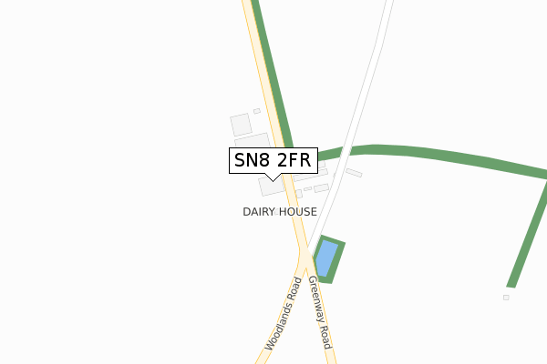
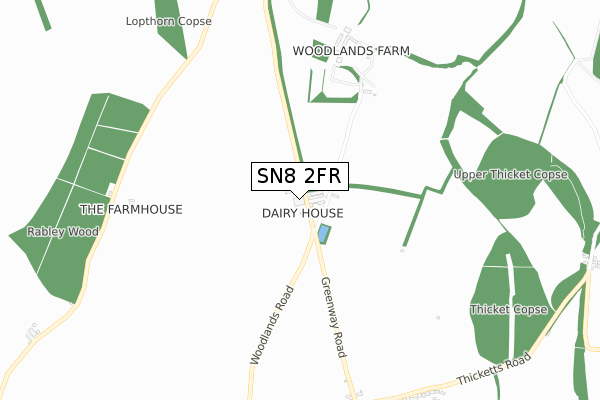
SN8 2FR is located in the Marlborough East electoral ward, within the unitary authority of Wiltshire and the English Parliamentary constituency of Devizes. The Sub Integrated Care Board (ICB) Location is NHS Bath and North East Somerset, Swindon and Wiltshire ICB - 92 and the police force is Wiltshire. This postcode has been in use since February 2019.


GetTheData
Source: OS Open Zoomstack (Ordnance Survey)
Licence: Open Government Licence (requires attribution)
Attribution: Contains OS data © Crown copyright and database right 2025
Source: Open Postcode Geo
Licence: Open Government Licence (requires attribution)
Attribution: Contains OS data © Crown copyright and database right 2025; Contains Royal Mail data © Royal Mail copyright and database right 2025; Source: Office for National Statistics licensed under the Open Government Licence v.3.0
| Easting | 421098 |
| Northing | 170729 |
| Latitude | 51.435170 |
| Longitude | -1.697867 |
GetTheData
Source: Open Postcode Geo
Licence: Open Government Licence
| Country | England |
| Postcode District | SN8 |
➜ See where SN8 is on a map | |
GetTheData
Source: Land Registry Price Paid Data
Licence: Open Government Licence
| Ward | Marlborough East |
| Constituency | Devizes |
GetTheData
Source: ONS Postcode Database
Licence: Open Government Licence
| Village Hall | Mildenhall | 981m |
| Village Hall | Mildenhall | 992m |
| Woodland Close (Main Street) | Mildenhall | 1,062m |
| Woodland Close (Main Street) | Mildenhall | 1,069m |
| The Leaze | Mildenhall | 1,096m |
GetTheData
Source: NaPTAN
Licence: Open Government Licence
GetTheData
Source: ONS Postcode Database
Licence: Open Government Licence


➜ Get more ratings from the Food Standards Agency
GetTheData
Source: Food Standards Agency
Licence: FSA terms & conditions
| Last Collection | |||
|---|---|---|---|
| Location | Mon-Fri | Sat | Distance |
| Barnfield | 17:30 | 12:00 | 2,039m |
| Poulton Hill | 17:45 | 12:00 | 2,161m |
| London Road | 17:45 | 12:00 | 2,259m |
GetTheData
Source: Dracos
Licence: Creative Commons Attribution-ShareAlike
The below table lists the International Territorial Level (ITL) codes (formerly Nomenclature of Territorial Units for Statistics (NUTS) codes) and Local Administrative Units (LAU) codes for SN8 2FR:
| ITL 1 Code | Name |
|---|---|
| TLK | South West (England) |
| ITL 2 Code | Name |
| TLK1 | Gloucestershire, Wiltshire and Bath/Bristol area |
| ITL 3 Code | Name |
| TLK15 | Wiltshire |
| LAU 1 Code | Name |
| E06000054 | Wiltshire |
GetTheData
Source: ONS Postcode Directory
Licence: Open Government Licence
The below table lists the Census Output Area (OA), Lower Layer Super Output Area (LSOA), and Middle Layer Super Output Area (MSOA) for SN8 2FR:
| Code | Name | |
|---|---|---|
| OA | E00162537 | |
| LSOA | E01031868 | Wiltshire 012B |
| MSOA | E02006634 | Wiltshire 012 |
GetTheData
Source: ONS Postcode Directory
Licence: Open Government Licence
| SN8 2NQ | 106m | |
| SN8 2NH | 515m | |
| SN8 2NZ | Thicketts Road | 994m |
| SN8 2LR | 996m | |
| SN8 2LL | Ash Tree Close | 1003m |
| SN8 2LZ | 1003m | |
| SN8 2LS | Berrycroft | 1022m |
| SN8 2ND | 1040m | |
| SN8 2NA | The Leaze | 1085m |
| SN8 2LP | 1095m |
GetTheData
Source: Open Postcode Geo; Land Registry Price Paid Data
Licence: Open Government Licence