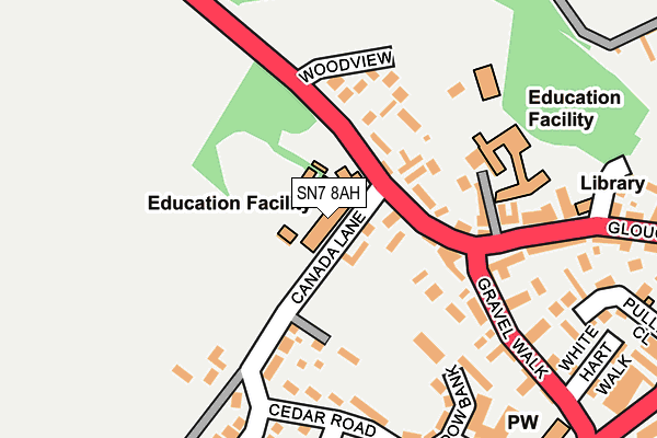
SN7 8AH is located in the Faringdon electoral ward, within the local authority district of Vale of White Horse and the English Parliamentary constituency of Wantage. The Sub Integrated Care Board (ICB) Location is NHS Buckinghamshire, Oxfordshire and Berkshire West ICB - 10Q and the police force is Thames Valley. This postcode has been in use since January 1980.


GetTheData
Source: OS OpenMap – Local (Ordnance Survey)
Source: OS VectorMap District (Ordnance Survey)
Licence: Open Government Licence (requires attribution)
| Easting | 428430 |
| Northing | 195581 |
| Latitude | 51.658300 |
| Longitude | -1.590405 |
GetTheData
Source: Open Postcode Geo
Licence: Open Government Licence
| Country | England |
| Postcode District | SN7 |
➜ See where SN7 is on a map ➜ Where is Faringdon? | |
GetTheData
Source: Land Registry Price Paid Data
Licence: Open Government Licence
Elevation or altitude of SN7 8AH as distance above sea level:
| Metres | Feet | |
|---|---|---|
| Elevation | 100m | 328ft |
Elevation is measured from the approximate centre of the postcode, to the nearest point on an OS contour line from OS Terrain 50, which has contour spacing of ten vertical metres.
➜ How high above sea level am I? Find the elevation of your current position using your device's GPS.
GetTheData
Source: Open Postcode Elevation
Licence: Open Government Licence
| Ward | Faringdon |
| Constituency | Wantage |
GetTheData
Source: ONS Postcode Database
Licence: Open Government Licence
| Infants School Car Park (Lechlade Road) | Faringdon | 72m |
| Oakwood Day Centre (Meadowbank) | Faringdon | 235m |
| Chestnut Avenue (The Pines) | Faringdon | 275m |
| Coxwell Street | Faringdon | 307m |
| Marlborough Street | Faringdon | 333m |
GetTheData
Source: NaPTAN
Licence: Open Government Licence
GetTheData
Source: ONS Postcode Database
Licence: Open Government Licence


➜ Get more ratings from the Food Standards Agency
GetTheData
Source: Food Standards Agency
Licence: FSA terms & conditions
| Last Collection | |||
|---|---|---|---|
| Location | Mon-Fri | Sat | Distance |
| Canada Lane | 17:30 | 12:15 | 167m |
| Gravel Walk | 17:30 | 12:15 | 182m |
| Faringdon Post Office | 18:30 | 12:30 | 379m |
GetTheData
Source: Dracos
Licence: Creative Commons Attribution-ShareAlike
The below table lists the International Territorial Level (ITL) codes (formerly Nomenclature of Territorial Units for Statistics (NUTS) codes) and Local Administrative Units (LAU) codes for SN7 8AH:
| ITL 1 Code | Name |
|---|---|
| TLJ | South East (England) |
| ITL 2 Code | Name |
| TLJ1 | Berkshire, Buckinghamshire and Oxfordshire |
| ITL 3 Code | Name |
| TLJ14 | Oxfordshire CC |
| LAU 1 Code | Name |
| E07000180 | Vale of White Horse |
GetTheData
Source: ONS Postcode Directory
Licence: Open Government Licence
The below table lists the Census Output Area (OA), Lower Layer Super Output Area (LSOA), and Middle Layer Super Output Area (MSOA) for SN7 8AH:
| Code | Name | |
|---|---|---|
| OA | E00146261 | |
| LSOA | E01028719 | Vale of White Horse 009D |
| MSOA | E02005986 | Vale of White Horse 009 |
GetTheData
Source: ONS Postcode Directory
Licence: Open Government Licence
| SN7 8SN | Aspen Court | 42m |
| SN7 8AL | Lechlade Road | 56m |
| SN7 8AQ | Lechlade Road | 90m |
| SN7 8AR | Canada Lane | 137m |
| SN7 8EL | Woodview | 140m |
| SN7 8AY | Cedar Road | 165m |
| SN7 7JN | Gravel Walk | 179m |
| SN7 8DD | Meadow Bank | 192m |
| SN7 8EH | Meadow Bank | 212m |
| SN7 7JW | Gravel Walk | 216m |
GetTheData
Source: Open Postcode Geo; Land Registry Price Paid Data
Licence: Open Government Licence